Forecast Published 9:45 PM MDT 11/4/2024
Forecast Summary
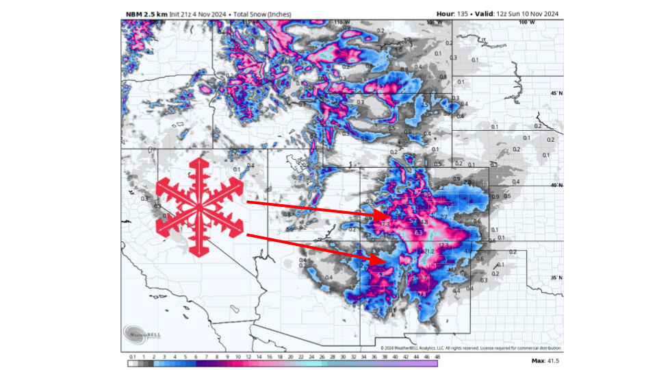
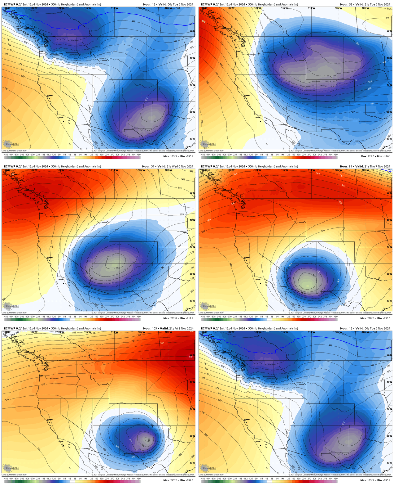
As the storm from this weekend continues to exit the region, our next system will dive in from the north during the day on Tuesday. As it does so, it will split off from the mean flow and become a cutoff low over the four-corners region. This will allow for moisture to stream into the southern Rockies, resulting in snow stacking up. Some areas may see upwards of 1-2 feet, but there is some uncertainty. Let’s dive into that below…
Short Term
(Now through Wednesday)

As mentioned above, our system from this weekend will move out of the area tonight and tomorrow, with our next storm diving in from the north on Tuesday. This will split from the mean storm track and become a cutoff low over the four corners region. The airmass from where this low originates from will be quite dry, but as it sits over the four corners over the next few days, it will draw in subtropical moisture from Mexico. As this moisture is drawn in northward, it will collide with the mountains of both Colorado and New Mexico.
Now, here’s the catch: there is some disagreement in the models on the exact placement of where most of the snow will fall. If the center of the low is a bit more to the west, then more snow will be possible over the mountains. If the center of the low is a bit further to the east, then most of the snow will fall over the high plains. This will be the main decider of where the highest amounts will be. Regardless, at least a foot will be possible in some locations, with some spots seeing up to two feet. The main focus will be over southern Colorado/northern New Mexico.
Notable Resort Storm Totals Through Saturday:
- Taos: 18-24 inches
- Ski Santa Fe: 18-24 inches
- Wolf Creek: 18-24 inches
- Silverton: 12-18 inches
- Telluride: 8-14 inches
- Monarch: 8-14 inches
- Purgatory: 8-14 inches
- Snowmass: 8-14 inches
- Aspen: 6-12 inches
Long-Term
(Thursday and Beyond)
This cutoff low will slowly move from west to east in the second half of this week, resulting in some wrap-around moisture interacting with terrain on Thursday and Friday. By this weekend, this low will finally move off to the east, and drier conditions will fill its place.
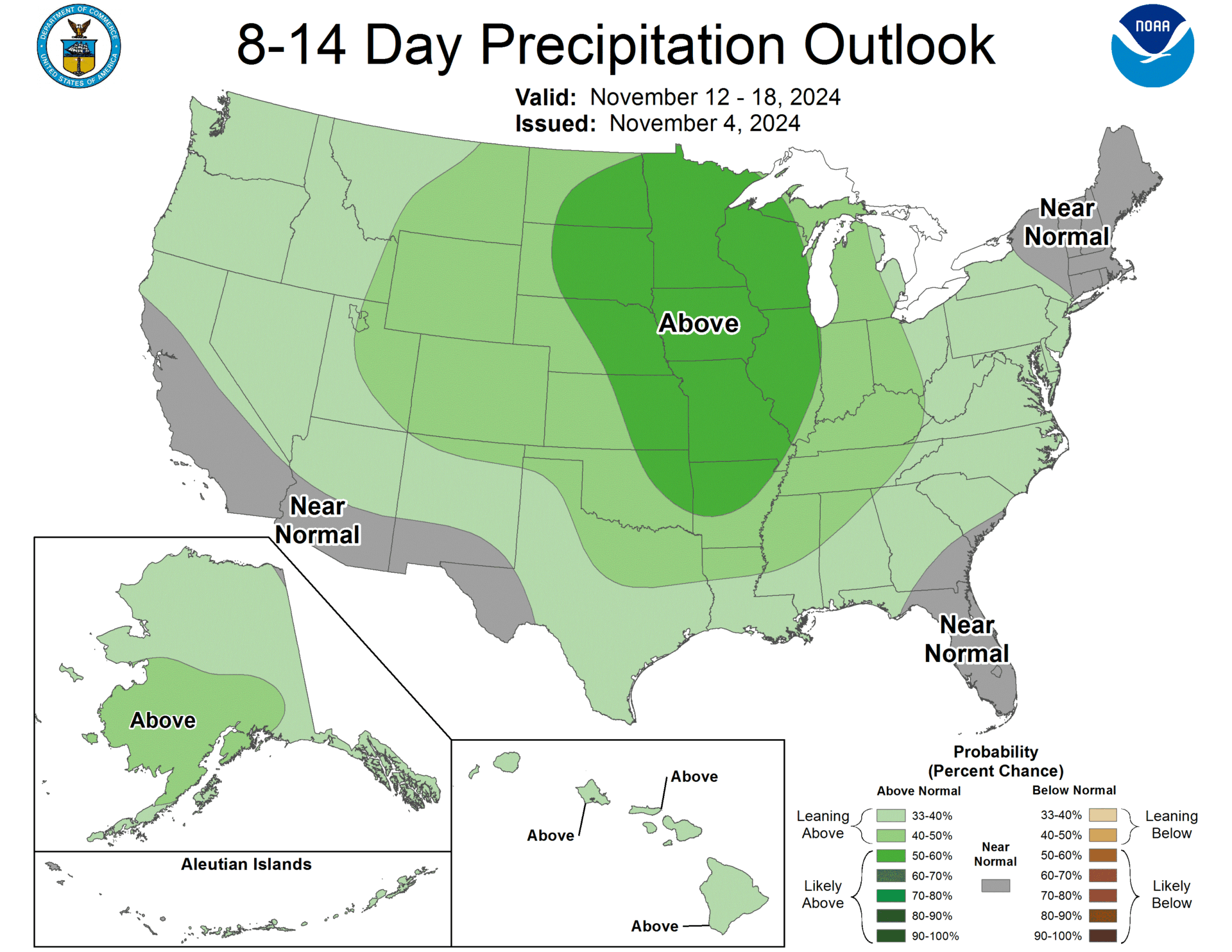
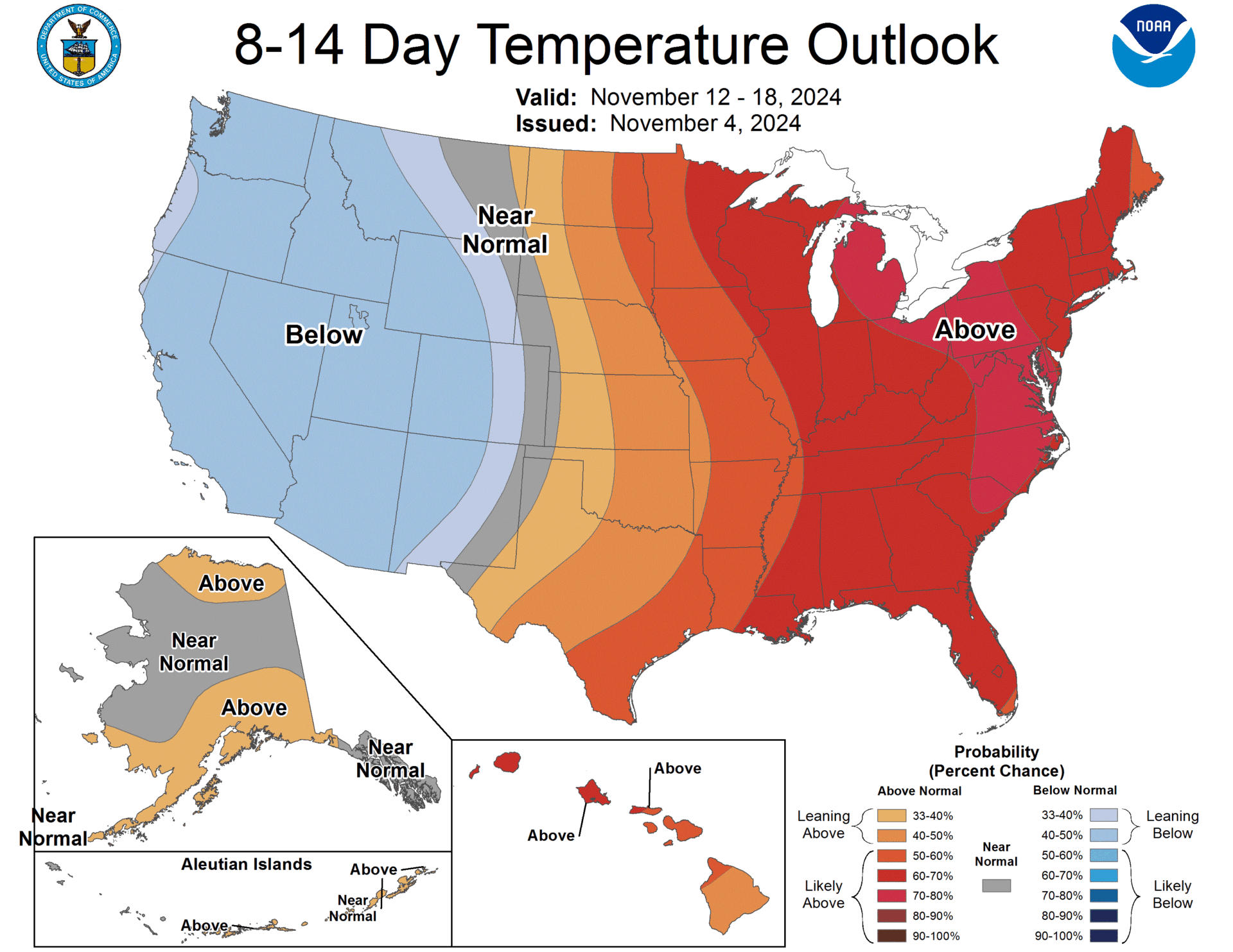
Looking ahead to next week, ensembles are indicating above-average precipitation and below-average temperatures will likely be in place. This indicates more active weather is possible on the horizon.

