Forecast from 10/16/2024 at 10:30 pm MDT
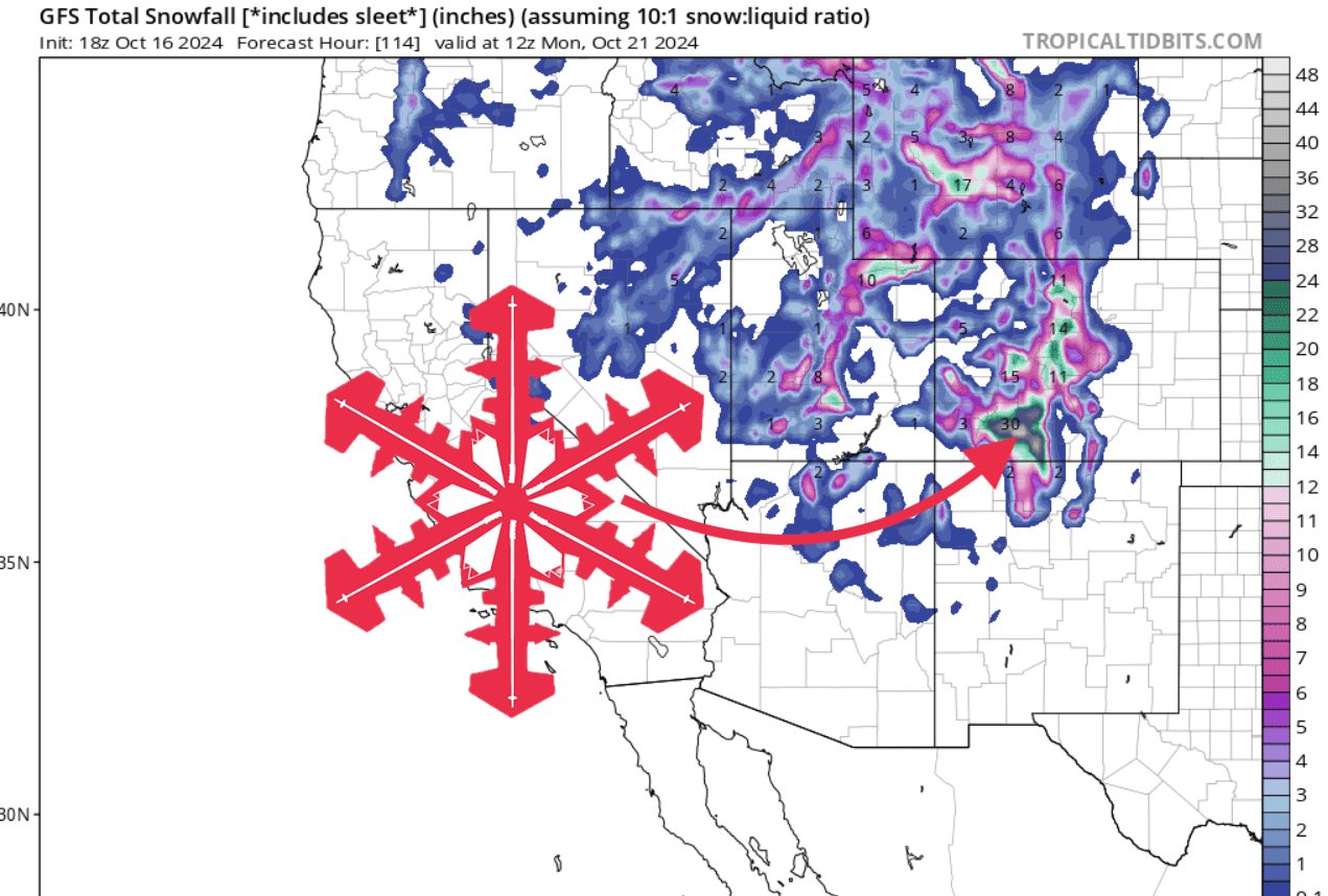
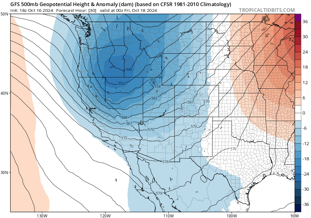
An early-season winter storm will move into the interior western U.S. this Thursday and Friday, October 17 and 18, bringing much-needed precipitation to most of the region and widespread mountain snow. Precipitation will move into the area along the front side of a trough that digs in from the northwest Thursday night.

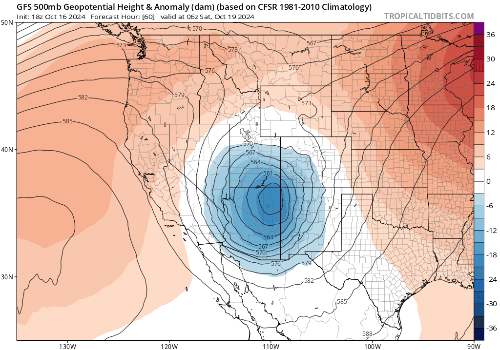
As the trough moves further into the western U.S., it will transition to a cutoff low. As it does so, it will draw in moisture from the Pacific. This moisture will collide with mountain ranges across the southern portions of the Rockies and begin to stack up snow.

The San Juans in Colorado will be the biggest winners, where upwards of 2-3 feet of snow will be possible by Sunday night.
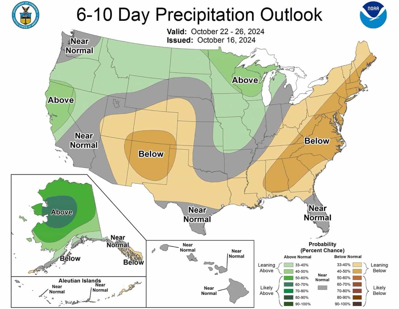
Conditions will dry out by Monday and stay dry for most of the week, with long-range models/ensembles indicating below-average precipitation.
