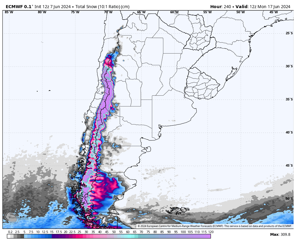
A massive winter storm will roll through the Andes this week. This storm is expected to drop feet of snow, with the highest totals being found in the north, near Portillo, Valle Nevado, and Las Leñas. Up to 10 FEET is expected by next weekend.
This storm will consist of two main surges of snowfall: one from Saturday morning until Monday morning and another one from Monday morning into the weekend.
The first storm, the smaller of the two, will come in particularly warm – with most mountains seeing temperatures in the 40s and even low 50s. A surge of cold air will push into the mountains on Saturday, increasing the odds of snow rather than rain or sleet. Resorts in the south will initially experience rain transitioning to snow. In contrast, central and northern resorts will have more snow due to the stronger arrival of colder temperatures on Saturday.
The second storm is really several small storms linked together under the same synoptic setup. Precip will stay to the south until the storm really ramps up in the north on Wednesday afternoon. As temperatures drop following the frontal passage, snow quality will continue to increase. It won’t exactly be blower powder, but certainly unusually fluffy for early June.
In total, between the two storms, the north will fare the best. Las Leñas should lead the pack with 85-12o”. Valle Nevado shouldn’t be far behind, looking good for 75-115″ by next weekend. Portillo should pick up 60-90″. In the central region, resorts like Caviahue, Corralco, and Pucon should pick up 25-60″ (with much higher totals likely at Corralco). However, these resorts will be more hit-or-miss and have the potential to boom or bust big (whereas model certainty in the north is much better). In the south at Cerro Catedral, these systems should bring 15-30″ of fairly wet snow.
Fingers crossed for a deep season ahead! If the way things have been going so far are any indication of what’s ahead, it should be a good one!