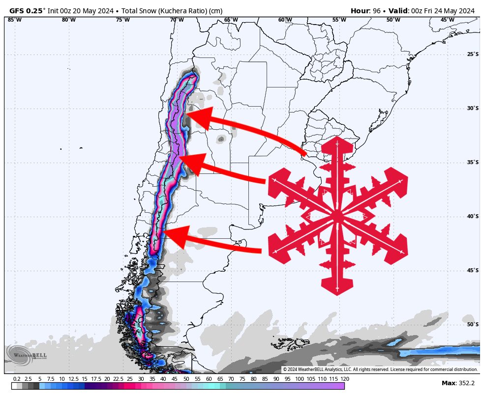
A major winter storm will hammer South America this week, bringing over 4-6 feet of snow to ski resorts in the Andes. The deepest totals will be found at Valle Nevado and Portillo, some of the northernmost resorts in the region.
Snowfall has already kicked off in the south around Bariloche. This precipitation will continue to move north overnight, reaching the Las Leñas/Valle Nevado/Portillo region to the north on Monday morning. Precipitation at resorts south of this northernmost region will die down by Tuesday night. Snowfall will basically linger stagnantly in this northern region into Thursday afternoon, dumping an impressive amount of snow.
In terms of totals, the deepest totals will be found in the north. Below are reasonable totals between Sunday night and Thursday evening (although again, snowfall at most of these resorts will be wrapped up by Tuesday night):
- Valle Nevado: 45-70″
- Portillo: 35-48″
- Las Leñas: 25-42″
- Pucon: 24-35″
- Corralco: 24-30″
- Cerro Bayo: 12-22″
- Antillanca: 15-20″
- Nevados de Chillan: 15-20″
- Caviahue: 10-15″
- Cerro Catedral: 9-15″
- Chapelco: 9-14″
The next opportunity for snowfall in South America will come late next weekend around Saturday evening, where a weak system will bring some snow to the northern region. Not much is expected, likely 10″ at most. After that, some high pressure in the region will keep things high and dry for the majority of next week before better chances for snowfall return.