This forecast was written at 12 a.m. MST on Thursday, December 19, 2024
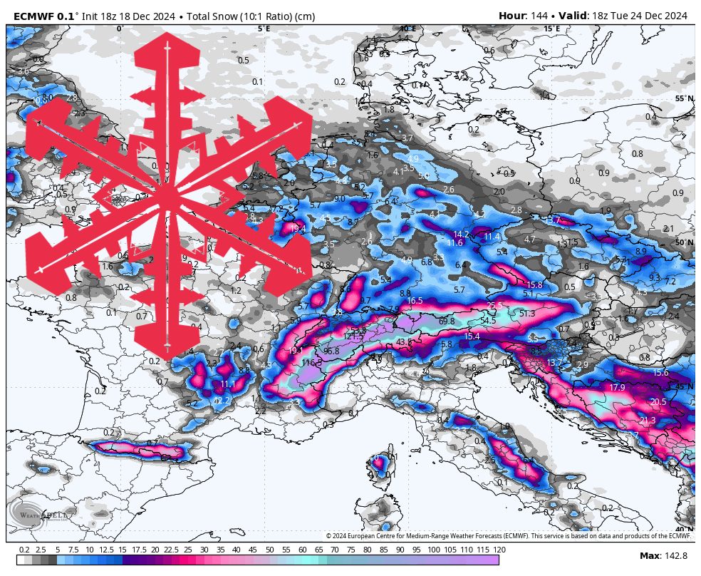
Europe was off to an early start for the 2024-25 season but then hit a lull with little snow falling in recent weeks. The dry spell is about to end as back-to-back storms could bring over a meter of snow to the Alps between now and Christmas.
Storm #1 (Thursday)

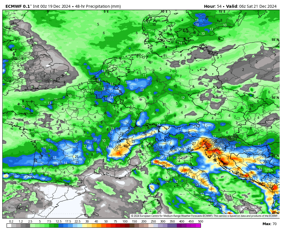
The first storm is already bringing widespread precipitation to Central Europe, and will reach the Alps later this morning. Temperatures are relatively warm when precipitation starts, but will drop midday behind a significant cold front. Snow in the morning will be heavier, wetter snow, with drier, fluffier snow falling the rest of the day. Heavier snow is bad for snowfall totals because it has snow:liquid ratios, essentially meaning that less snow is generated from a given amount of liquid.
The western end of the Alps will do especially well because the moisture is flowing in from the WNW, allowing the western slopes to receive moisture first. The French and Swiss Alps should see between 15-35 centimeters of snow on Thursday, with conditions drying out again in the early hours of Friday as the trough axis swings across the Alps and cuts off the flow of moisture
Storm #2 (Saturday Night-Tuesday)

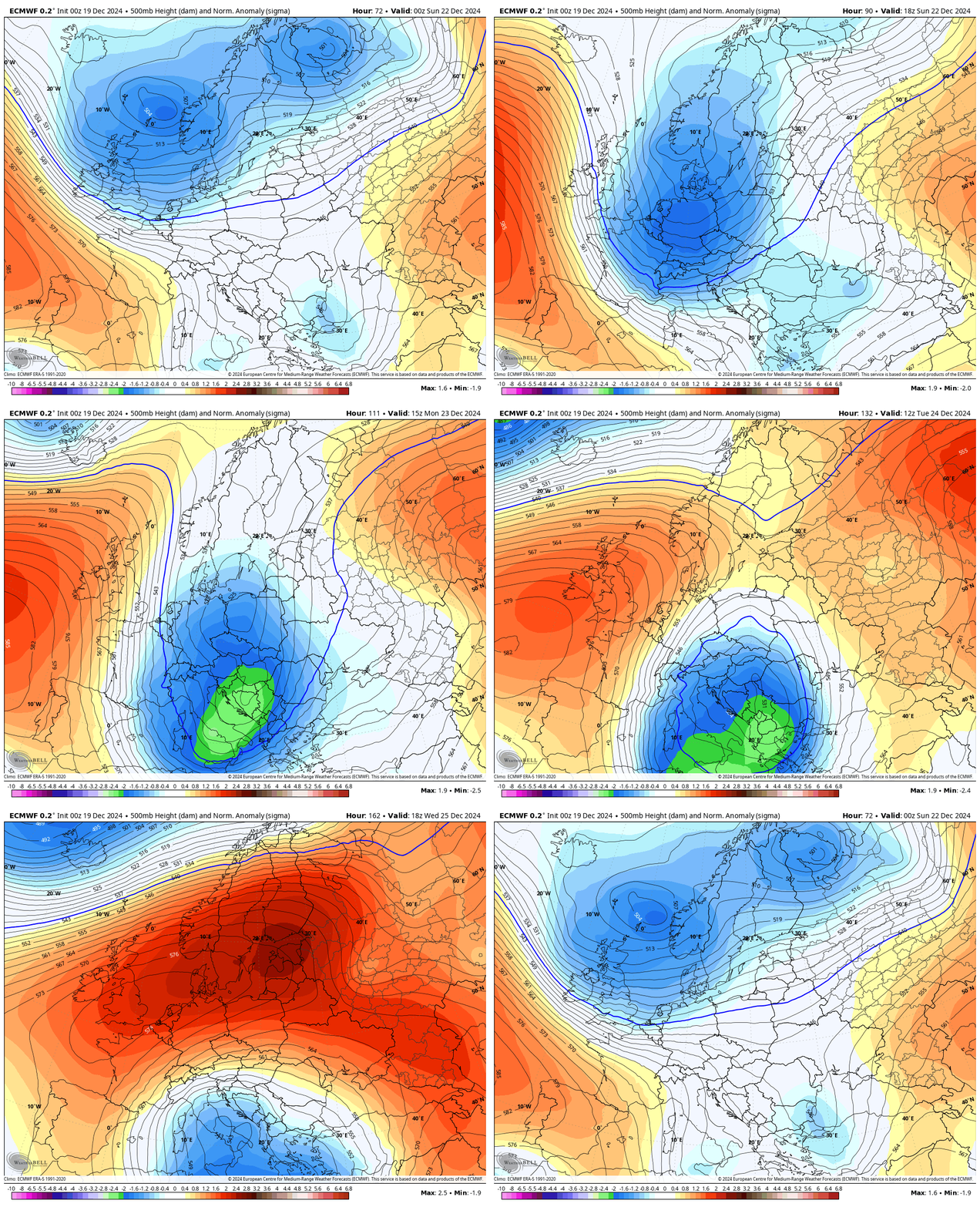
The second storm this week is much more impressive, and features a stronger low pressure system and a deeper trough. This storm will move along practically the same path as the previous storm, but will create a broader area of precipitation. Once again, snow will start out heavier, but will become lighter and fluffier once the cold front arrives. The cold front for this storm is expected to reach the Alps early Sunday morning.
Snow begins ramping up across the Alps on Saturday evening, with steady, and sometimes heavy, snow continuing through Sunday morning. There is then a bit of a drop off in snowfall rates Sunday afternoon before a secondary disturbance moves down across Germany on Sunday night and produces more snow, especially on the eastern half of the Alps, on Monday morning. Temperatures will already be cold, so all of the snow that falls on Sunday night/Monday will be fluffier snow. The trough axis takes much longer to reach the Alps with this storm, and that will allow light snow to continue all the way until Tuesday.
Forecast Snow Totals:
-
Chamonix Mont-Blanc (France): 1.25 – 1.75 meters
-
Tignes (France): 1.35 – 1.90 meters
-
Les 3 Vallees (France): 0.85 – 1.20 meters
-
Kitzbuhel (Austria): 0.45 – 0.80 meters
-
Zermatt (Switzerland): 1.10 – 1.60 meters