Forecast completed 8 a.m. MT, Tuesday, December 3
Summary
Things are looking up for Northeastern skiers & riders, with healthy recent snowfall and more on the way.
Cold and unsettled weather continues this week. Pow skiing potential peaks on Thursday, but decent conditions should last into the weekend.
A milder weather pattern develops in the long range.
Short Term Forecast
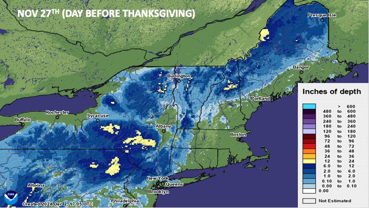
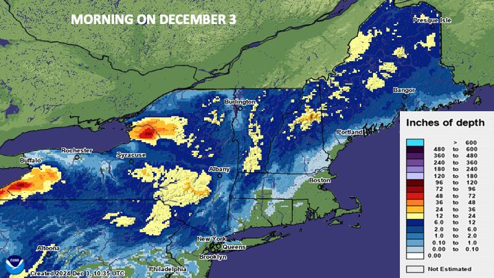
Chilly, unsettled W-NW flow has lingered behind the Thanksgiving day storm. For some resorts, bouts of lake effect snow have tacked on additional accumulation. It’s been a healthy region-wide boost to snowpack. To drive this point home, check out these estimates of regional snow depth before and after the recent cold weather:


The good fortune will continue, with two incoming weather systems to watch in the next week.
Storm #1 – Wednesday Night & Thursday
Another solid storm moves into the area on Wednesday afternoon. Cold air is already in place ahead of this one, so expect ski areas to see exclusively snow from this storm.
Snow will overspread New England west-to-east through Wednesday evening. Periods of snow will continue overnight and into Thursday morning before turning more sporadic and showery throughout the day. While the best skiing will be on Thursday, a few snow showers will stick around into Friday morning and add additional accumulation.
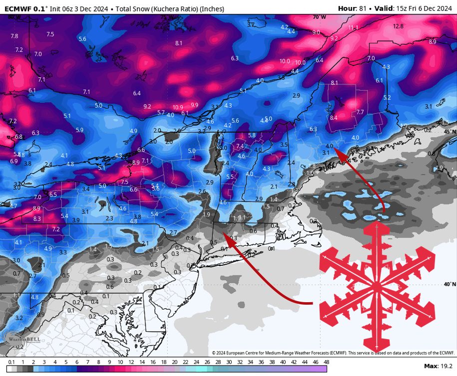
By Friday morning, expect storm totals something like this:
- 5-8″ for most Vermont resorts. 9-14″ for Jay Peak, 7-11″ for Stratton & Bromley (lake effect enhances totals)
- 3-6″ for New Hampshire resorts
- 5-9″ for the bigger Maine Resorts
- 4-7″ for Whiteface & Gore
- 1-3″ for Catskill resorts
Increasingly cold weather is expected Thursday and beyond. Be prepared for morning temperatures in the low teens or single digits on Friday & Saturday.
Long Range Forecast
A weak disturbance moves into the area Saturday night and may produce a bit more accumulating snow, especially for the northernmost resorts in the region.
Looking ahead, warmer conditions look to reestablish themselves next week.
There will likely be storms between December 9 and 12, but they look to come in warm with a threat for rainfall for many areas.