Forecast By SnowBrains Meteorologist – Eric McNamee
Brought to you by Alta Ski Area
12:30 PM MST, 1/21/2021
Forecast Summary:
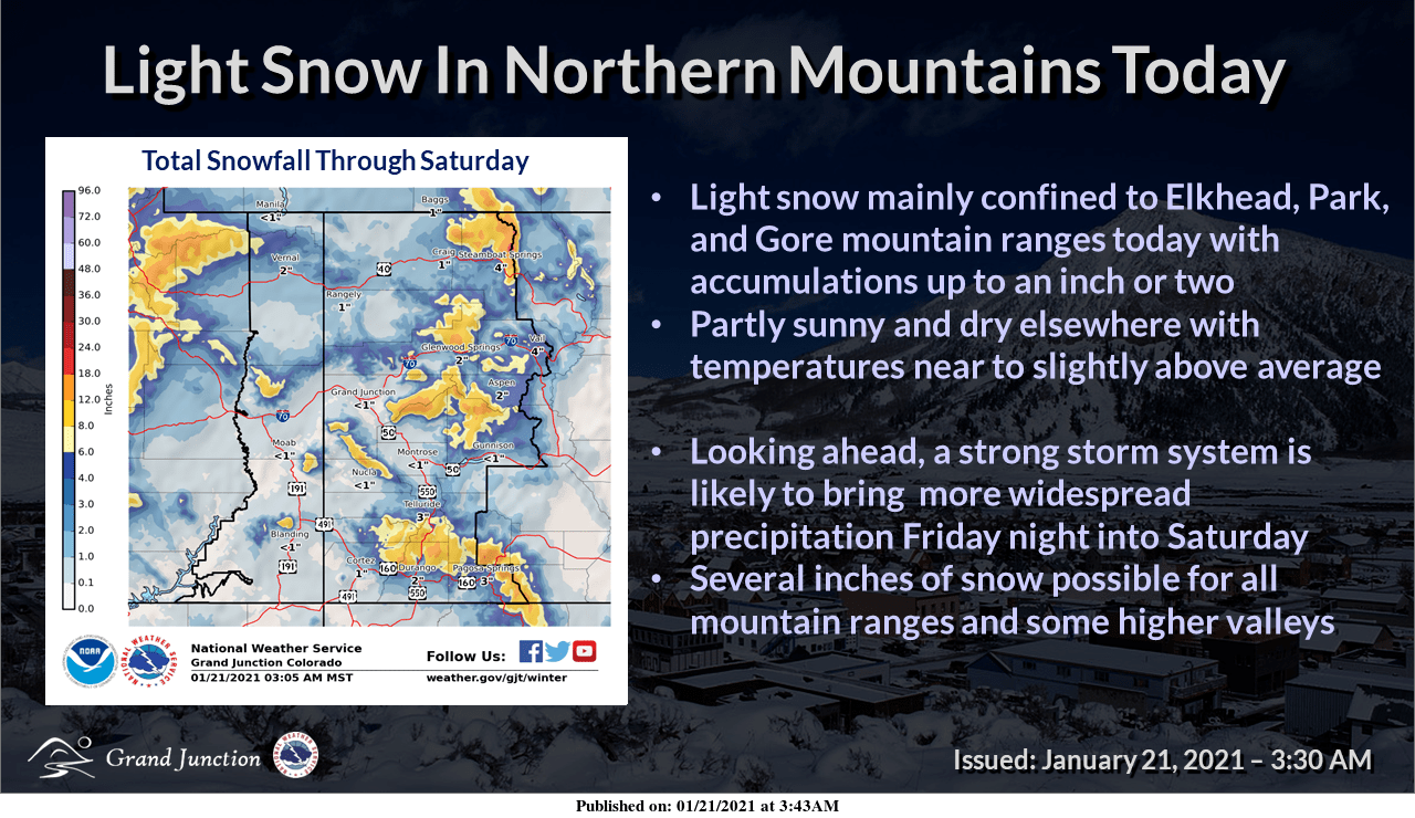
8-16″ of snow is expected in the mountains of the Southwest US through this weekend, with MUCH MORE next week.
This is all due in part to a major pattern change that is currently taking place over the Western US, which will bring rounds of snow across the entire West.
The first couple of rounds will target the Southwest this weekend and next week.
The active pattern looks to continue through the extended period of the forecast.
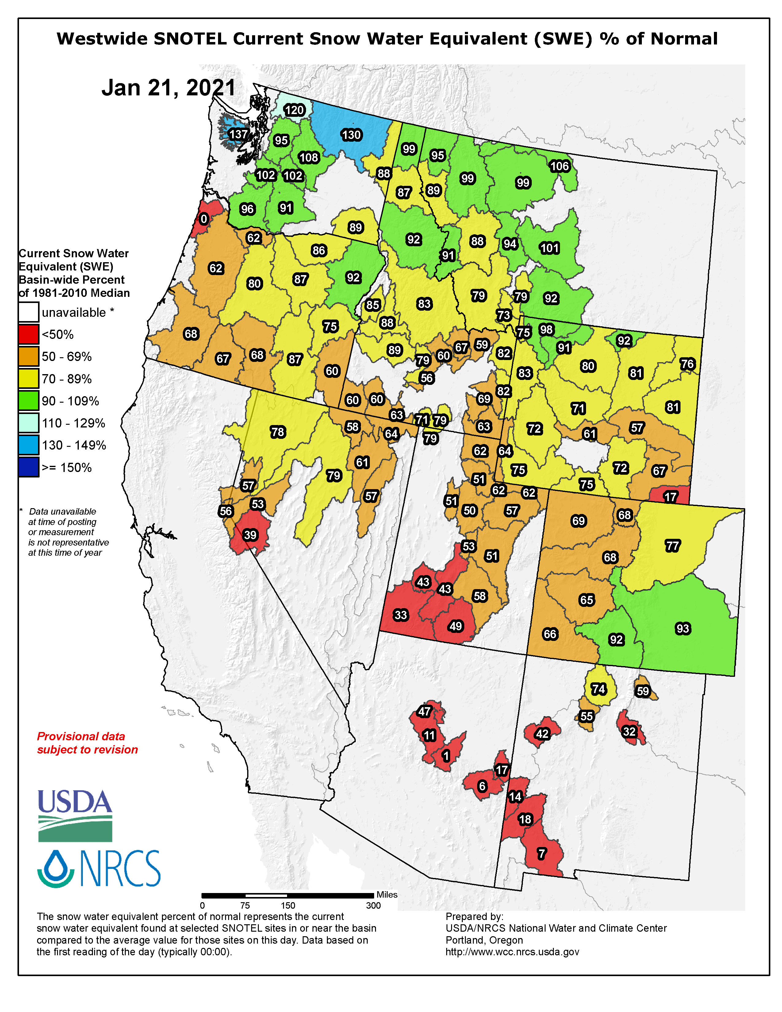
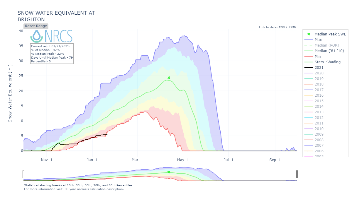
This will be extremely beneficial to snowpack across the region as they have been starved of moisture this winter (see images below).
Short-Term Forecast:
Friday-Sunday:
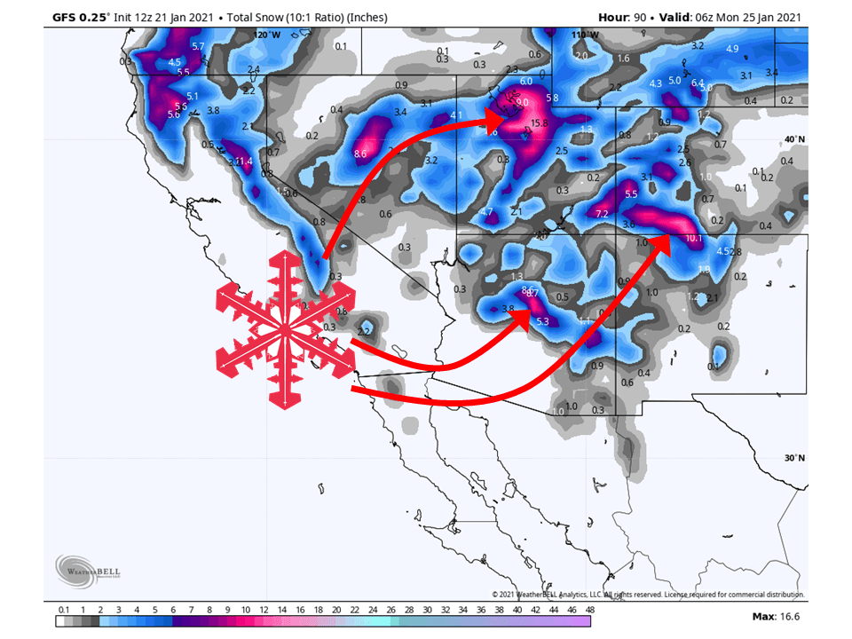
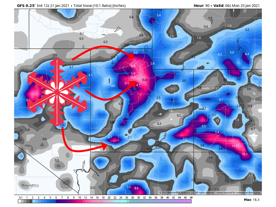
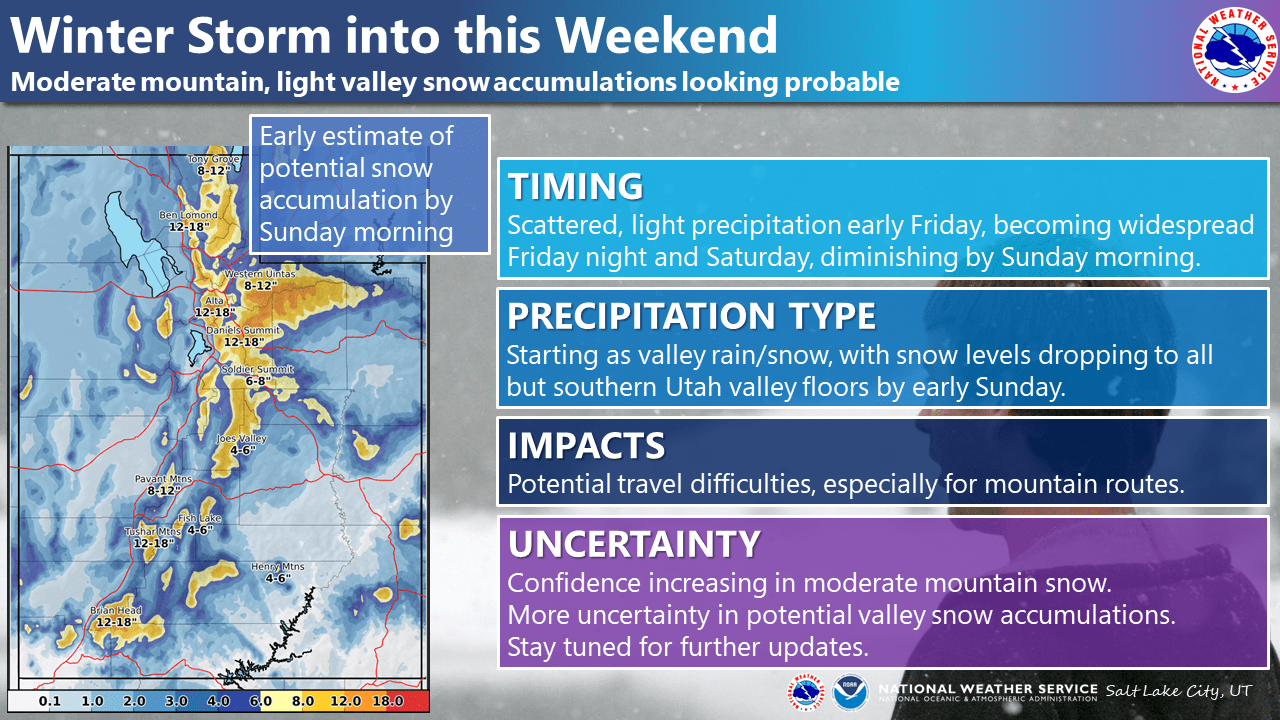
A shortwave trough currently located off the Pacific Northwest coast will dig into the Great Basin this weekend, bringing 8-16″ of snow to the mountains of the Southwest.
Precipitation will begin to fill in and become widespread across the region Friday afternoon.
This will continue through the day Saturday before tapering off a bit late in the day Sunday.
By then another shortwave trough will be pushing in from off the California coast.
Long-Term Forecast:
Monday-Thursday:
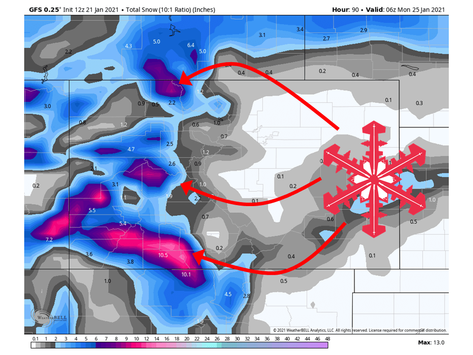
This next shortwave trough will move into the Southwest during the day Monday, bringing another sound of heavy snow to the southwest.
This looks to take more of a southerly track, so places that will see the most snow are Arizona, New Mexico, and Southwest Colorado.
Another shortwave trough will move in from the Pacific Wednesday/Thursday.
Snowfall amounts are not certain at this time, but these troughs look to be rich in moisture so there could be A LOT through next week.
Extended Forecast:
Sunday and Beyond:
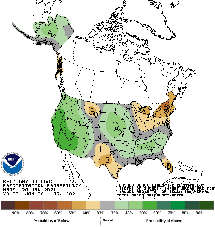
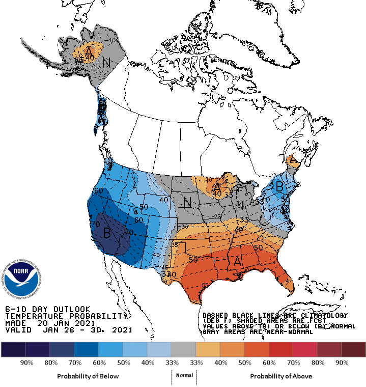
Global ensembles are indicating the pattern to remain active with above-average precipitation and below-average temperatures across the West, especially the Southwest.
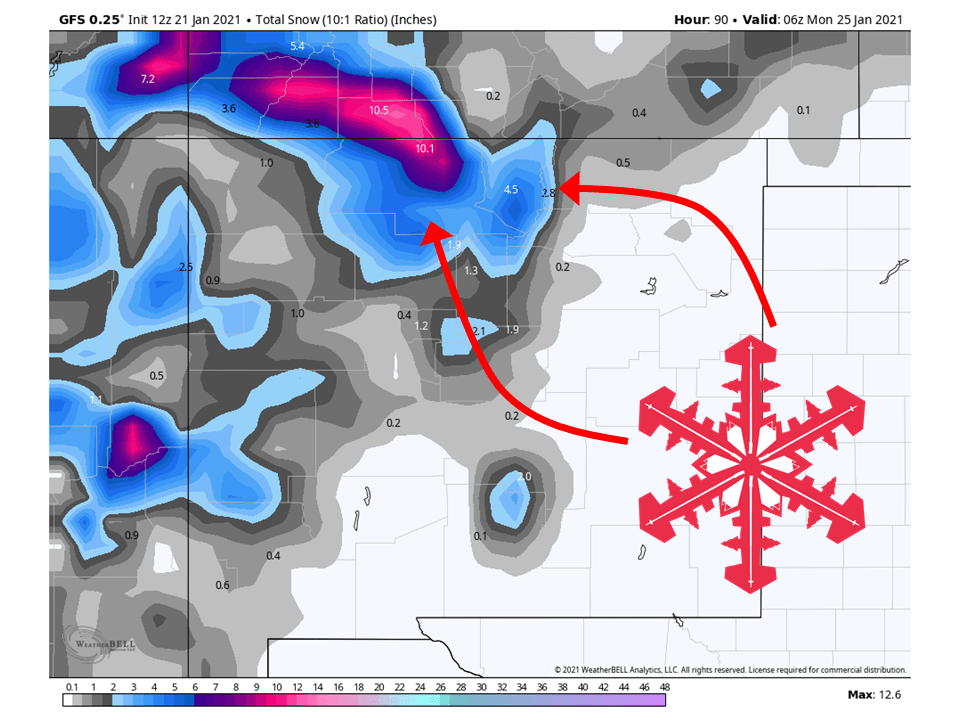
Utah:
The first in a series of shortwave troughs will move through the state this weekend, bringing 8-16” of snow to the mountains.
The next shortwave will move through the state on Monday, primarily bringing snow to the southern part of the state as the trough takes a more southerly track.
Another will move into the state Wednesday, bringing more widespread precipitation.
Snowfall totals are uncertain for next week, but it looks promising.
Resorts that look to be favored are Alta, Snowbird, Brighton, Solitude, Park City, Canyons, Deer Valley, Snowbasin, Powder Mountain, Beaver Mountain, and Brianhead.
**Alta Forecast**
The first in a series of shortwave troughs will move through the state this weekend, bringing 8-16” of snow to the Wasatch Mountains.
Snow will begin Friday afternoon and counting through the day Saturday, before tapering off Sunday.
More shortwave troughs will move through next week, bringing more snow to the mountain.
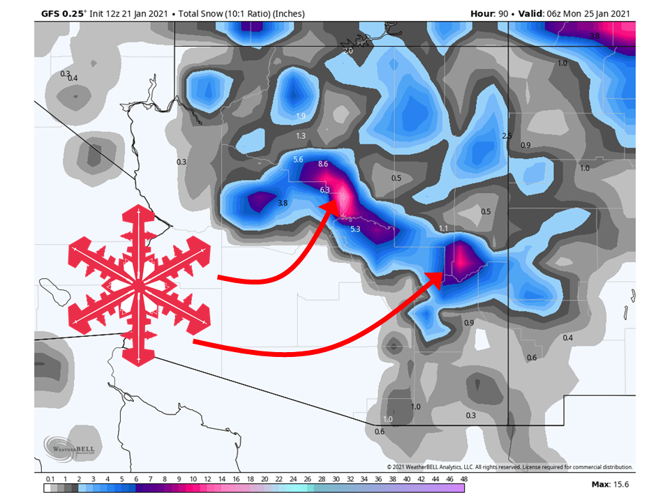
Colorado:
Colorado will see 8-16″ of snow over the weekend, especially the San Juans.
Snow will get going Friday afternoon and taper off Sunday morning as the first shortwave trough moves through.
The second shortwave will move through Monday/Tuesday, bringing more heavy snow to the mountains.
Resorts that look to see the most snow are Aspen, Steamboat, Wolf Creek, Telluride, Silverton, and Winter Park.
Arizona:
Colorado will see 8-14″ of snow through Sunday, especially along the Mogollon Rim.
Snowfall amounts will really pick up heading into next week as the second trough moves into the state, bringing heavy snow.
Another round of snow is likely later in the week as a third shortwave trough moves into the West.
Arizona Snowbowl will likely do well over the next week.
New Mexico:
New Mexico will see a bit less snow due in part to being further inland, with 6-12″ of snow falling in the northern part of the state.
However, the snow really picks up early next week as the next shortwave trough moves into the Southwest US.
Another round is possible late next week.
Taos and Ski Santa Fe will see a good amount of snow through next week.
USA:
Global ensembles are indicting that conditions will remain active with above-average precipitation and below-average temperatures across the West in the extended.