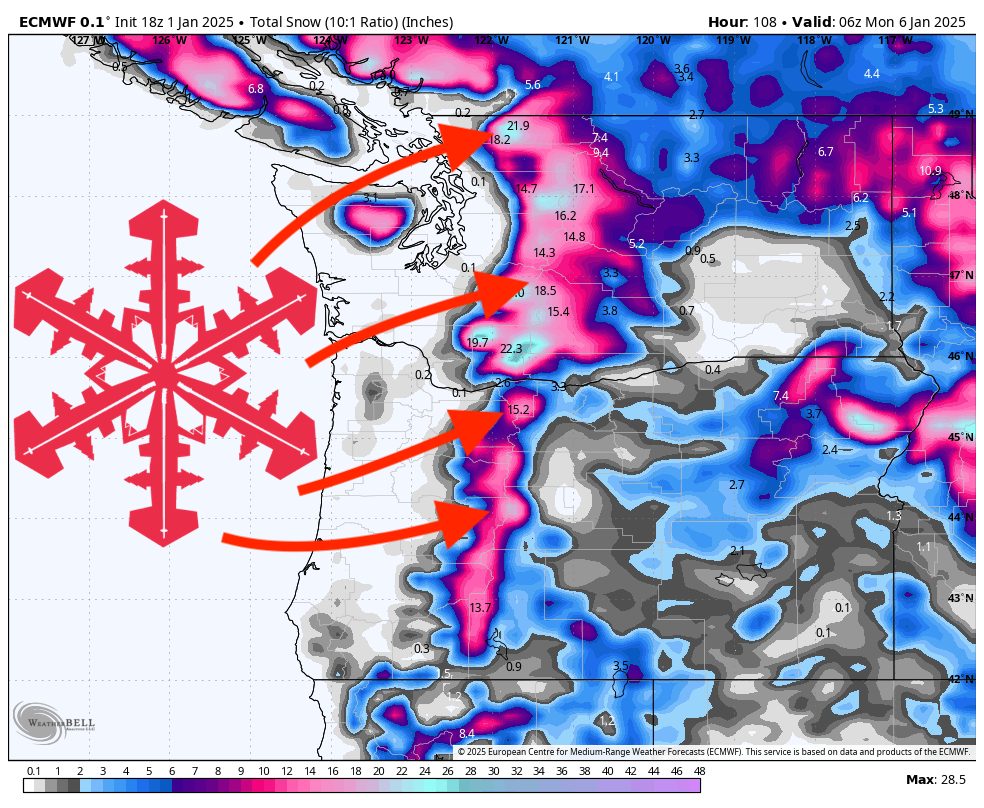
This forecast was written at 6 p.m. on Wednesday, January 1, 2025
A series of generally mild but persistent waves will affect the Cascades and surrounding mountains through Sunday, delivering respectable accumulations at mid and upper elevations. Snow levels will hover in Washington’s 3,000–5,000 foot range and Oregon’s 4,000–6,000 foot range, occasionally dipping lower with passing fronts. Winds will sometimes be breezy, especially late Thursday into Friday, but nothing unusual for most ridges and passes. A quieter pattern should emerge early next week, though some minor snow could still brush parts of the region on Tuesday.
Tonight–Thursday: Light snow will continue over the higher terrain, particularly above 3,000–4,000 feet in Washington and 4,000–5,000 feet in Oregon, as a weak system moves inland. Snowfall amounts will be modest, but enough to refresh the upper slopes. Precipitation could briefly mix with rain or a few wet flakes at lower elevations, although minimal accumulations are anticipated below mid-mountain.
Friday–Saturday: A stronger surge of moisture arrives from the southwest, bringing more widespread snow to the mountains and rain to most valleys. Snow levels will fluctuate around 3,500–45,00 feet in Washington and 4,000–5,500 feet in Oregon; expect moderate to occasionally heavier snow at the higher passes and summits. Gusty easterly or south-southwesterly winds could impact ridgelines, but speeds should only occasionally be high enough to affect lift operations.
Sunday Wave: Additional light to moderate snow remains possible on Sunday, primarily in Washington’s Cascades and Oregon’s highest peaks, before tapering that night. Snow levels won’t change much, staying roughly in the 3,500–5,000 feet zone, depending on location. Next week looks more settled, though a weak disturbance on Tuesday may brush a few northern mountains with minor accumulations.
Storm-by-Storm Forecast Totals
Wednesday (1/1)-Sunday night (1/5)
Timberline: 18″-31″
Mt Bachelor: 13″-23″
Stevens Pass: 12″-22″
Crystal Mountain: 12″-21″
Mt. Baker: 11″-20″
Snoqualmie Pass: 9″-16″
Whistler: 5″-11″