10:45 pm MST, 12/7/2022
Forecast By SnowBrains Chief Meteorologist – Eric McNamee
Forecast Summary:
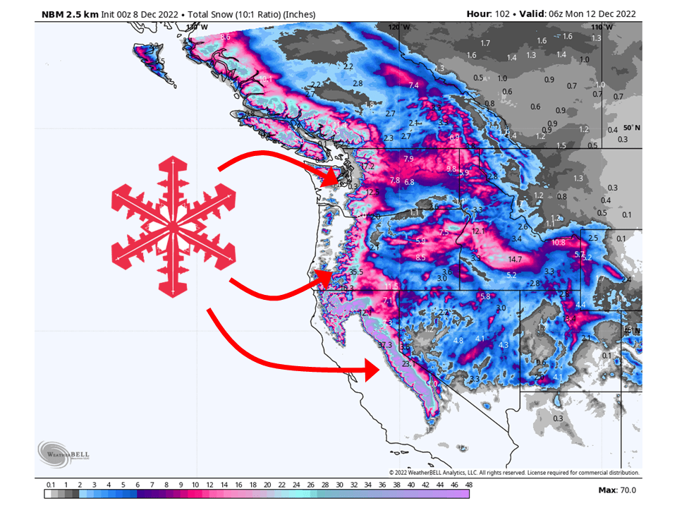
A series of troughs will move through the west coast and bring multiple FEET of snow to the Cascades and Sierra by Sunday.
Snow starts Thursday morning across the Cascades and moves south to the Sierra by Thursday night as the first trough digs into the region.
The second, more robust trough pushes into the west coast Friday evening, bringing widespread mountain snow through Sunday.
A break in the action comes early next week before more active weather is possible across California in the latter half of next week.
Resorts likely to see the most snow are:
Pacific Northwest:
- Alpental
- Crystal Mountain
- Mt. Baker
- Stevens Pass
- Summit at Snoqualmie
- Mt. Hood
- Bachelor
- Timberline
- Hoodoo
California:
- Kirkwood
- Mammoth
- Northstar
- Heavenly
- Sugar Bowl
- Palisades Tahoe
- Sierra at Tahoe.
Short-Term Forecast:
Thursday-Sunday:
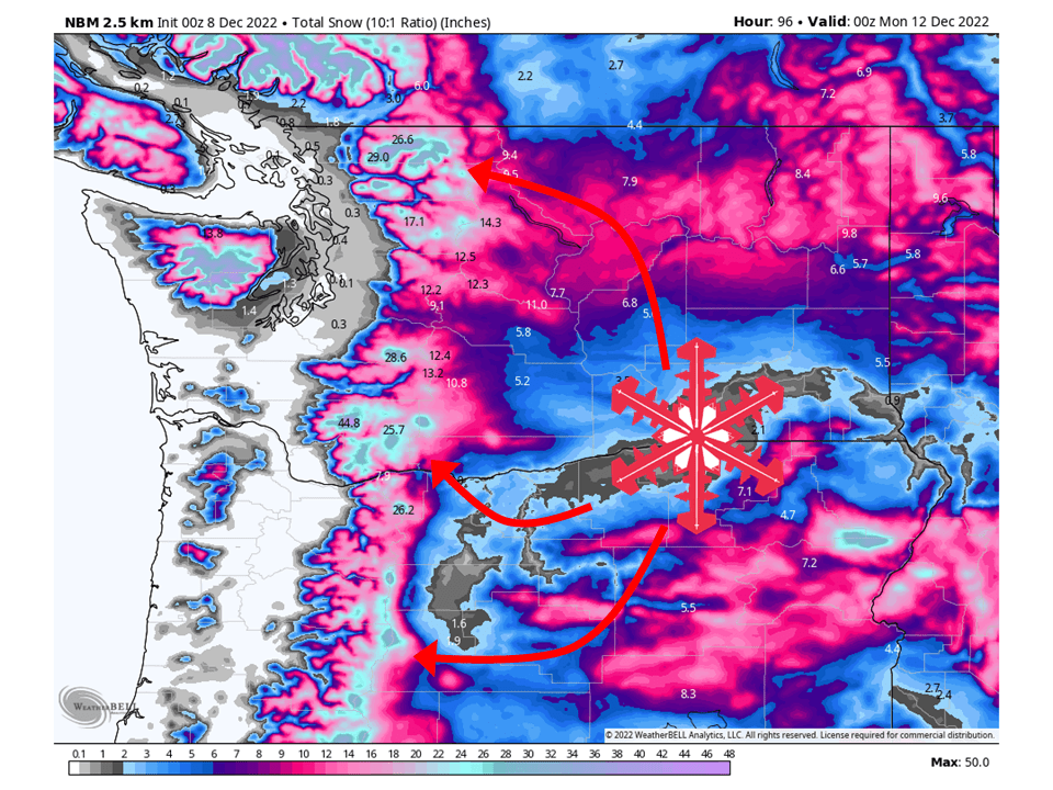
A series of troughs will move through the west coast and bring multiple FEET of snow to the Cascades and Sierra by Sunday. The first trough will push into the PNW early Thursday morning and bring widespread snowfall to the Cascades during the day, along a band of precipitation. This band will sag to the south with a cold front associated with the trough. By Thursday night, snow will start to fill in across the Sierra. Snow levels will likely begin in the 4000-5000′ range, fall to lowland levels in the PNW Friday morning, and down to roughly 3000-3500′ in the Sierra Friday morning.
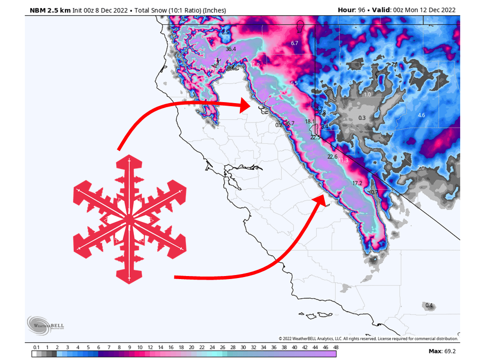
A second and more potent trough will push into the west coast Friday evening/night. Snow will initially start across the PNW as a swath of moisture is transported into the area. Snowfall rates won’t be too heavy but will be enough for decent totals. Late Friday night and into Saturday, snow will move into California along a band of heavy precipitation. Heavy snowfall is likely with this band, with snowfall rates reaching upwards of 4″ per hour at times. This band will dig push south along the Sierra Saturday afternoon and night, with instability snow showers behind it lingering into Sunday. By Sunday afternoon/evening, snow showers will taper off over both regions as the trough moves to the east. In total, 1-3 FEET can be expected in the Cascades and up to SIX FEET in the High Sierra.
Long-Term Forecast:
Monday-Wednesday:
Conditions will be dry to start next week as a ridge of high pressure builds along the west coast. However, temperatures will be pretty cold. By Wednesday next week, models indicate a cut-off low will develop off the California coast and bring precipitation chances back to California the latter half of next week.
Extended Forecast:
Tuesday and Beyond:
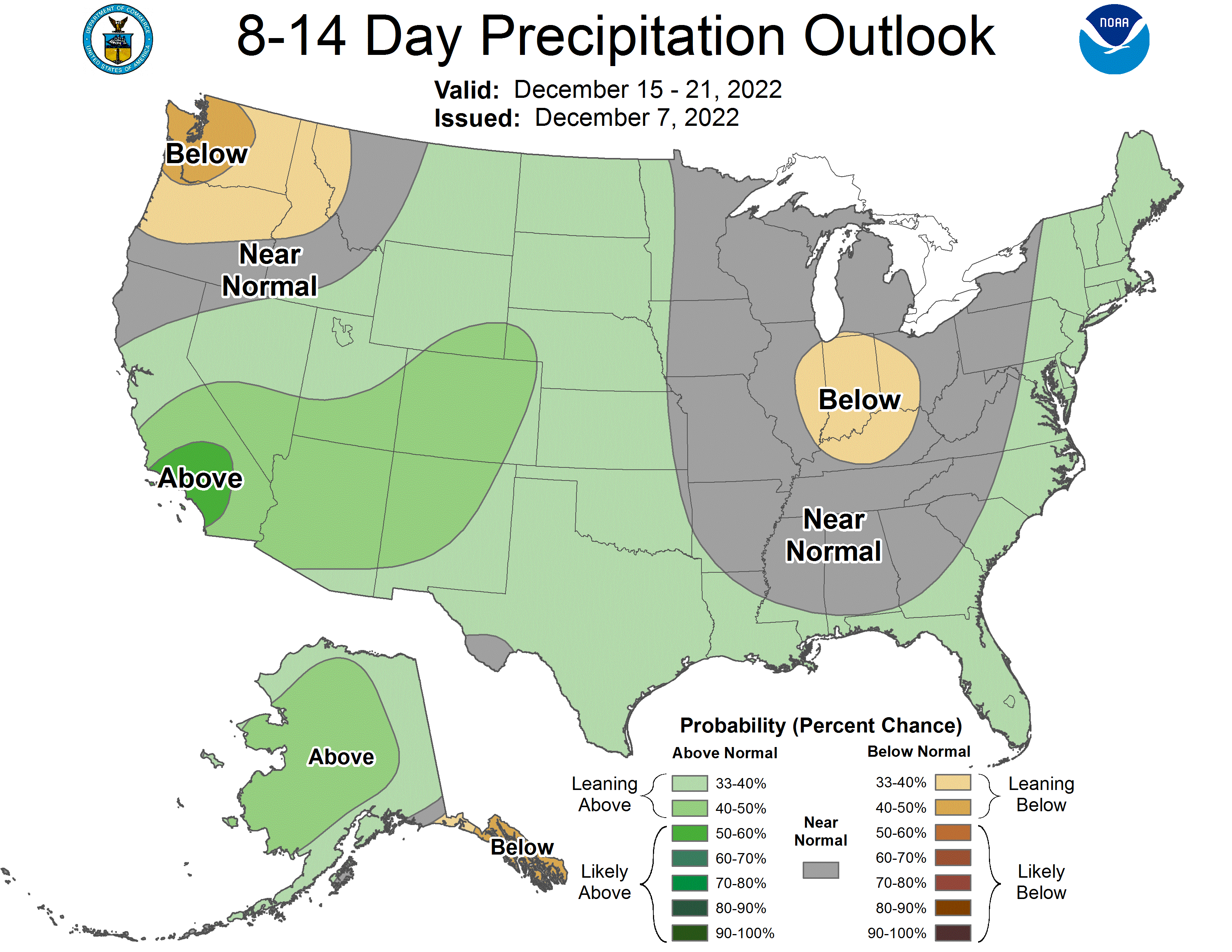
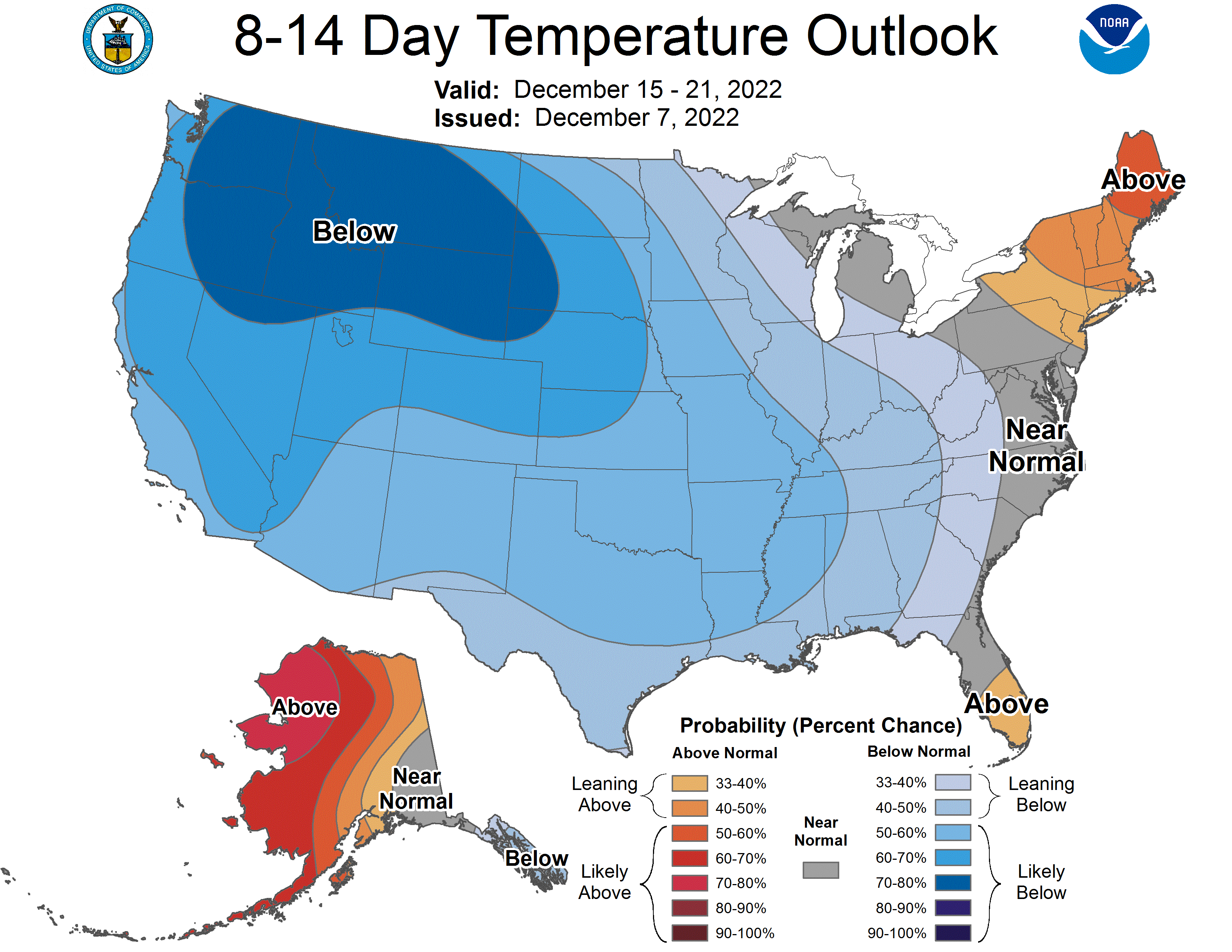
Global ensembles indicate above-average precipitation and below-average temperatures across California, with below-average precipitation and below-average temperatures across the PNW in the extended.
