Forecast prepared 10 AM MST Thursday, Feb 01.
After a giant storm cycle in the beginning of January (~130″ in two weeks at Alta!), warm & dry weather has presided over Utah for the last week or so.
Change arrives this afternoon when the first of two powerful Pacific storm systems pushes into the Intermountain West.
We’ll see periods of mountain snowfall Thursday night through Saturday morning from the first storm. Both Friday and Saturday should offer great snow, with some leftovers on Sunday.
Another storm arrives Monday through Wednesday night. This one looks to bring big snowfall statewide. Gusty winds, new snow, and the stubborn persistent weak layer in the snowpack will likely bring about some avalanche issues in the Cottonwoods, so keep that in mind if you’re looking to get up to ride this week.
Don’t be surprised to see southern Utah resorts pick up 30-45″ of snow in the next week. 15-30″ seems reasonable for the northern resorts.
Details
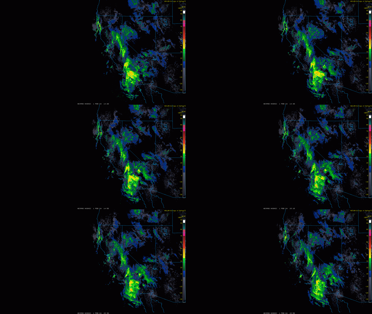
Storm #1 is on our doorstep this morning. Rain/snow showers are just barely starting to push into the area, as you can see on radar data:

This storm comes in two pieces. The first piece is today (Thursday) through midday Friday, and is characterized by tons of moisture in a stiff south-southwesterly flow. Snow levels will be high during this period, reaching up to ~7500′ at times. This portion of the storm will favor the mountains of Southern Utah, with Brian Head the place to watch for impressive snowfall today and tonight. Northern Utah will see some snow from this too, but I don’t expect huge snowfall until after the first chair on Friday.
By midday Friday, piece two arrives in the form of a cold frontal passage, bringing much lower snow levels and winds turning out of the west-northwest. Snow levels fall to ~5000′ by Friday night before snowfall fizzles out slowly through Saturday morning. This piece of the storm will be more productive in the northern half of the state, and I’d aim to hit the slopes either Friday afternoon or Saturday morning for the best stuff.
A few mountain snow showers will linger as late as Saturday evening.
As for storm total snowfall, thinking the following:
- Brian Head: 14-20″
- Eagle Point: 12-18″
- Sundance: 8-15″
- Park City/Deer Valley: 7-14″
- Solitude/Brighton: 10-18″
- Alta/Snowbird: 12-20″
- Powder Mountain/Snowbasin/Beaver: 5-9″
Storm #2 looks bigger than its predecessor. But there are lots of moving parts to this one and still a few days for things to go wrong. I’ll try to avoid getting too specific in this discussion, perhaps an updated forecast will be warranted a day or so ahead of this one.
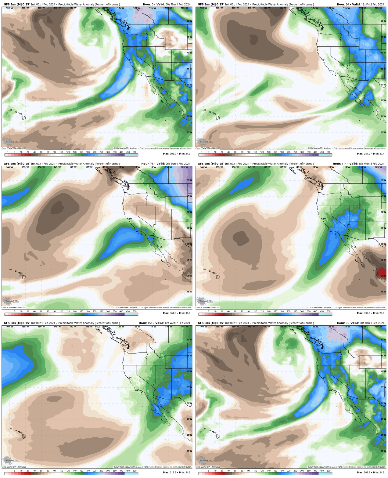
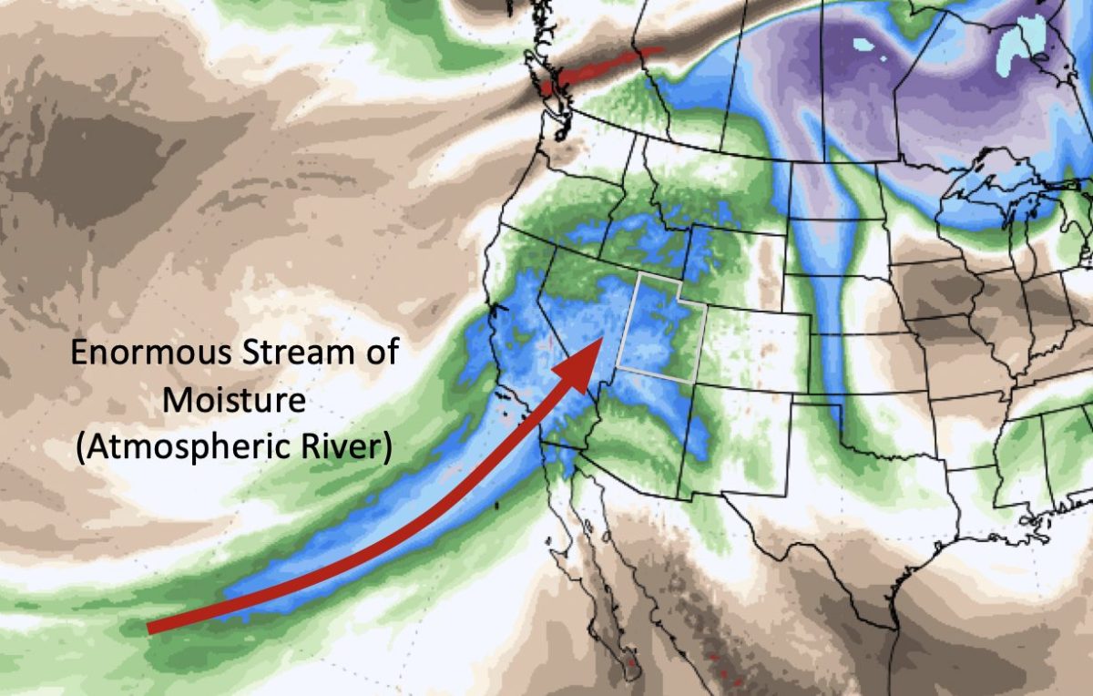
Anyway, like the first storm, this event is fueled by a ton of subtropical moisture—just look at the plume of moisture being sent into the Western U.S. by Monday morning:

Once again (and as is typical in these atmospheric river setups) we’ll see snow levels get pretty high when the rain/snow arrives on Monday—probably in the ballpark of 7500′ again.
Periods of rain/snow with high snow levels look to last all the way until Wednesday night. Finally, cold air moves in for the last bits of this system Wednesday night-Thursday AM, with a chance for snow down to valley floors.
We look to dry out by Thursday afternoon. I’m expecting to see some pretty hefty snow totals from this event, especially in southern Utah. Something on the order of 10-22″ for the resorts in the northern half of the state with as much as 16-30″ in favored spots (Brian Head) down south.
Local Wisdom
Two things that felt worth adding:
First, these atmospheric river-type storms are great for the snowpack—heavy dense snow helps with coverage and adds lots of liquid to the snowpack. They also don’t ski quite as well as colder storms. I’d make an effort to catch both of these storms after cooler air filters in so that you might find some true pow on top of creamy snow from earlier in the storm. I think your best bet is Saturday morning for storm #1, and probably Thursday for storm #2.
Second, keep in mind that both of these storms will add a lot of water weight to our snowpack. They will also both be fairly windy, with a long duration period of ridgetop gusts to 50+ MPH.
We’re still dealing with a weak layer in the snowpack that formed during a long period of dry weather in December. Expect this layer to start acting up again over the next week, and monitor avy forecasts.
In combination with the hype of a ‘big storm cycle’, this will likely lead to some canyon closures/traffic issues. Something to consider as you play your cards this week.
Happy shredding.