Forecast completed 5 a.m., Friday, November 15
Forecast Summary
- The first of two quick-hitting weather systems will move through Utah Friday p.m. – Saturday a.m. General accumulations of 3-5″ are likely with a bit more in the Cottonwoods.
- After a short break on Sunday, another weather system will clip the area Monday p.m. – Tuesday a.m. It looks like a minor storm, but a few inches of extra snowfall are possible.
- We’ll dry out for the second half of next week.
- Brighton, Solitude, and Brian Head are now spinning (a limited number of) lifts.
Short Term Forecast
Our next storm system to watch moves in later today. Forecast models depict a pretty impressive trough centered over Nevada by midday Friday. However, watch as the trough ‘splits’ over the weekend. One piece heads towards the Northern Plains while the rest of the trough closes off over Northern Mexico:
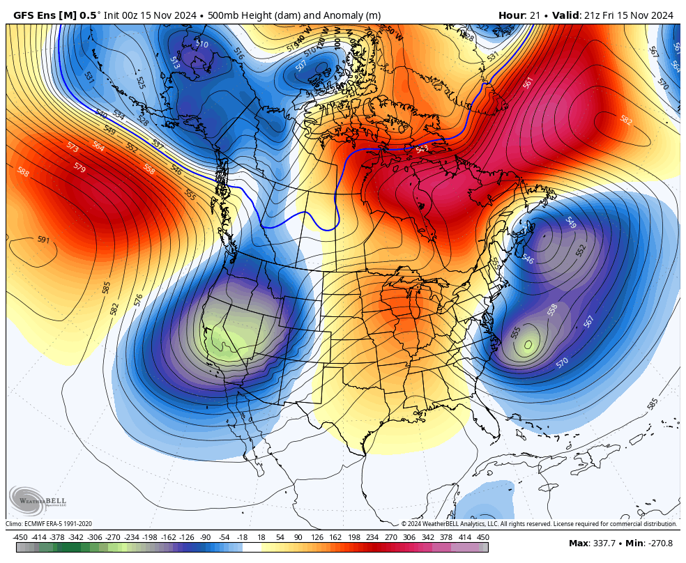
The result for us in Utah is a fairly messy storm.
Still, look for a few mountain snow showers to get going Friday evening amid an increasingly moist SW flow. Snow initially close to 6,500′ will fall to around 4,500-5,000′ by Saturday morning as a cold front moves through. Periods of snow will last into Saturday morning before tapering off by midday.
Once the front passes, we’ll get a short window of chilly and moist NW flow. I hope this helps the Cottonwoods squeeze respectable accumulations out of an otherwise unimpressive storm.
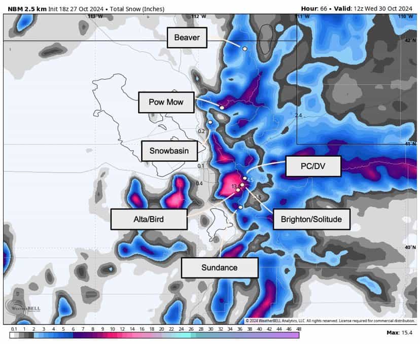
As for accumulations, expect:
- 6-9″ for Alta, Snowbird, Brighton, & Solitude
- 3-5″ for Snowbasin
- 3-5″ for Park City & Deer Valley
- 2-4″ for Powder Mountain & Beaver Mountain
- <2″ near Brian Head & Eagle Point
Monday through Tuesday’s Storm
Quick on the heels of the Friday-Saturday snow, another storm system will push into the Great Basin on Monday. This should bring a pretty stiff blast of cold air into Utah:
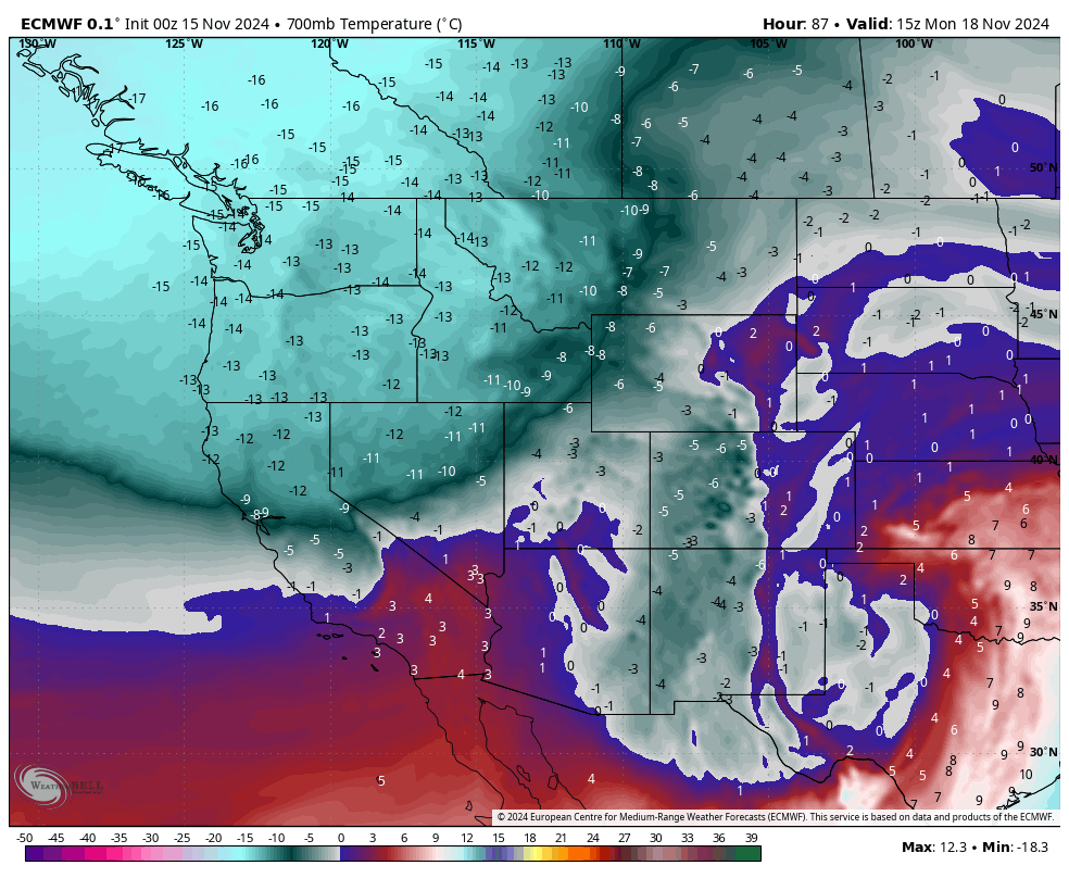
But there are still some key uncertainties regarding the track of the front and whether there will be enough moisture around for appreciable snowfall. At this point, the likely outcome will be another period of chilly and unsettled weather with mostly unimpressive snowfall. Expect occasional mountain snow showers to gradually produce a couple of inches of accumulation for the resorts in northern Utah.
No blockbuster storms, but I’ll take having a little something in the forecast.
Extended Forecast
This is where the news turns slightly drier.
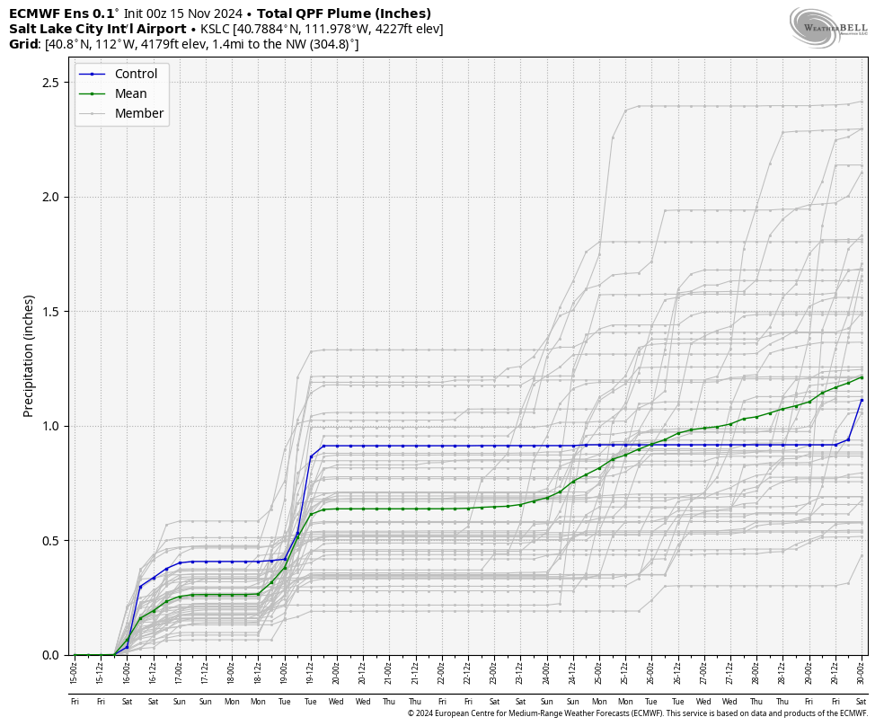
I like these charts for an at-a-glance peek into the extended forecast. You’re looking at an ensemble of model forecasts predicting rain/snow amounts at the Salt Lake International Airport. The lines jump upwards for the storms I discussed earlier: one FRI-SAT and the next MON-TUE.
But by midweek next week, we’ll ridge out for a few days & the door to storms will close. As you can see, it isn’t until around November 25 before any prospects of snow return.
10 days out is probably as far out as you should ever trust weather models, so who knows what will happen during the closing week of November. Just know that the forecast looks a little drier after Wednesday next week.