Forecast created 11:00 a.m. on Thursday, December 12, 2024
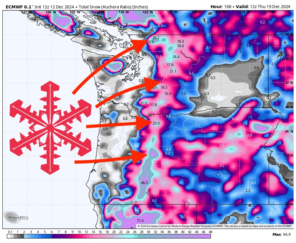
The upcoming stretch of weather will deliver periods of light to moderate snowfall today, followed by a much stronger and prolonged storm event beginning Friday and extending into mid-next week. While initial snow accumulations today will remain modest, snow levels will hover around 2500-3500 ft, ensuring that higher ski terrain will pick up a fresh dusting. Beginning Friday, a series of more potent systems will roll in, bringing heavier and more sustained mountain snowfall well into the middle of next week. Expect variable snow levels, strong winds at times, and substantial accumulations for many resorts.
Today (Thursday), conditions will remain relatively mild and unsettled across the region’s mountains. Snowfall will be on the lighter side, with snow levels generally around 2500-3500 ft. While accumulations will be limited, higher elevation terrain should manage a modest refresh. Temperatures will remain cool enough to keep most precipitation as snow above these levels, providing a lightly dusted surface, though lower slopes may see just a mix or rain.
From Friday through the weekend, a stronger, multi-day storm event will bring more widespread and heavier snowfall to nearly all mountain locations. Snow levels will bounce around, starting near 3000-3500 ft on Friday, then fluctuating through the weekend as additional waves push through. This prolonged event will include periods of intense snowfall, ensuring deepening coverage and excellent turns at mid and upper elevations.
Early next week, the storm pattern will continue, delivering extended, and in some areas, nearly continuous snowfall. Some resorts will experience a break late Saturday before the next wave hits Sunday night, while others will see uninterrupted snowfall through mid-next week. Gusty winds are likely, which may occasionally affect chairlifts and visibility, but also help refresh the surface. By the middle of next week, accumulations will be quite impressive at many locations, with the deepest totals in those spots that never really see the storm door close.
Overall, the extended period from Friday into mid-next week will feature two primary rounds of snowfall, ultimately blended into one long, productive storm cycle for the region. Resorts that briefly pause in accumulation late Saturday will still total out impressively once the second wave arrives Sunday night. Meanwhile, those that do not see a break in precipitation will likely record the highest totals.
Storm-by-Storm Resort Snowfall Totals
Thursday-Thursday night (December 12)
Timberline: 1-2″
Mt Bachelor: 0-2″
Crystal Mountain: 0-1″
Friday (12/13)-Wednesday night (12/18)
Two primary systems (with smaller waves embedded) combined into one prolonged event. Some resorts will see a brief lull late Saturday, while others continue receiving snow uninterrupted through early to mid-next week.
Mt Baker: 19-33″
Timberline: 18-31″
Mt Bachelor: 17-29″
Crystal Mountain: 11-22″
Stevens Pass: 11-20″
Snoqualmie Pass: 8-15″