9:25 pm MDT, 10/30/2022
Forecast By SnowBrains Chief Meteorologist – Eric McNamee
Forecast Summary:
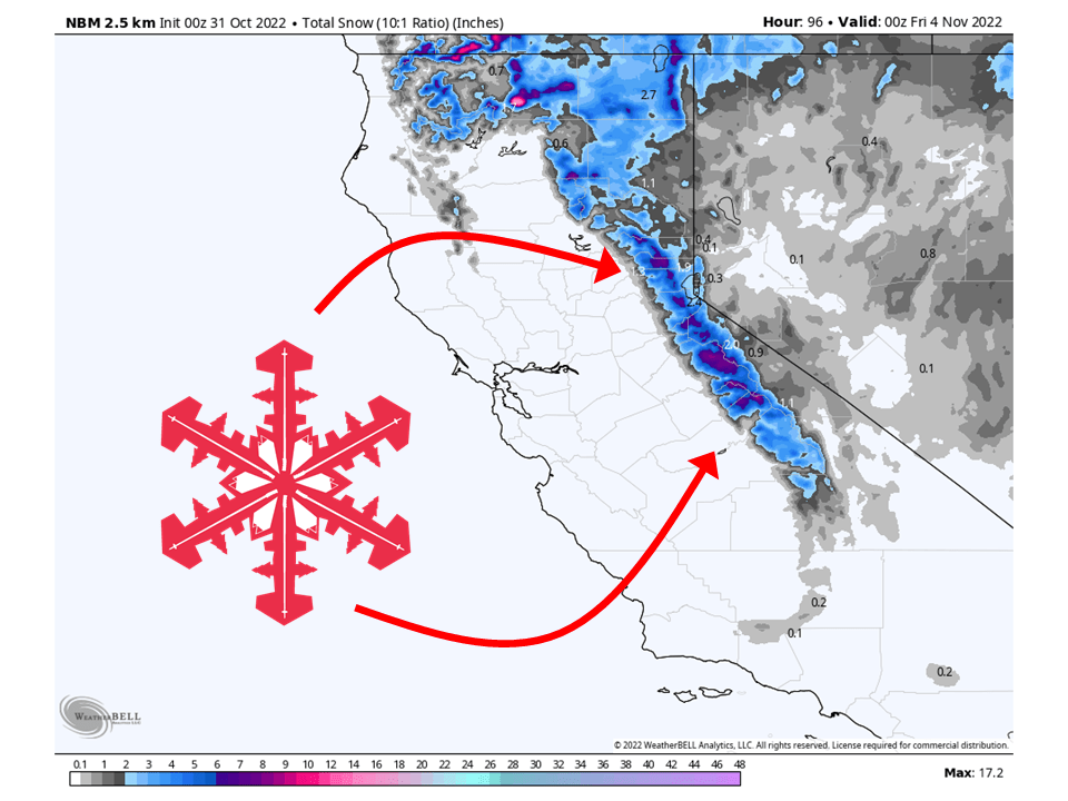
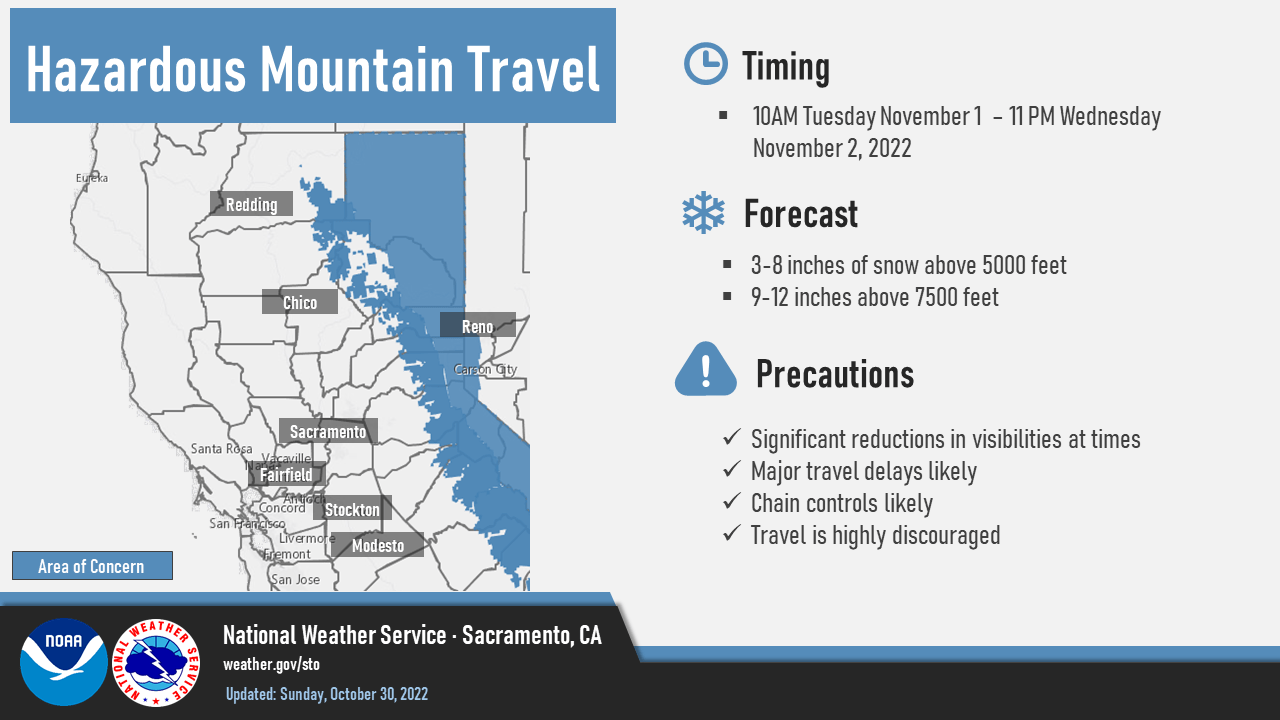
A trough will move through California and bring up to a foot of snow to parts of the Sierra through Thursday.
Snow will initially start Tuesday as moisture is transported in the region.
Snow tapers off Thursday but then chances return through the long-term and into the extended.
Resorts likely to see the most snow are Kirkwood, Mammoth, Northstar, Palisades Tahoe, and Sierra at Tahoe.
Short-Term Forecast:
Monday-Wednesday:
A trough currently over the Gulf of Alaska will move through California and bring up to a foot of snow to parts of the Sierra through Thursday.
As it does so, moisture will be driven toward the Sierra Nevada, starting Tuesday.
Snow will initially start as a well-defined band that will move north to south as the cold front associated with the trough pushes through the region.
Snow levels will initially start around 6,500′ but fall to around 3,500-4,500′ by Wednesday morning.
Through the day Wednesday, snow will become more showery and continue on and off into Thursday.

Long-Term Forecast:
Thursday-Sunday:
Snow showers will taper off during the day Thursday and taper off by Thursday night as more stable conditions return.
However, dry weather will not last long as a more zonal flow pattern develops and allows for moisture to stream into at least the northern Sierra this upcoming weekend
Snowfall totals are unknown at this time but the active pattern looks very promising.
Extended Forecast:
Sunday and Beyond:
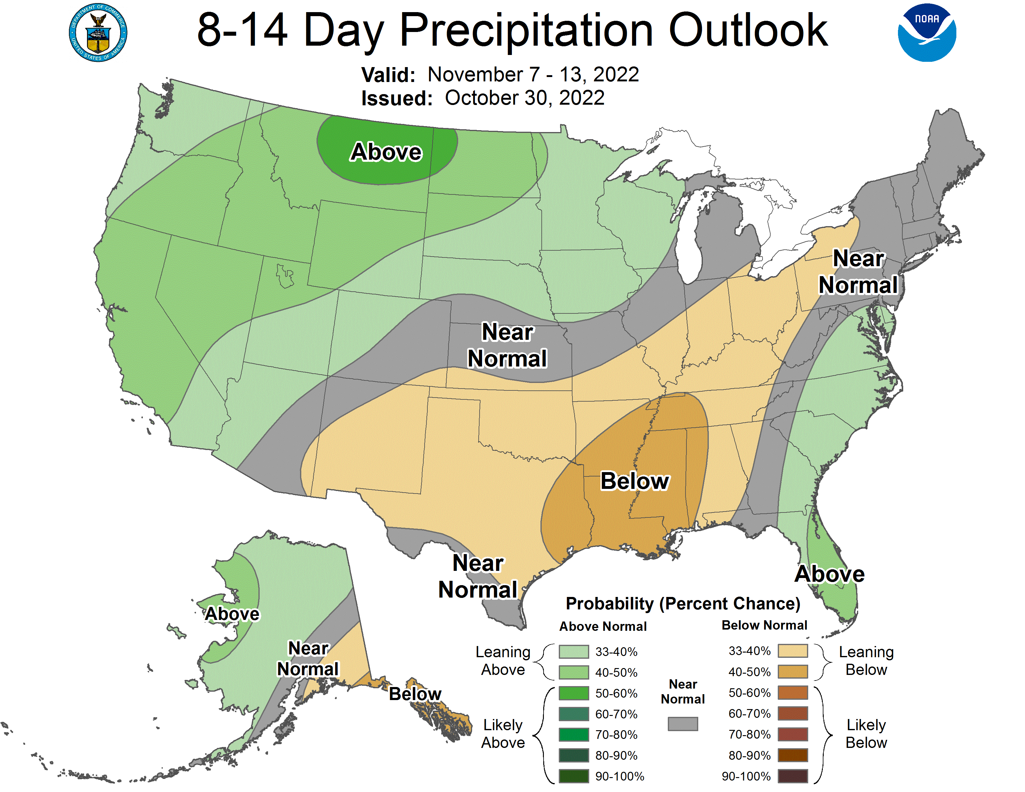
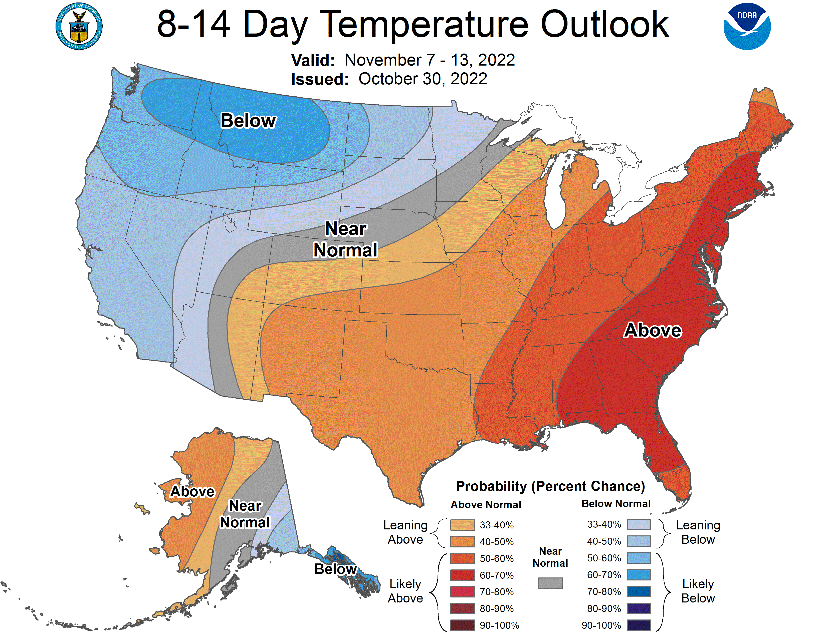
This active pattern looks to continue into the extended as global ensembles indicate above-average precipitation and below-average temperatures across California.

