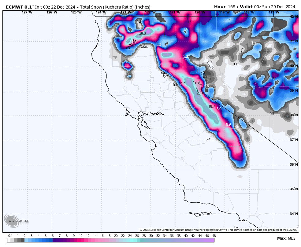
This forecast was written at 11:00 p.m. on Saturday, December 21
We’re kicking off the Christmas week with multiple waves of snowfall across the Sierra, delivering deep turns just in time for the holiday. Upper snow levels this weekend will give way to colder air by Tuesday, setting the stage for moderate to heavy snowfall in many resorts. Another system will roll in Thursday into Friday night, promising a second shot of powder before the new year.
An unsettled pattern will remain over the Sierra through much of the week. Snow levels will initially hover around 8,000 feet or higher, meaning only the upper mountain terrain will see fresh snow from the first round on Sunday. Winds along the ridges will be moderate, potentially strong at times, so keep that in mind if you plan on venturing off-piste.
As we approach Christmas Eve, a colder system will sweep in, lowering snow levels. By late Monday night into Tuesday, expect snow levels to dip closer to 6500–7000 feet, bringing more widespread coverage across the resorts. This storm also carries enough moisture to deliver moderate to locally heavy accumulations, so holiday powder turns look likely for Christmas Eve and Christmas Day.
The next wave arrives Thursday through Friday night, bringing another round of fresh snow fairly comparable to the Monday night/Tuesday storm. Winds will remain breezy at upper elevations, so be prepared for variable conditions on the ridgelines and potential lift wind holds at higher elevations.
Temperatures will generally stay cool enough for decent snow above mid-mountain levels, though mid-mountain elevations and below could suffer from variable temperatures and mixed precipitation types. There may be brief lulls between each storm cycle, but overall, a steady flow of winter weather should keep conditions fun and fluffy up high. It’s shaping up to be a white Christmas for much of the California high country!
Storm-by-Storm Snowfall Totals
Storm #1: Sunday (12/22 Day)–Sunday Night (12/22)
- Kirkwood: 2″-4″
- Palisades Tahoe: 1″-4″
- Mammoth: 1″-3″
- Heavenly: 1″-2″
- Mt Rose: 0″-1″
Storm #2: Monday Night (12/23)–Tuesday Night (12/24)
- Kirkwood: 8″-15″
- Palisades Tahoe: 7″-14″
- Sugar Bowl: 7″-13″
- Mammoth: 7″-12″
- Heavenly: 4″-8″
- Mt Rose: 3″-6″
- Northstar: 3″-6″
Storm #3: Thursday (12/26)–Friday Night (12/27)
- Kirkwood: 8″-15″
- Palisades Tahoe: 7″-12″
- Sugar Bowl: 6″-12″
- Mammoth: 3″-6″
- Heavenly: 3″-6″
- Northstar: 1″-5″
- Mt Rose: 0″-4″
Recent Report From Lake Tahoe, CA:

