Forecast from October 27, 8 p.m. MDT.
Forecast Summary
- A series of storms descend on the northern Rockies beginning Sunday.
- Temperatures drop 15-25 degrees after the first storm arrives. Temperatures, which are currently ~10 degrees above normal, will drop to ~10 degrees below normal by Monday evening.
- Best chance for snow comes Sunday night in ID/Western MT, and Tuesday in WY.
- The next storms follow close behind, keeping temperatures cool and allowing for periodic snow chances all week.
Short-Term Forecast (Now-Wednesday a.m.)
The busy week ahead begins with a strong cold front that moves in from the Northwest. Idaho and Western Montana see the cold front arrive Sunday night into Monday morning, while Western Wyoming has to wait until later on Monday or even Tuesday morning.
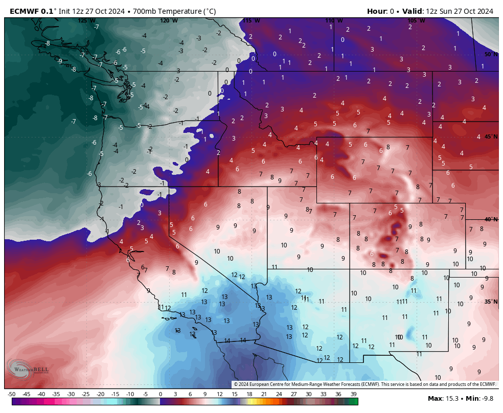
While precipitation will continue at times for at least a couple of days, the heaviest and most consistent precipitation will fall just ahead and along the initial cold front. This will result in many areas, even at higher elevations, seeing a good amount of their precip falling as rain because snow levels ahead of the cold front will be 10,000’+. Snow levels will quickly drop down to ~4,500′ behind the cold front, but only a few scattered snow showers are expected when snow levels are that low.
Widespread below freezing temperatures are expected at night across much of Idaho, Montana, and Wyoming, with temperatures close to 10 degrees below normal.
If you’re looking for the best powder, your best bet looks to be the Wind River or Bighorn Mountains in Wyoming, which should see steady snowfall all day Tuesday, partly due to many peaks in those ranges being high enough elevation for snow to fall, even ahead of the cold front.
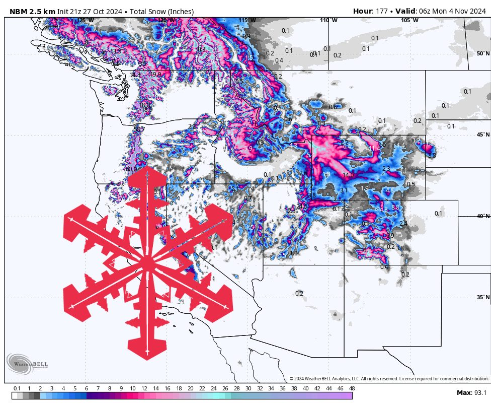
Forecast Snow Totals:
- Gannett Peak (WY): 8-14″
- Meadowlark (WY): 3-10″
- Big Sky (MT): 3-7″
- Grand Targhee (WY): 2-5″
- Sun Valley (ID): 1-3″
Extended Forecast
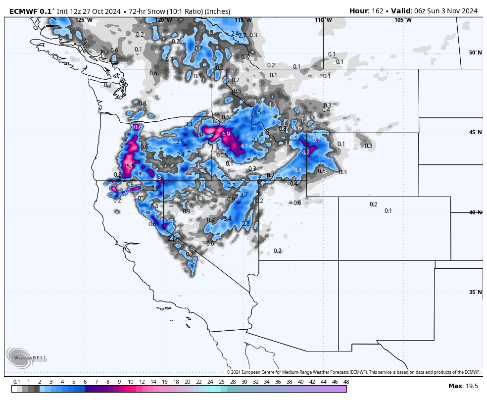
After a mostly dry period midweek, another storm moves in on Thursday/Friday, bringing widespread rain/snow once again and keeping temperatures below normal.
Once again, snow mostly falls just ahead of and along the cold front. However, the cold front looks to stall for a day or two over the Northern Rockies. This should allow snow to fall pretty consistently from Thursday/Friday through Saturday night.
This second storm may produce more snow for much of the Northern Rockies than the first storm, in part due to snow levels starting out much lower due to cold air still being in place from the first storm.
The forecast becomes much murkier past Saturday, as another storm is expected to move down into Montana, but this time on the east side of the Rockies. If this is the case, then much of Montana and Wyoming could still see decent snow chances, but the resort areas on the eastern ends of those states would not be favored.
We’ll be watching that storm as it gets closer, and will put out a forecast if it looks like a significant storm for the mountains.
One thought on “SnowBrains Forecast: Winter Is Here—Northern Rockies See Much Cooler Temps and High Elevation Snow All Week”