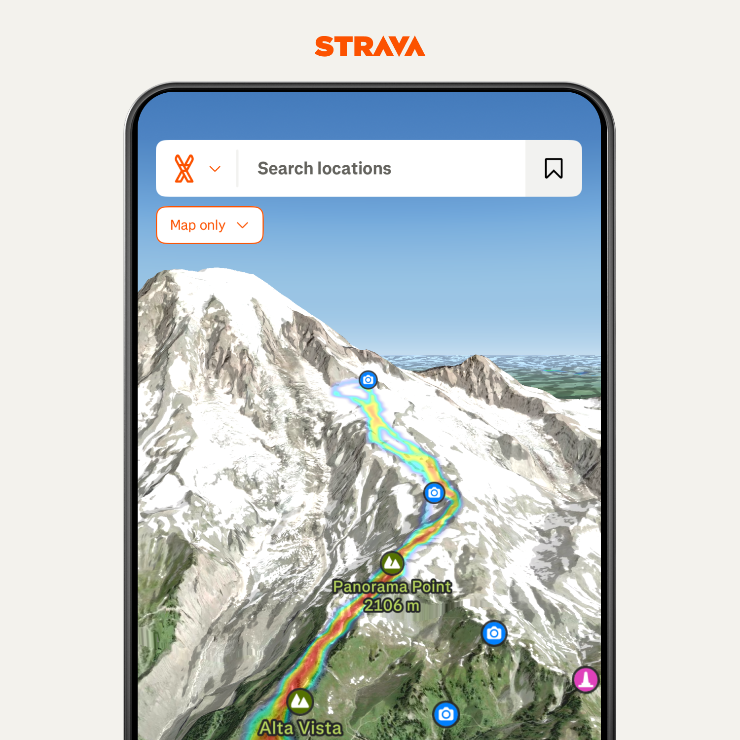
Strava has unveiled a major mapping upgrade, introducing lifelike 3D terrain and winter-specific layers to its app. The new tools are powered by Strava’s own Map Rendering Engine (MRE), marking a significant shift away from third-party providers and incorporating technology from FATMAP, an outdoor adventure platform Strava acquired in 2022. This release adds several advanced features aimed at helping athletes plan safer and more informed outdoor activities, particularly in the mountains.
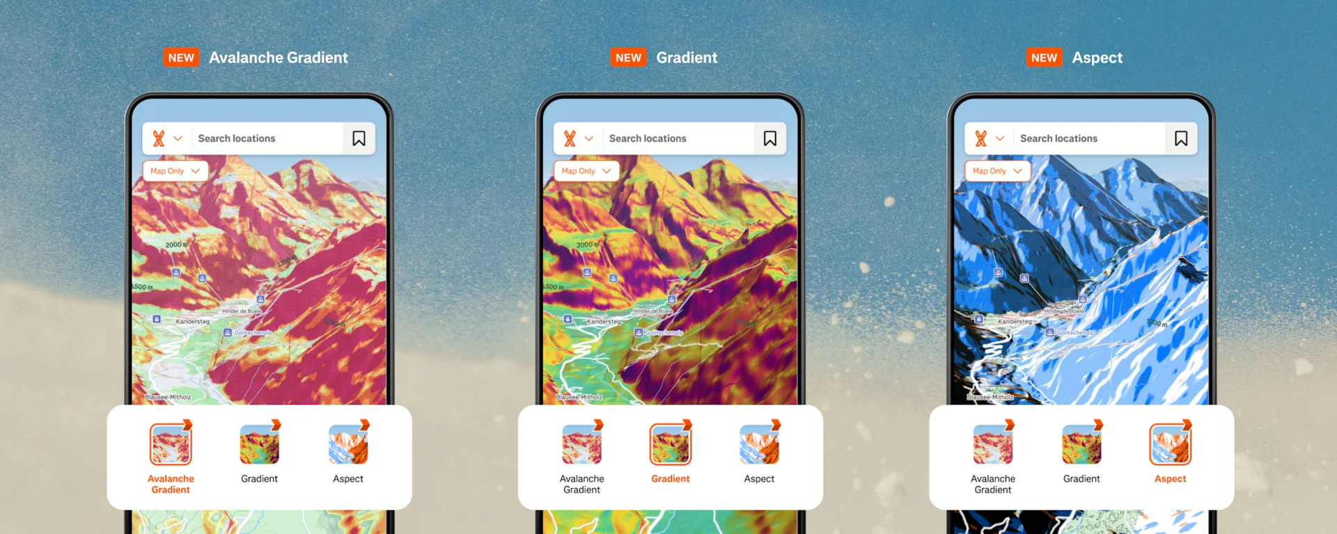
Among the most notable additions are terrain-focused tools that highlight slope angle, aspect, and avalanche risk. Strava users can now view an Avalanche Gradient layer, which isolates slopes between 25° and 45°+—the range where avalanches are most likely to release. A general Gradient layer displays slope angles from 0° to 90°, offering a clearer picture of how steep the terrain is. The new Aspect layer reveals which direction a slope faces, helping backcountry users assess sun exposure, melting, and potential snow conditions. These features are complemented by a Winter Map Style—visually optimized for snow sports and seasonal travel.
The new features reflect Strava’s push to expand its value beyond basic activity tracking. By integrating FATMAP’s high-resolution mapping tools into its core platform, Strava is providing users with a more comprehensive trip planning experience, while maintaining the social and motivational aspects the app is known for. The updates are available within the app’s Maps tab and when reviewing past activities.
Strava says this is just the beginning of what its new mapping engine will deliver. According to the company, the MRE will serve as a foundation for continued map innovation across disciplines—running, cycling, skiing, and more. It builds on earlier additions such as Night and Weekly Heatmaps, released last year, which help users explore routes based on time-of-day and popularity trends.
Strava’s new map features mark a clear shift in how the platform is being used. Once seen primarily as a GPS tracker for runners and cyclists, the app is increasingly becoming a planning tool—especially for users venturing into more complex or higher-risk environments. The addition of slope, aspect, and avalanche layers suggests Strava is aware of how many of its users are now spending time in the backcountry or in steep, unfamiliar terrain. The update also reflects a broader trend in outdoor recreation: more people are seeking advanced, accessible tools to make smarter decisions.