Forecast completed 7 a.m. MST on Thursday, December 26
Summary
Utah’s first legitimate 2024-25 season storm cycle is poised to improve our low-tide riding conditions. Back-to-back storms will bring heavy accumulations to Northern & Central Utah ski areas Thursday-Friday. Maybe a lull Saturday-Sunday, then more snow is likely Sunday night into Monday.
Short Term – Thursday & Friday
Even after a disappointing 1-4″ out of our Xmas day storm, skiing conditions are improving. This trend will continue throughout the week with back-to-back-to-back waves of snowfall.
Wave one of snowfall moves across Utah Thursday a.m., bringing a quick burst of snowfall to the ski areas. This shouldn’t be more than an inch or two of new snow, but we’ll take anything at this point. Expect to see light snow falling to valley floors with this wave.
Wave two arrives late Thursday afternoon – Thursday evening (mainly after resorts close for the day). This wave will feature a nice period of moist NW flow, which should help the Cottonwoods pull down some efficient accumulation. Snow levels will be close to valley floors again.
The most promising window for snow is Friday, with additional heavy accumulation likely between 8 a.m. and 10 p.m. The tail end of this system has a strong NW flow, which should again boost snowfall totals in the Cottonwoods.
It’s worth mentioning strong winds on Friday p.m. Ridgeline gusts of 50-70 MPH will be possible, and we’ll see quickly deteriorating avalanche conditions. Keep tabs on the avy forecast!
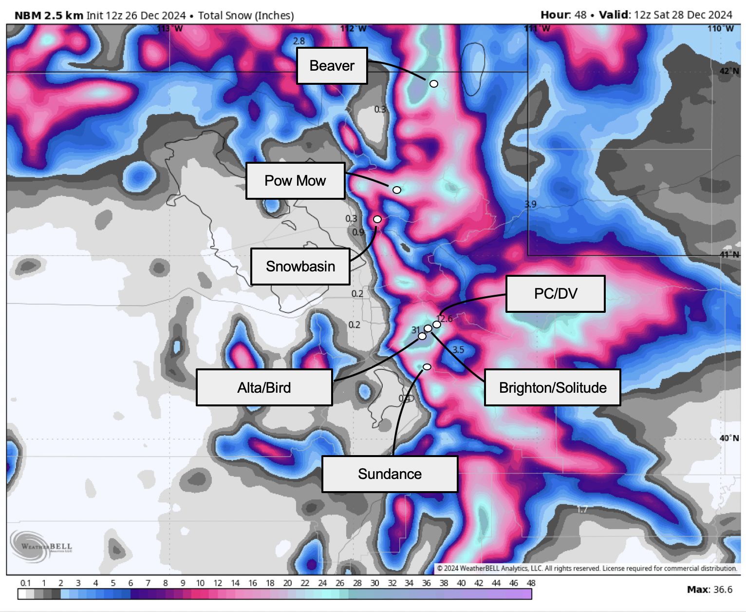
By Saturday a.m., I expect some very healthy storm total snowfall for Utah’s ski areas:
- Alta, Snowbird: 12-24″
- Snowbasin, Powder Mountain: 10-20″
- Brighton, Solitude: 10-20″
- Park City & Deer Valley: 7-14″
- Beaver Mountain: 8-16″
- Sundance: 6-12″
- Eagle Point: 1-3″
- Brian Head: 0-1″
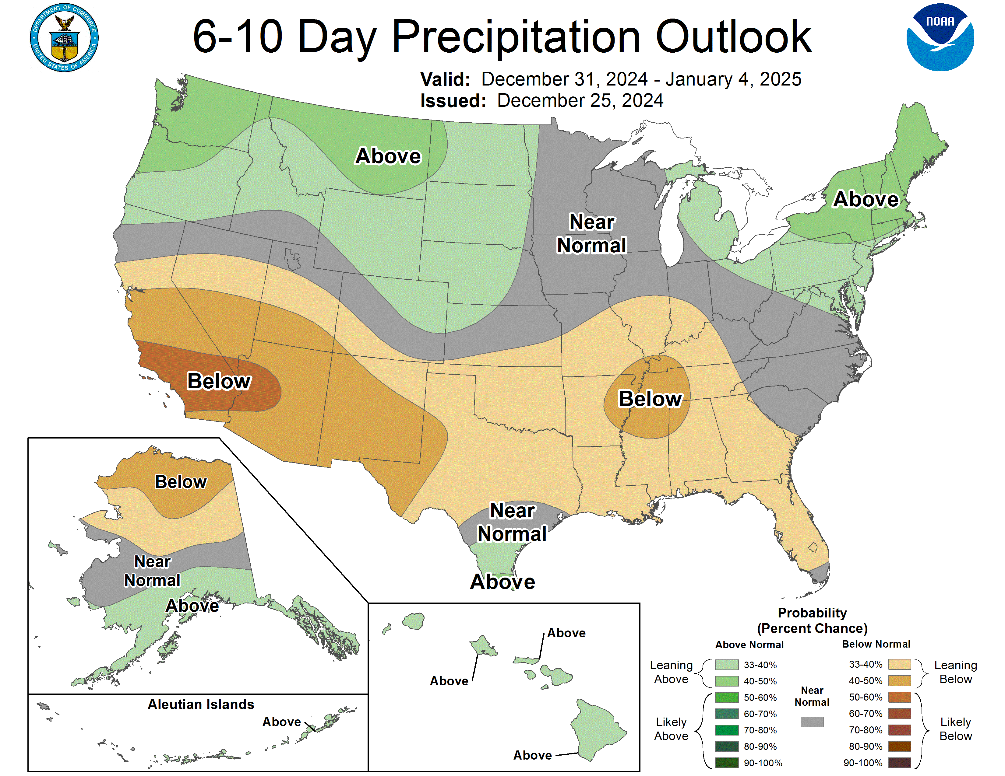
Weekend Forecast
This weekend’s forecast remains a bit uncertain. There will be a storm in the vicinity on Saturday and Saturday night, but I’m still worried that most of the precipitation will miss the Cottonwoods/Park City area to the north.
Farther north resorts like Beaver Mtn, Snowbasin, and Powder Mountain will likely see more accumulation Saturday, probably around 4-9″.
Farther south, Salt Lake/Park City area resorts *might* get in on the action. If we do, several inches of accumulation are likely Saturday and Saturday night. Or, conversely, we’ll get skunked. 0-10″ feels like a realistic range of possibilities here. I’ll consider a new forecast update sometime Friday if the weekend looks good for the Cottonwoods/PCMR area.
A cold front will eventually drag across northern Utah Sunday night into Monday, bringing another wave of accumulating snow to the ski areas.
Long Range Prospects
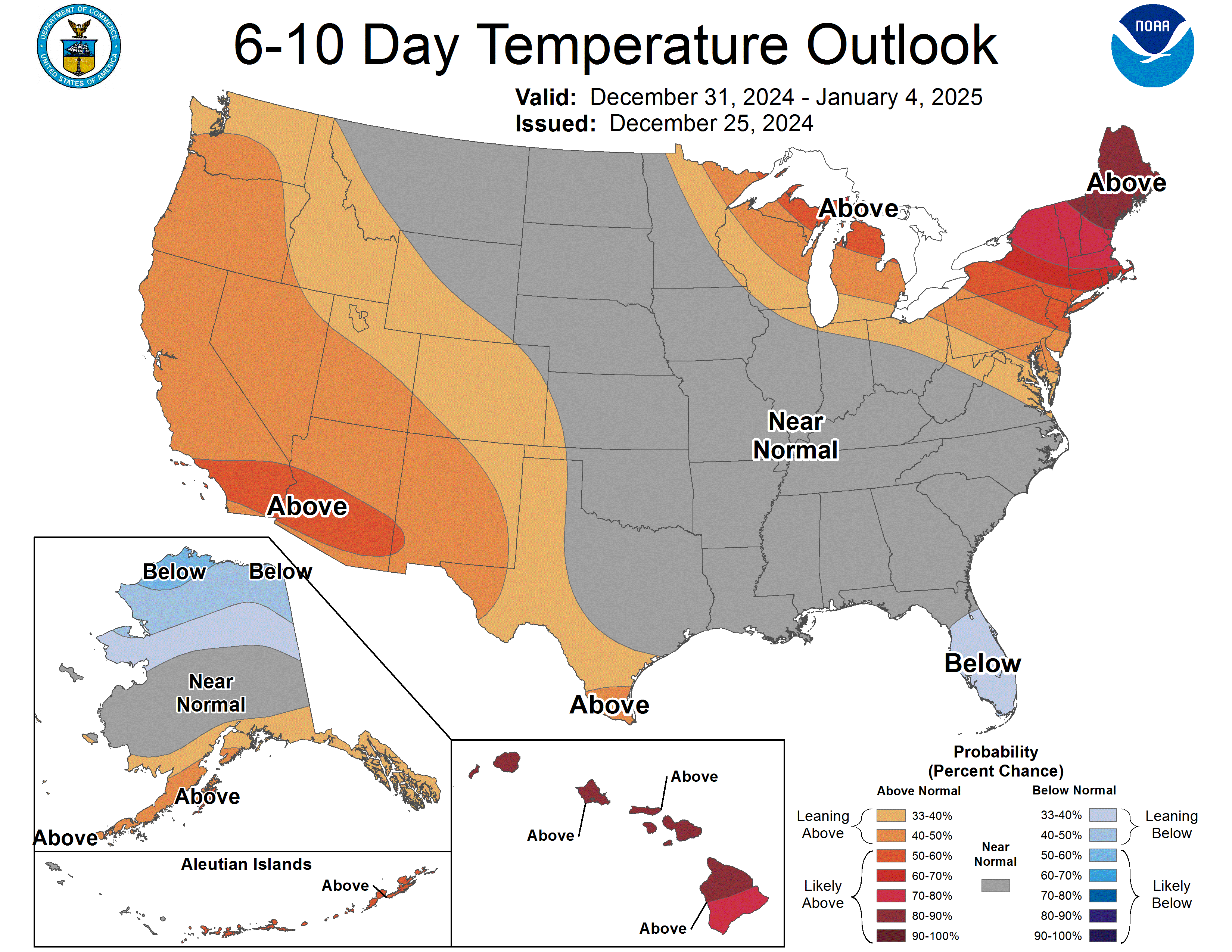
After the Sunday-Monday cold front, our brief relationship with a good weather pattern will end.
We trend warmer & drier as a ridge builds over the Western US into 2025. There will be occasional systems trying to flatten the ridge & bring precip to Utah, but I worry they’ll be infrequent.
Our best shot at more snow will come Jan 3-4, but it doesn’t inspire much confidence.