Report from Thursday, June 6, 2024
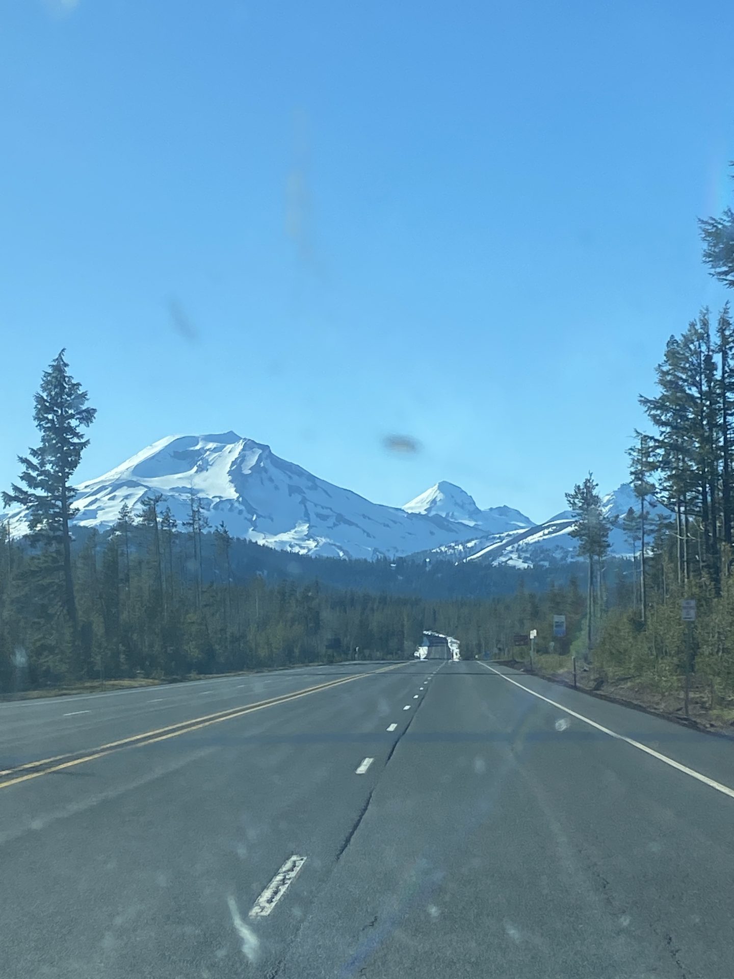
Driving north from Mount Shasta, having failed to reach the volcano’s summit, I was itching for another shot as I crossed state lines.
The Cascade Line reared its bony spine out my driver’s side window; miles of low, rolling, seemingly unexciting forest were interrupted every so often by a massive snow-capped volcano that rudely jutted into the stratosphere.
Each of them is covered with long, dreamy-looking ski lines.
I had to get up there on one of them. I had to find a way.
South Sister
“South Face”
Three Sisters Wilderness, OR
- Trailhead: South Sister Climber’s Route via Devil’s Lake
- Summit: 10,358 feet
- Car: 5,400 feet
- Vertical From Car: 4,800 feet
- Vertical skied: 3,500 feet
- Max Pitch: 38º
- Average Pitch: 33º
- Aspect: South
- Distance: 11.5-miles round trip
- Time From Car to Summit: 5-6 hours
- Car to Car Time: 7 hours
- Recommended Equipment: skins, ski crampons, crampons, ice ax

The tallest of the Three Sisters, a chain of three volcanoes in the Cascade Range near Bend, Oregon, the South Sister is one of the more easily accessible volcanoes of the Cascades.
It formed from eruptions between 50,000 and 30,000 years ago, building broad lava flows and domes that hold snow virtually all year due to the several glaciers on its flanks.
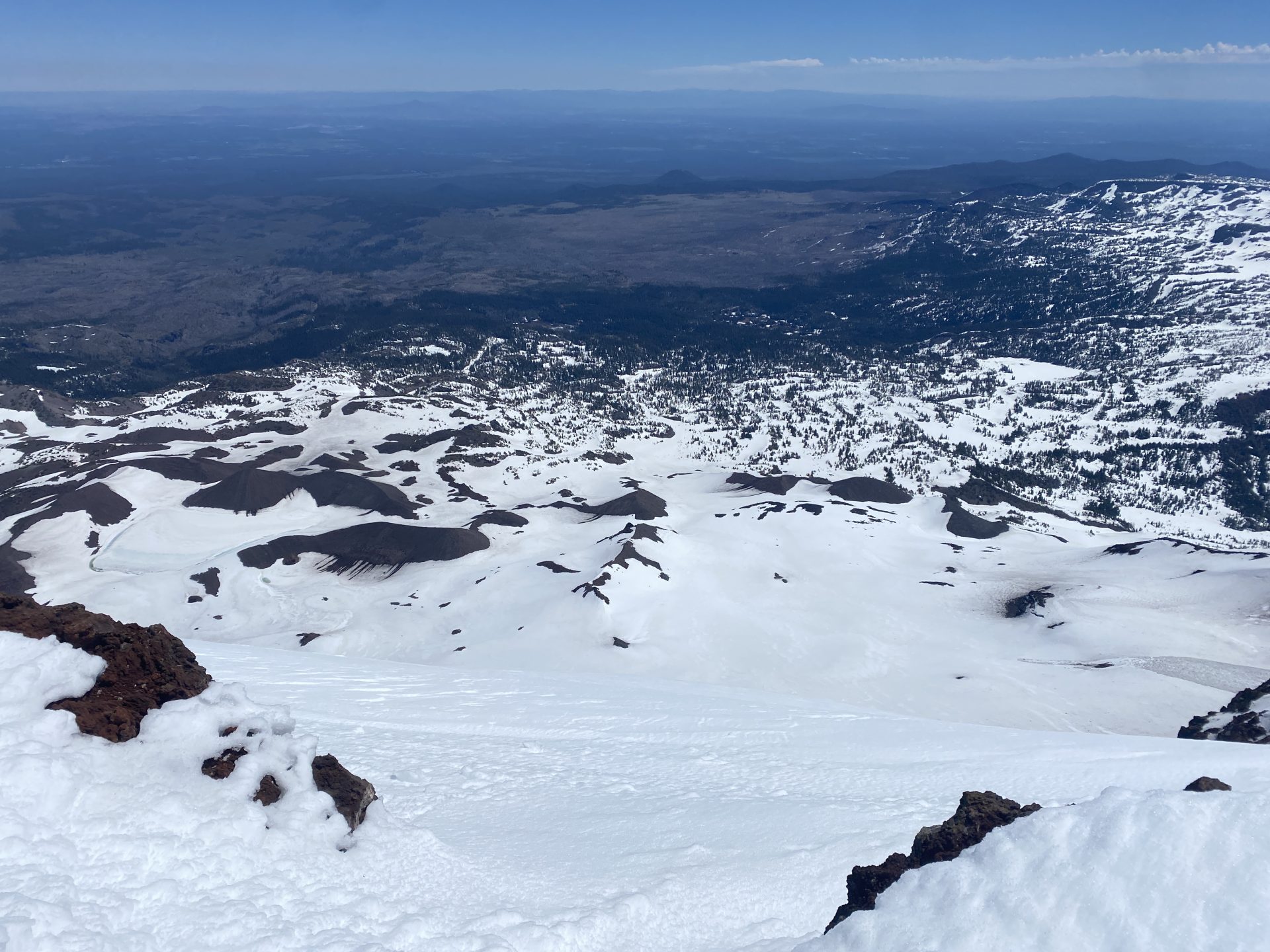
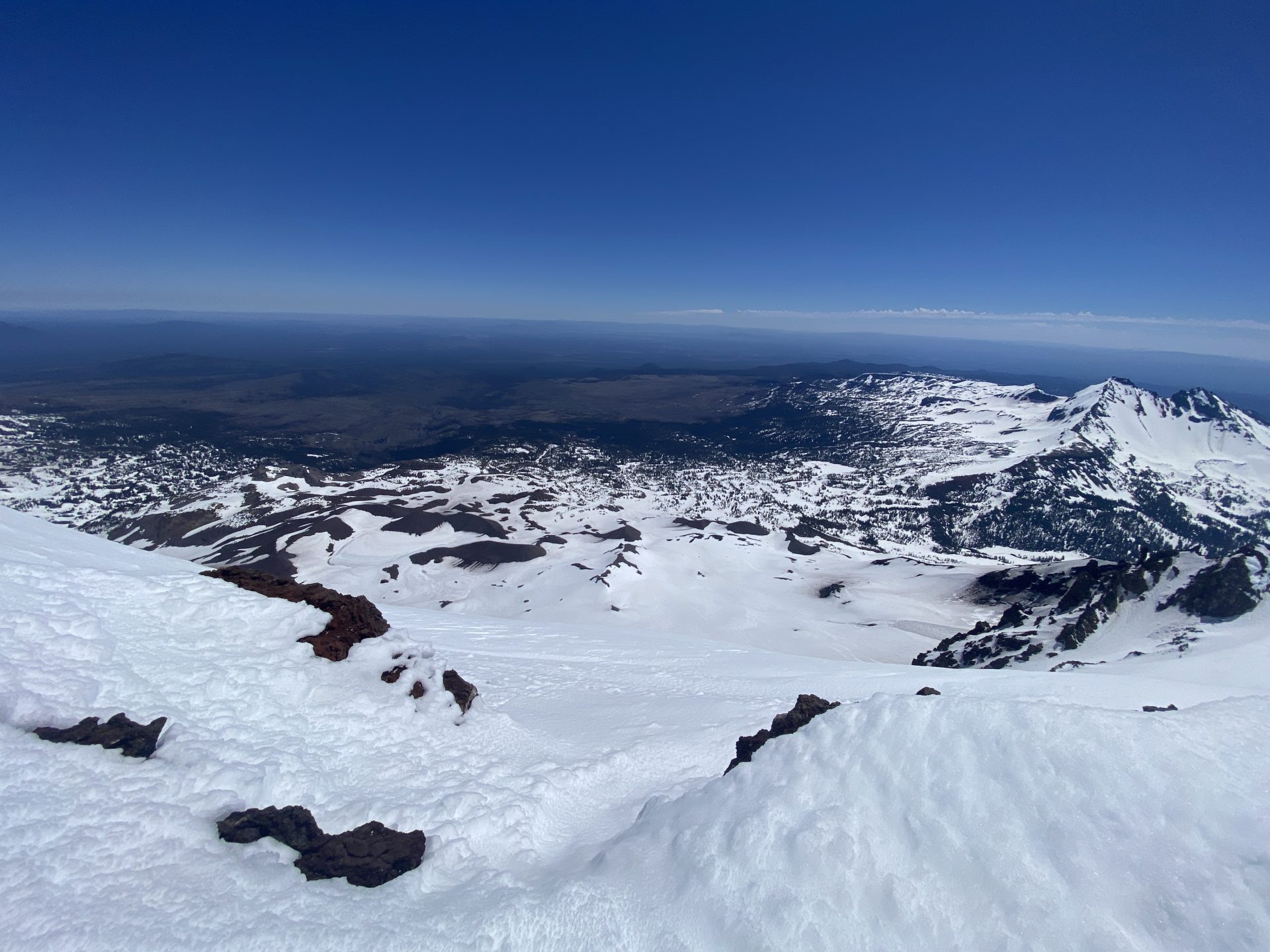
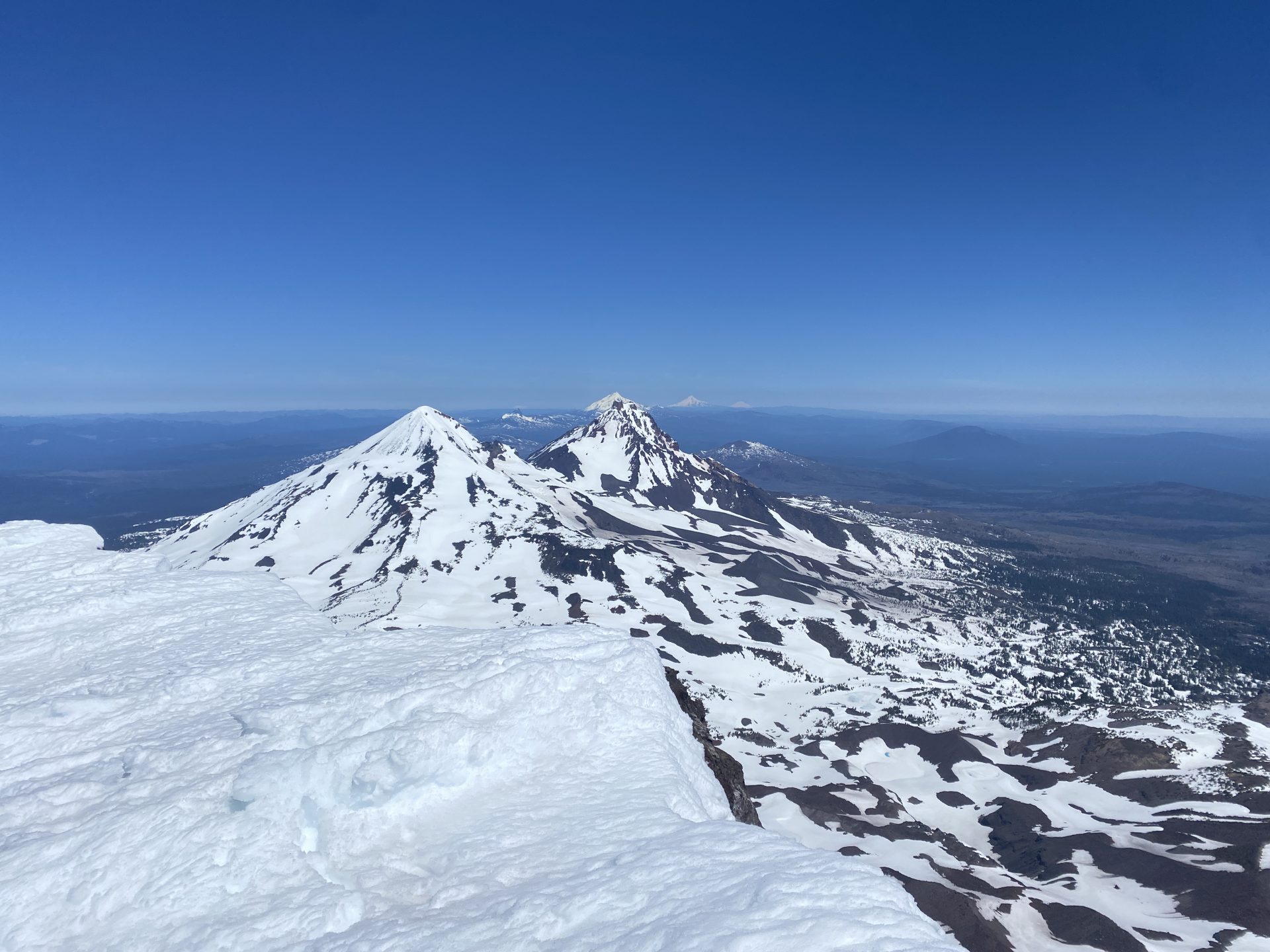
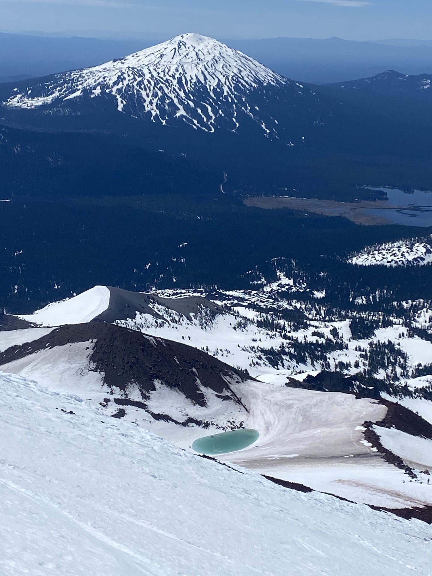
It also is the volcano that provides perhaps the most distinct view of the Cascade Range, with all the volcanos of the range visible in a direct line north and south of its summit.
Shasta, Mount Ashland, Diamond Peak, Bachelor, Broken Top, Middle and North Sisters, Three Finger Jack, Mount Jefferson, Mount Hood, Mount Adams, Mount St. Helens, and—on an exceptionally clear day like this one—a very faint outline of a distant Mount Rainier.
South Sister is a photogenic bitch.

The day before, I was visiting a buddy in Smoke Jumper training in Redmond and as I looked west I pondered which volcano I could ski next.
My good friend and Oregon native Juan Peon Bakers recommended the Three Sisters, specifically the South Sister, because it had such a nice look at the range from the top.
He wasn’t wrong.
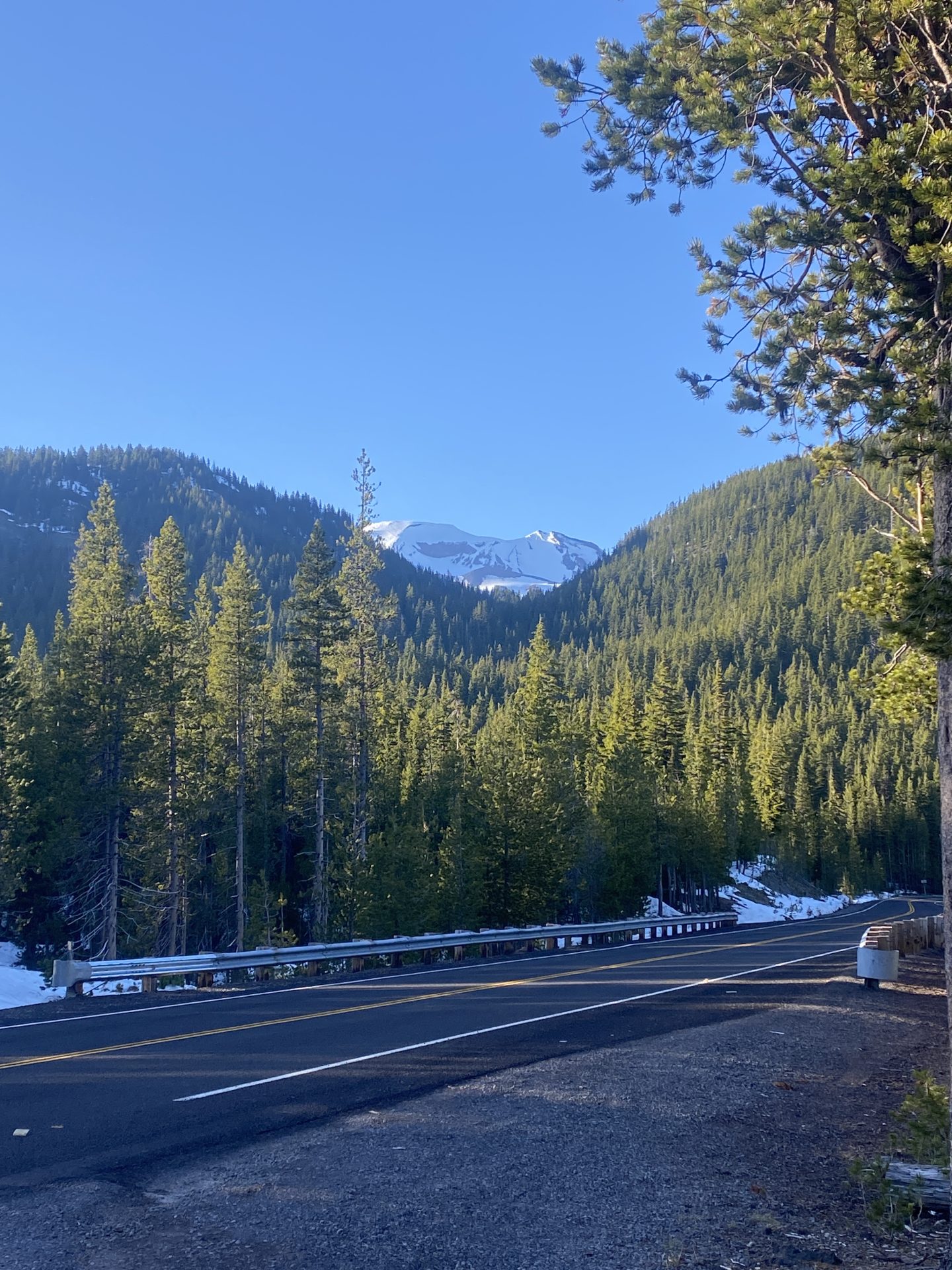
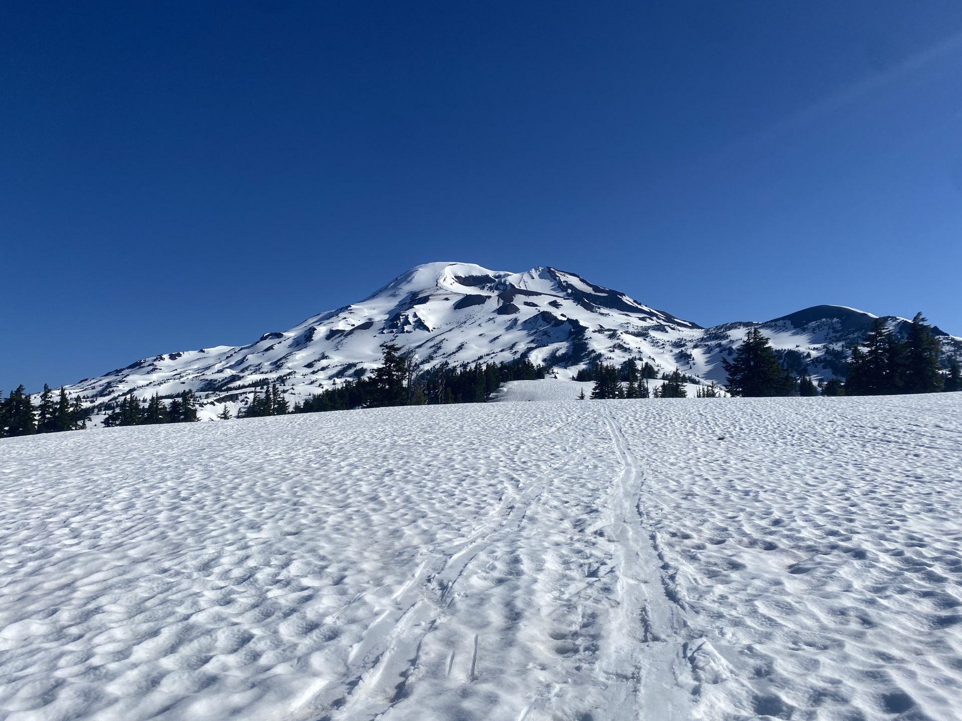
I camped out the night before on the Cascades Highway at Devil’s Lake where the Climber’s Trail to the South Sister summit starts.
From the road, you could just barely see a portion of its South Face tucked around the corner between forested mountains.
The South face looked giant in the pink evening light.
I started hiking at 6:45 the next morning which was later than I had planned by almost two hours.
I was tired and had a hard time rolling out from the back of my car.
The start of the trail was also confusing, with a sign saying that the route to the summit started from the Devil’s Lake parking lot, which was snowed over and on the other side of the highway.
That was not accurate. The Climber’s Route is the route to take.
Luckily the snowline was low for this time of year, virtually down to the highway still, which meant easier than usual travel, so I was able to make up lost time quickly.
I started in hiking shoes, switched to skinning about a quarter of a mile in, and then skinned about two miles and 1,000 vertical feet through old-growth, moss-covered forest.
The morning light was seeping in through the trees, giving a fairytale-like effect.

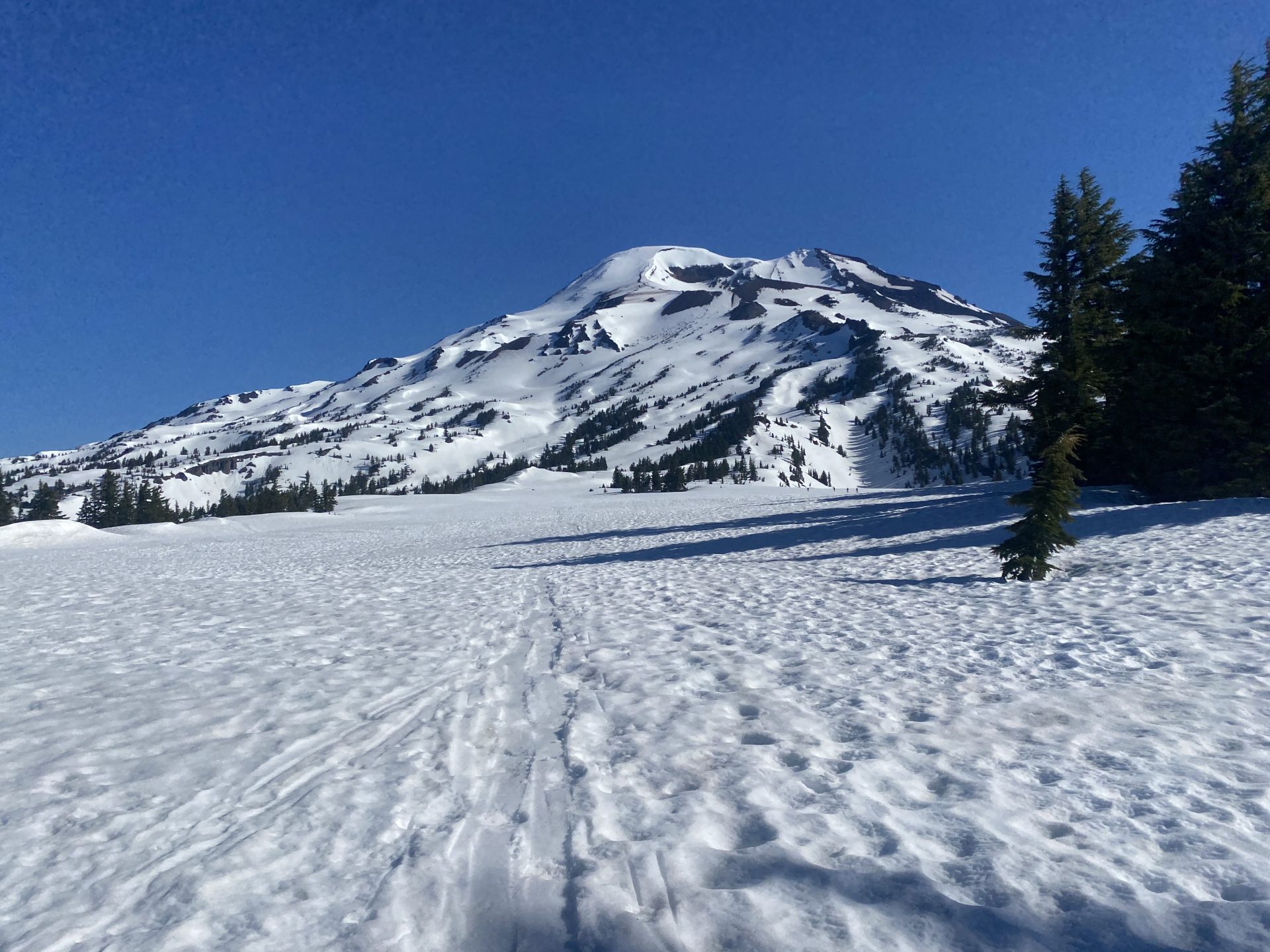
A hard, steep push through the woods and I was up on the plateau leading to South Sister, which was now bluntly in my face.
It was huge and still seemingly very far away.
I kept chugging, hiking in a t-shirt in the warm sunshine.
There were a couple of other parties that day headed for the summit but not many.
The predominant solitude of the area was lovely.

By 9 a.m. I was skinning up the South Face proper.
The thing was massive and it felt like I was climbing nowhere as I sweated, huffed, and puffed my way up the mountain’s abdomen.
I reached a bootpack that a couple of climbers were taking, booted in ski boots for about 10 minutes, took a break on the ridge, and then continued the skin up to the summit.
From there it was a cool hour and a half to the top which was made easy with ski crampons.
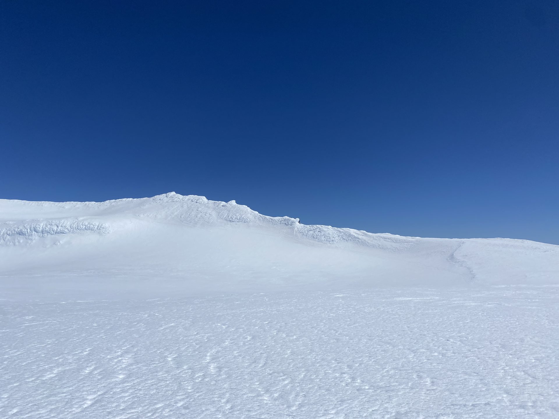
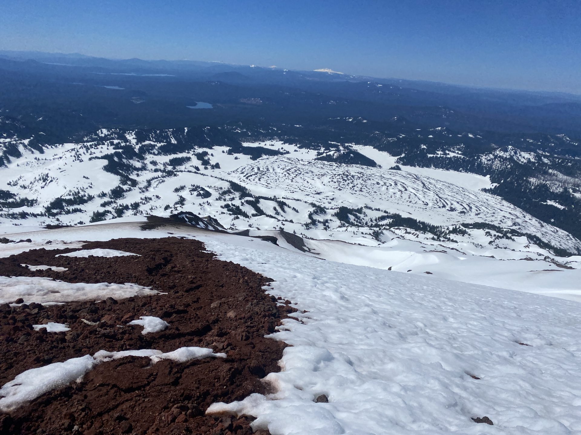
I skinned all the way up the upper steep section of the South Face and mosied my way up into the summit caldera.
At the top, I got the view I had been working tirelessly for.

I felt like a microbe sitting on a pimple looking out toward a perfect line of other pimples poking out from the face of the PNW.
The Cascade Line was really that: a row of very spaced out but neatly organized mountains and volcanoes, each with huge prominence above the lowlands rainforest that surrounded them.
It was a mountain view like none other.
I sat at the summit for a while, taking in the view and mind-skiing so many different lines on the surrounding peaks.
There was a slight breeze at the top but other than that it was sunny, nice, and not windy on the rest of the mountain.
Perfect June skiing weather.

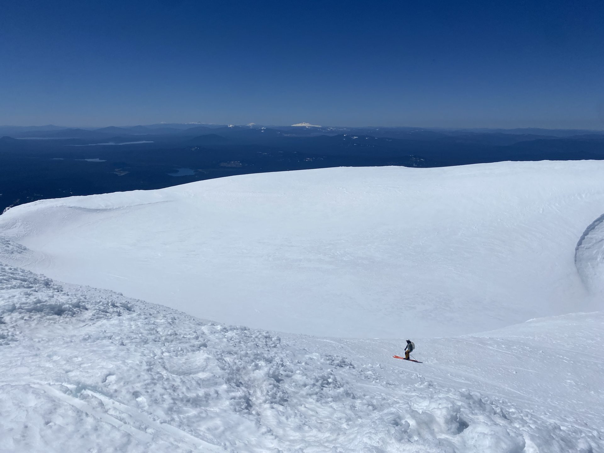
Then I dropped into what was maybe one of the best corn runs of my life and a wickedly fun, almost 4,000-foot descent down to the flats.
The snow on the first pitch by the summit was slightly firm corn.
The next pitch was perfect corn for about 1,000 feet or so.
And then the remaining 2,000 feet was sticky, slushy snow that still skied fun at a high velocity.
It was all over way too quickly.
I looked back at the massive run I had just skied and gazed at it for a while in awe.
It was one of the longest runs of the season for me and maybe one of the last.
My heart was full.
From there, I skinned back on the plateau to the edge of the forest where I transitioned and skied down to the highway.
There was enough snow to ski/rock-ski all the way back to the road without having to put my hiking shoes back on.
Great success.

Back to the highway, I promptly changed into swim trunks and took a dip in the ice-cold Devil’s Lake.
It was so refreshing and needed after a nearly 5,000-foot, 11.5-mile round-trip day that had me sweating bullets.
I thoroughly indulged in the crystal waters of the high mountain lake and the gorgeous sunshine.
Summer was in full swing, even after skiing a volcano.
I would love to meet her sisters one day, too.

Photos in Chronological Order