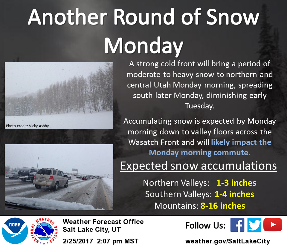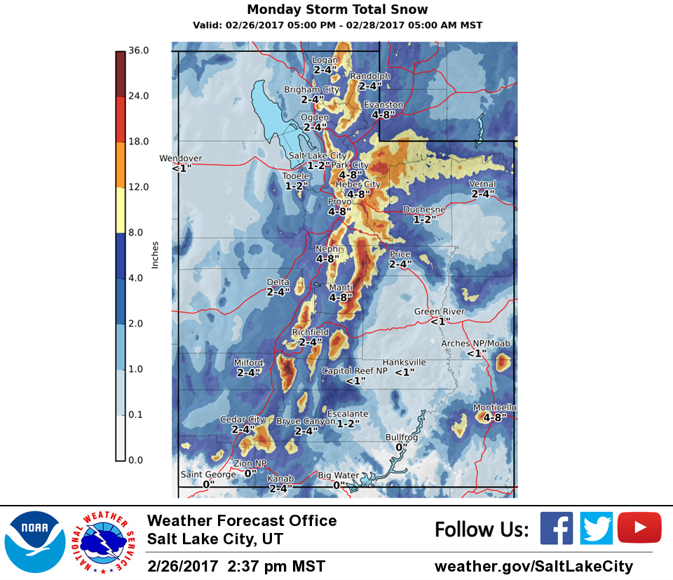
Utah got absolutely pounded by persistent storms over the past week and it’s going to continue. NOAA has issued Winter Storm Warnings & Winter Weather Advisories for Utah Sunday Night – Tuesday Morning.
1-2 FEET of snow is forecasted to fall throughout the state.


Cold temperatures are associated with this storm, so all of the moisture that falls should be in the form of snow, at least for the ski areas.


Utah: 1-2 FEET of Snow Sunday Night – Tuesday Morning
* SNOW ACCUMULATIONS...1 to 2 feet.
- NOAA Salt Lake City, UT


Utah Winter Storm Warning:
URGENT - WINTER WEATHER MESSAGE
National Weather Service Salt Lake City UT
210 PM MST Sun Feb 26 2017

Wasatch Mountains South of I-80-Western Uinta Mountains-
Wasatch Plateau/Book Cliffs-Central Mountains-
Including the cities of Alta, Brighton, Mirror Lake Highway,
Scofield, Cove Fort, Koosharem, and Fish Lake

...WINTER STORM WARNING IN EFFECT FROM 11 PM THIS EVENING TO 4 AM
MST TUESDAY...

The National Weather Service in Salt Lake City has issued a
Winter Storm Warning for heavy snow and strong winds...which is
in effect from 11 PM this evening to 4 AM MST Tuesday.

* AFFECTED AREA...The Wasatch Mountains from I-80 southward,
  Western Uinta Mountains, Wasatch Plateau, Book Cliffs, and
  Central Mountains.

* SNOW ACCUMULATIONS...1 to 2 feet.

* TIMING...Developing tonight, then heavy at times Monday before
  diminishing later Monday night.

* WINDS...Ridgetop winds may gust around 60 mph causing blowing
  snow.

* IMPACTS...Winter driving conditions are expected with snow
  covered roadways and poor visibility on all mountain routes,
  including both commutes through Parleys Canyon.
