View this post on Instagram
The snowpack in Utah’s Wasatch Mountains is off to a remarkably good start this year. That’s surprising for October because often early-season snowfall can create weak layers hidden deep within the snowpack which can cause devastating avalanches later in the winter. That is unless it melts away before winter kicks into full gear or it keeps snowing, preventing the early snow from being exposed to the elements and weakening.
- Related: [PHOTO ROUND UP] Record-Breaking Weather Event Slams Multiple California Ski Areas With Feet of Snow
That looks to be the case this October, as Utah Avalanche Forecaster Craig Gordon shows how the Wasatch’s current snowpack is bonding well in the video above. But, he advises skiers to keep an eye on the incoming warm, wet storm (atmospheric river) that will bring lots of water content with its snowfall—which will likely raise the avalanche danger.
The Utah Avalanche Center shared in an Instagram post:
“We’ve had a good run so far with solid riding and straight-forward avy danger. But… a powerful and unusually warm, wet storm (atmospheric river) is slated to slam into our mountains and it’s going to change the landscape.
Remember to keep up with the latest avalanche forecast for the zone you plan to travel in.
We’ll keep you updated as the storm evolves.”
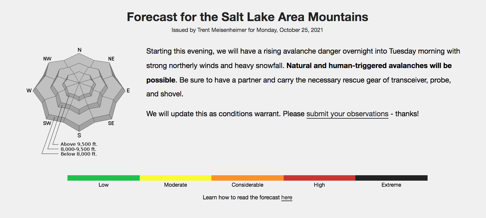
Starting this evening, the avalanche danger in the Salt Lake area mountains will rise overnight into Tuesday morning with strong northerly winds and heavy snowfall. Natural and human-triggered avalanches will be possible. Be sure to have a partner and carry the necessary rescue gear of transceiver, probe, and shovel.
To read the full Utah Avalanche Center forecast for October 25, 2021, click here: https://utahavalanchecenter.org/forecast/salt-lake
