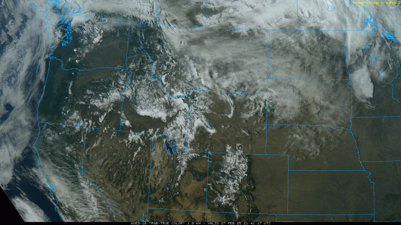
The end of February is upon us, and spring will be here in three short weeks, so let’s take a look at the current snowpack across the Western U.S. and see how it compares to historical averages. The snowpack comprises layers of snow from various storms that coalesce throughout the winter while temperatures are cold and snow storms are plentiful. If there are fewer storms and/or warmer temperatures, the snowpack won’t develop as expected.
The snowpack can be measured in either the depth of existing snow or the snow-water equivalent (SWE). SWE is the unit preferred by meteorologists and hydrologists because it measures how much water is stored in the snowpack, something the depth alone cannot tell you. For example, 10 feet of snow can store the same amount of liquid as 20 feet of snow if the lesser snowpack is made up of denser, heavier snow.
Let’s start by taking a look at the entire US and plot the SWE to see how the current snowpack compares to the 30-year median:
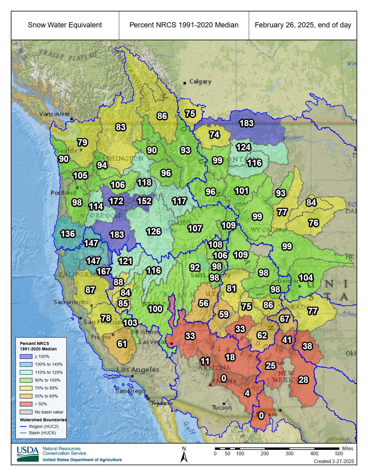
The good news from this map is that much of the U.S. has a near-normal or above-normal snowpack. In particular, Northern California, Oregon, and much of the Northern Rockies have done well so far this season. On the other end of the spectrum is the Southern Rockies (yikes).
Let’s look closer at three different basins:
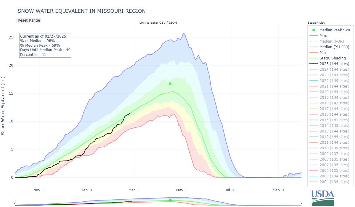
The Missouri Region is essentially Wyoming and some surrounding North and South Dakota and Montana mountains. The Missouri Basin has seen an average winter, with an average of 12 inches of SWE in the snowpack across that area. Compared to the next two basins that we’ll look at, the Missouri Basin sees peak snowpack occur later in the year. This is due in part to the higher elevations found in this part of the country, as well as the tendency for the east side of the Rockies to see their heaviest snowfall events in the early spring.
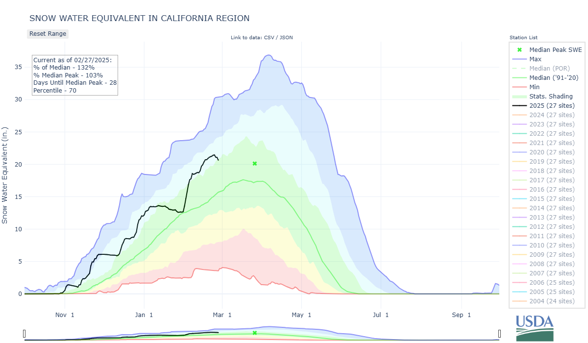
The California Region includes Northern California and parts of Oregon and Nevada. This part of the country has seen a tremendous winter so far, aided by several atmospheric rivers that have brought huge amounts of heavy, wet snow to the region. Peak snowpack occurs at the end of March, but the current snowpack alone would be 103% of the median peak snowpack. However, elevations in this part of the country aren’t particularly high, and the snowpack is susceptible to warm temperatures and a great deal of early runoff. You can see that starting to happen in the last few days, as there hasn’t been any new snow, and temperatures have been abnormally warm.
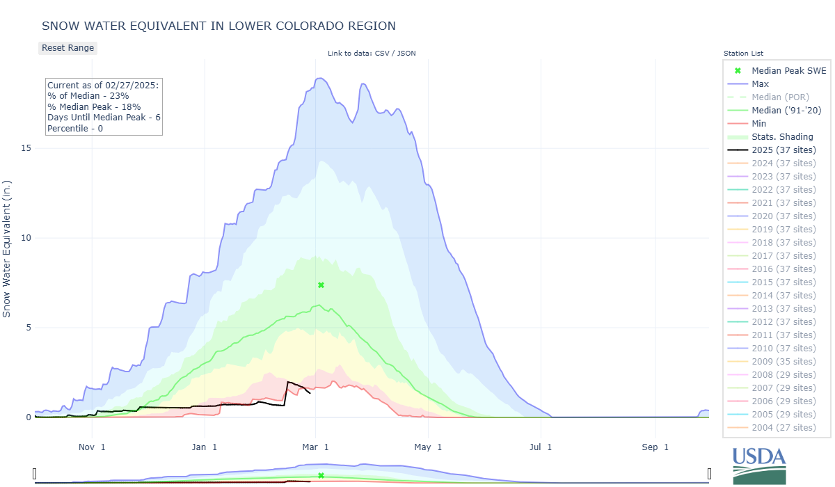
The Lower Colorado Region includes Southern Colorado, Arizona, and New Mexico. As you can see below, this winter has been abysmal in this part of the country. Storms have consistently stayed to the north all winter, except a couple of weeks ago when they finally saw a decent snowstorm that increased the average SWE across the area from ~0.5 inches to 1.3 inches. Despite that last storm, this winter has been historically dry, with this being the lowest snowpack since at least 1991, and perhaps all-time.
