Winter Recap: A quick synopsis of why we had such a dry and mild winter. Back in November the Western Pacific Oscillation anchored itself way farther west then what would be considered normal 140 E. The Eastern Pacific Oscillation was setting up close to the dateline, with a 40-60 degree wavelength across the Pacific that left room for a third ridge to sit to our west. With the shorter long wave pattern during November and December, that stationed the ridge at 140 degrees west which kept us in a cold and dry inside slider pattern.
As the jet stream strengthened, lengthening the long wave pattern, we ended up with the ridge at 120 degrees pretty much on top of us making it feel even less like winter. Eventually by mid January the Western Pacific Oscillation began to shift 20 degrees from west to east. As the WPO would shift east it would pinch the Eastern Pacific Oscillation to the north allowing the jet to undercut and flatten the ridge off our coast to our south. The ridge for the most part managed to keep the core of the jet to our north this entire winter so most of our precipitation fell in liquid form, which made for a mild January till now.
As we close out the last couple weeks of winter there have been no real fundamental changes in the Pacific. As we approach spring the long wave pattern is shortening again setting us back up for an inside slider pattern. It seems like the ridge in contrast to last December wants to take on a positive tilt which may allow the jet to curve out over the Pacific and pull in some moisture.
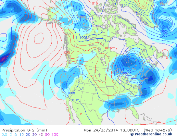
Here is a look at the Global Forecasting System for March 24th. Notice how the bottom portion of the ridge tilts away from the coast. This should allow the storms to draw in some moisture.
As we go beyond the last couple of days of winter and towards the end of the month it looks like the ridge retrogrades further to the west and pinches off to the north. This may allow the jet stream to come down into California to end the month of March, and it looks to continue into the beginning of April.
Two teleconnects support this outlook, first and foremost the Madden Julian Oscillation. The MJO currently has been moving through space phase 8 and is about to enter space phase 1 and then weaken temporarily before it reenters space phase 1 and strengthens again.
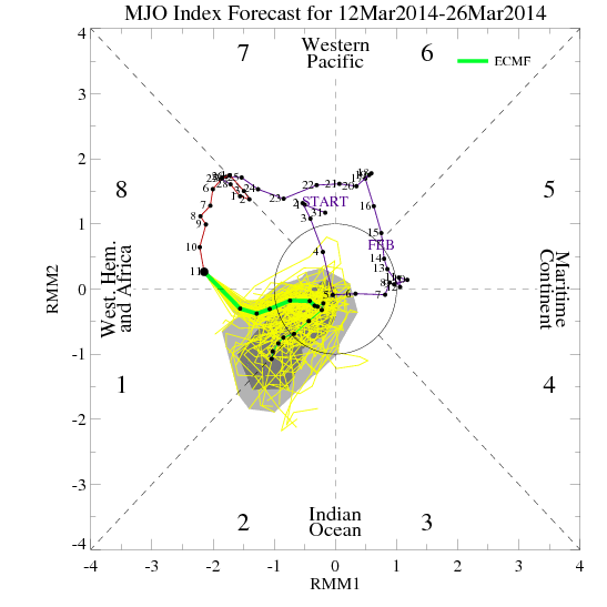
Here is the MJO forecast from March 12th to the 26th.
There are ensembles that show the MJO moving through space phase 1-3 across the Indian Ocean. That would lend support to retract the ridge to the west and send the jet stream into the west coast.
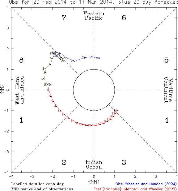
Here is Maharaj and Wheeler Plot for the next 20 days as of the 11th of March. It shows the MJO traveling across the entire Indian Ocean.
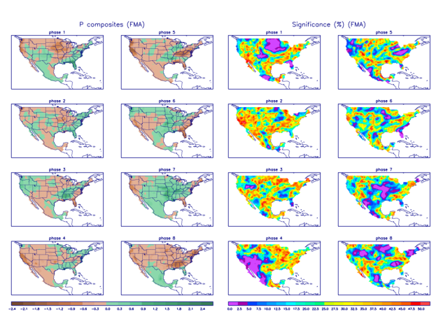
This is the precipitation composites for Feb,March April. As you can see if the MJO travels all the way through space phase 3 the entire west coast gets hammered.
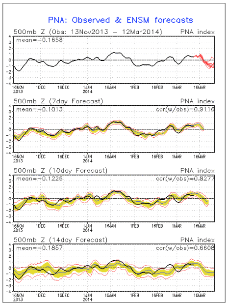
Second teleconection is a negative spike in the Pacific North American Pattern. This lends support to a trough off the west coast. The only concern would be if the trough sets up a little to far too the west which some ensembles are showing. That could cause the jet to split.
Here is the forecast for PNA index for the next 14 days.
So as far as trying to come up with a sensible forecast. We start to warm up to record levels by this weekend, peaking by Monday. For Tuesday and Wednesday looks like a low comes right into Central and Northern California the GFS has it come through but not a lot of moisture associated with it. The EMCWF slows the low allowing it to be absorbed by a larger low in the Northeast Pacific. The GFS shows the larger low but keeps them separate and brings it in separately on Thursday and Friday.
Beyond that the ensembles show the ridge retrograding further to the west and north allowing for the possibility of bigger storms for the very end of the month into April. Confidence for a forecast this far out is relatively high considering it stretches all the way out into the fantasy charts. Fingers crossed, because from the ski perspective this could be the best pattern set up of the entire season.
We absolutely love your blog and find nearly all of your post’s to be precisely what
I’m looking for. Does one offer guest writers to write content in your case?
I wouldn’t mind writing a post or elaborating on a number of the subjects you
write in relation to here. Again, awesome web log!
My web blog :: glass art chandeliers california
it’s dumping!
Snowbrains……….can’t you correct the file photo? I’d love to see this in May, but come on it’s March! or don’t you read your comments?
You guys obviously didn’t get the memo. This year in Tahoe, May is actually occurring during the entire time that normally would be November through May – one month lasting half a year! That is the only logical explanation for our snowpack this year.
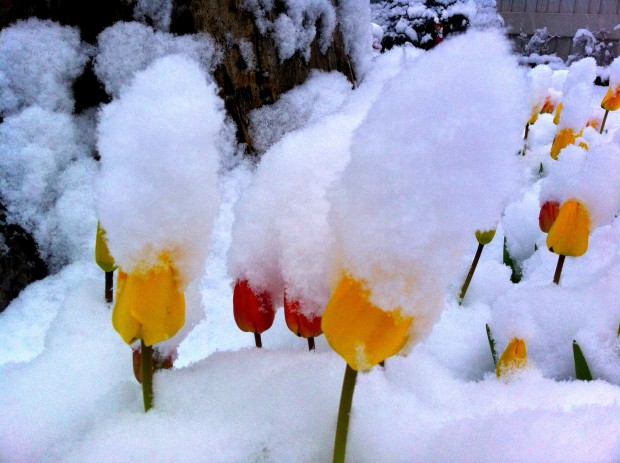
How can that photo of the flowers be May 2014? File photo I say! come on….#FreeAlpine!
May 2014?! Where did Snowbrains get this future camera?