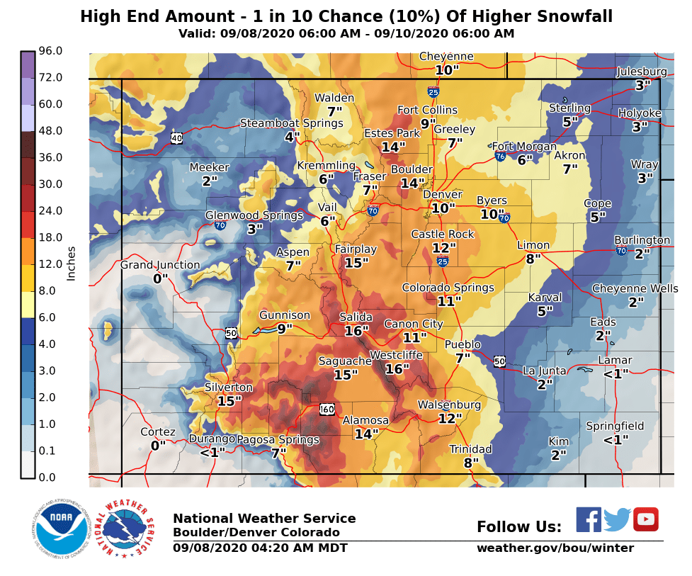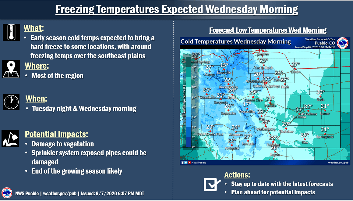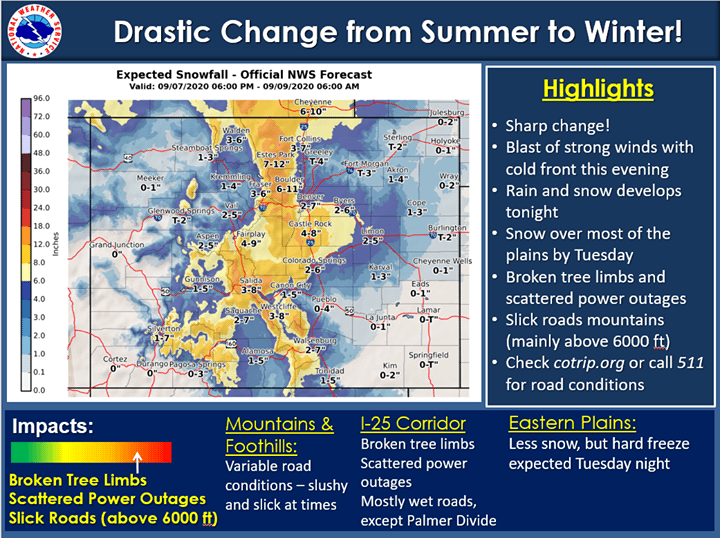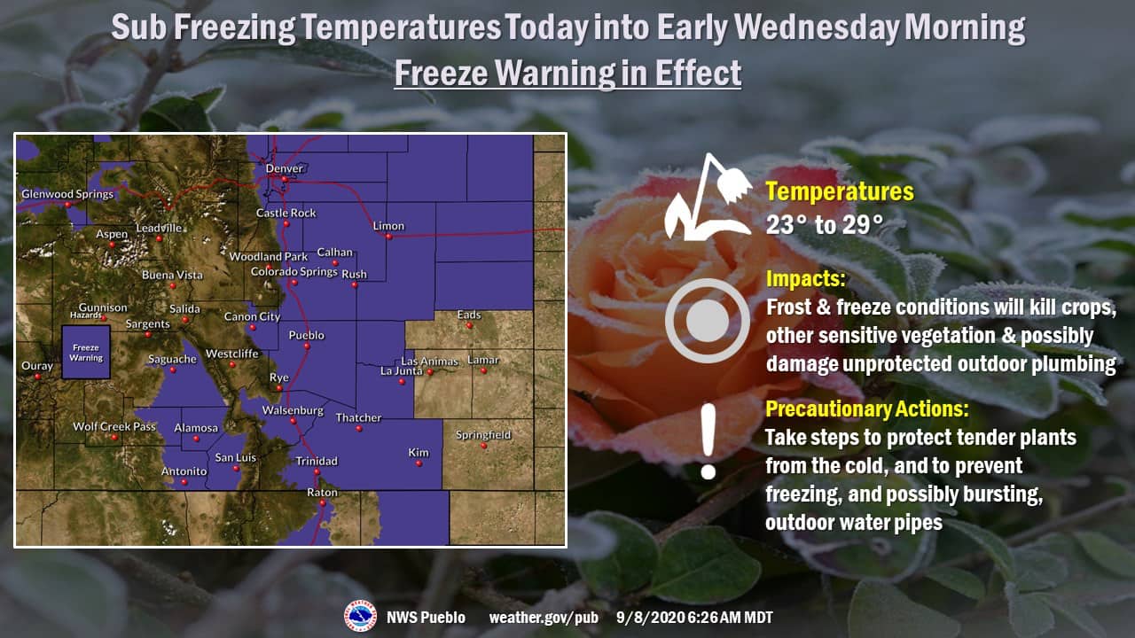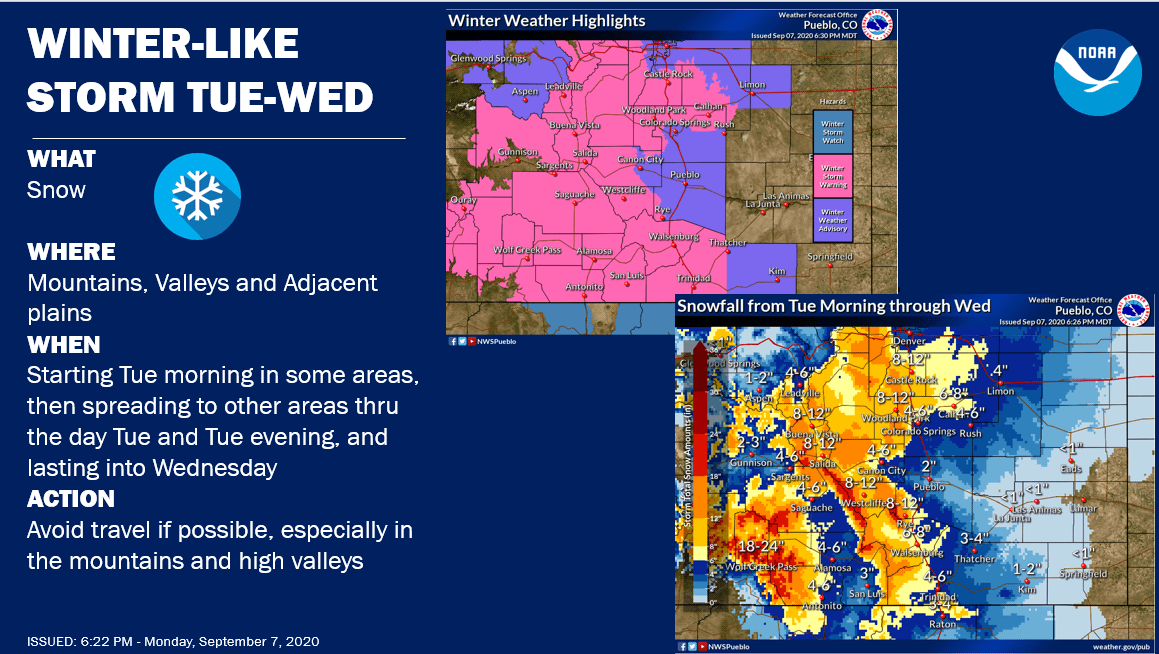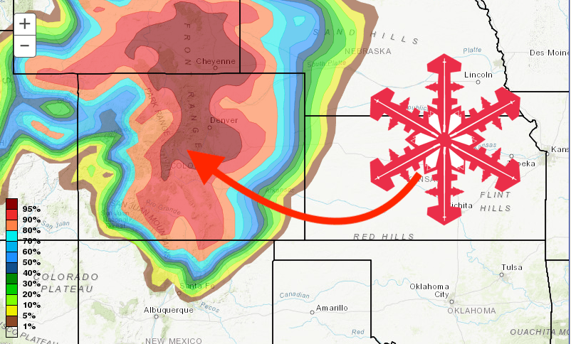
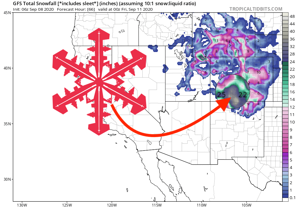
After record triple-digit highs on Saturday in Denver, a cold front is bringing teeth-chattering cold to the state of Colorado, with significant accumulations of snow expected across the mountains. Resorts further south, such as Wolf Creek and Monarch Mountain, can expect to see up to 2-FEET of fresh snow.
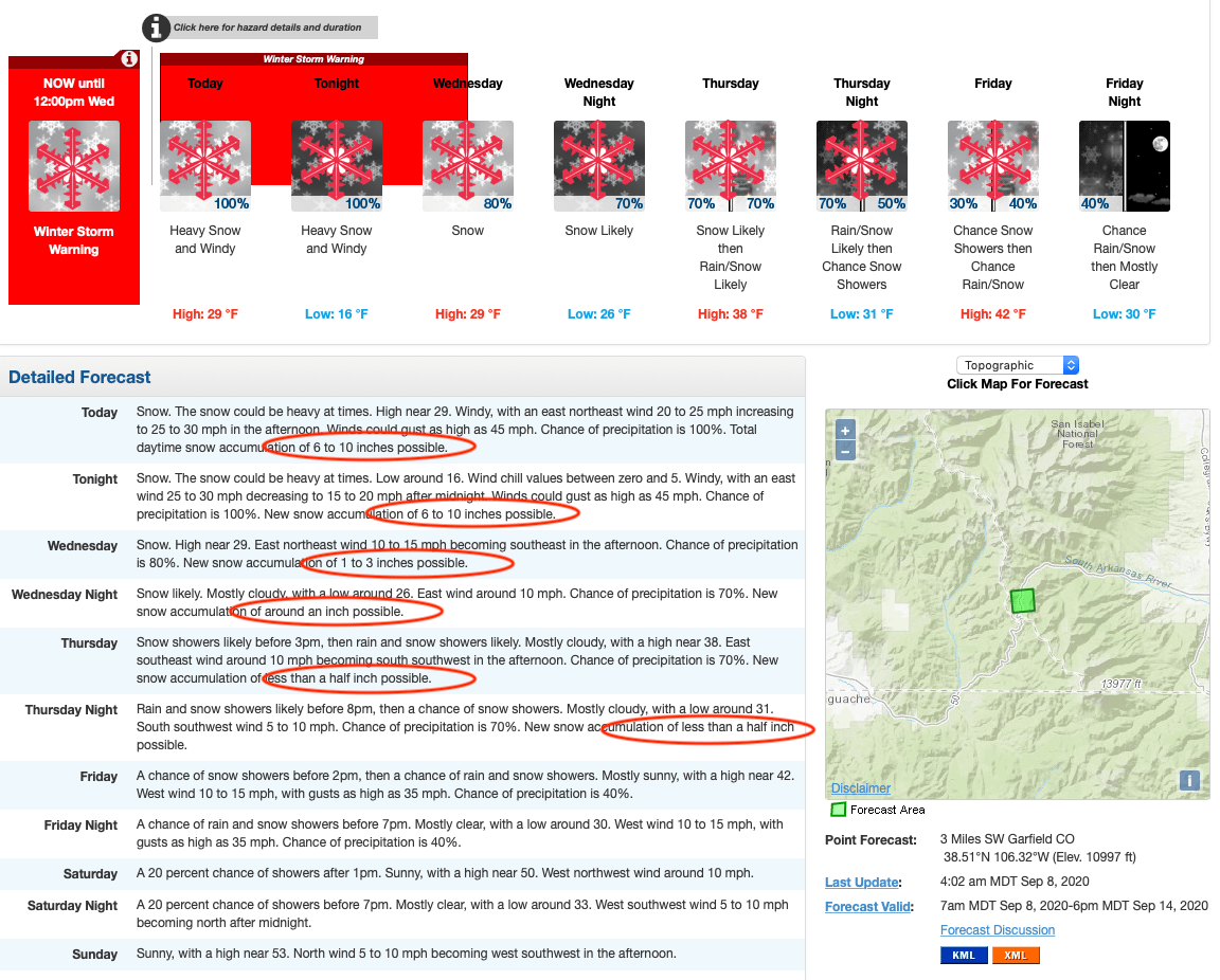
The NOAA issued a winter storm warning, that is in effect until noon tomorrow. Between now and then, ski areas across the state should be buried under the first snow accumulations of the winter 20/21 season. Denver could see up to 7″, the earliest that snow has accumulated in the Mile-High city since the year 2000.
- Related: Denver, CO Hit 101ºF on Saturday, the Latest Date Ever Recorded for a 100º Day | Today it Will Snow…
...WINTER STORM WARNING REMAINS IN EFFECT UNTIL NOON MDT
WEDNESDAY...

* WHAT...Heavy snow expected. Total snow accumulations of 5 to 16
  inches mountains, 4 to 8 inches northern El Paso County. Winds
  gusting as high as 40 mph.

* WHERE...Chaffee and Lake Counties, northwest Fremont County,
  Teller County and Pikes Peak, northern El Paso County.

* WHEN...Until noon MDT Wednesday.

* IMPACTS...Travel could be very difficult. The hazardous
  conditions could impact the morning or evening commute.

* ADDITIONAL DETAILS...This is an early season snow event, so
  some melting of the snow on warm surfaces is expected,
  especially during the early portions of the storm and when
  snowfall rates decrease. This will result in highly variable
  snow amounts.
Expect high winds, with gusting up to the 50-mph range, as Tuesday progresses, and temperatures dipping to zero. Snow will continue Wednesday but the wind will die off.
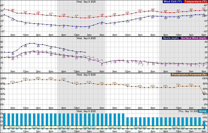
The front will move through by the end of the week, although low temperatures and snowfall could be possible through Friday. As we pass through the weekend, expect the weather to warm up, and become drier. It’s unlikely any of this snow will stick around for long.
GFS Snowfall Totals Forecast Model:
Other Info:
