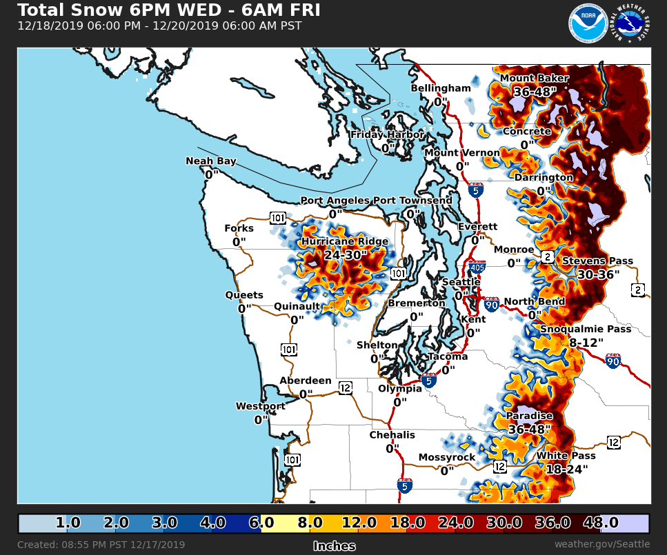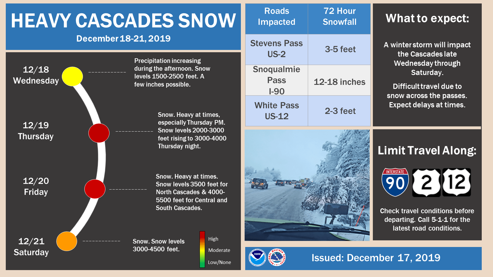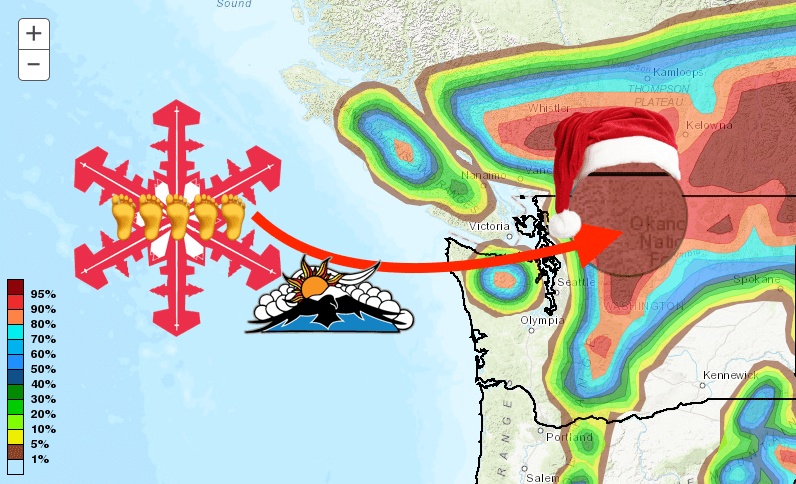
The NOAA has issued a Winter Storm Warning for the Cascade Mountains from Whatcom to Lewis counties above 3,000 feet from 6 pm Wednesday to 6 am Friday. Snow accumulations of 6″ to 3 FEET and more are expected during that time. Mount Baker Ski Area could see up to 5-FEET!
- Related: VIDEO: The FIFTY Ep. 19 – The Watson Traverse on Mt. Baker, WA – Crevasse Dodging and Storm Evading
...WINTER STORM WARNING REMAINS IN EFFECT FROM 6 PM THIS EVENING
TO 6 AM PST FRIDAY ABOVE 3000 FEET...

* WHAT...Heavy snow expected above 3000 feet. Total snow
  accumulations of 6 inches to 3 feet. Highest amounts will be
  near Mount Baker.

* WHERE...Cascade mountains and valleys of Whatcom and Skagit
  Counties, including the Mount Baker Ski Area and Cascade
  mountains and valleys of Snohomish and King Counties, including
  Stevens Pass and Snoqualmie Pass.

* WHEN...From 6 PM this evening to 6 AM PST Friday.
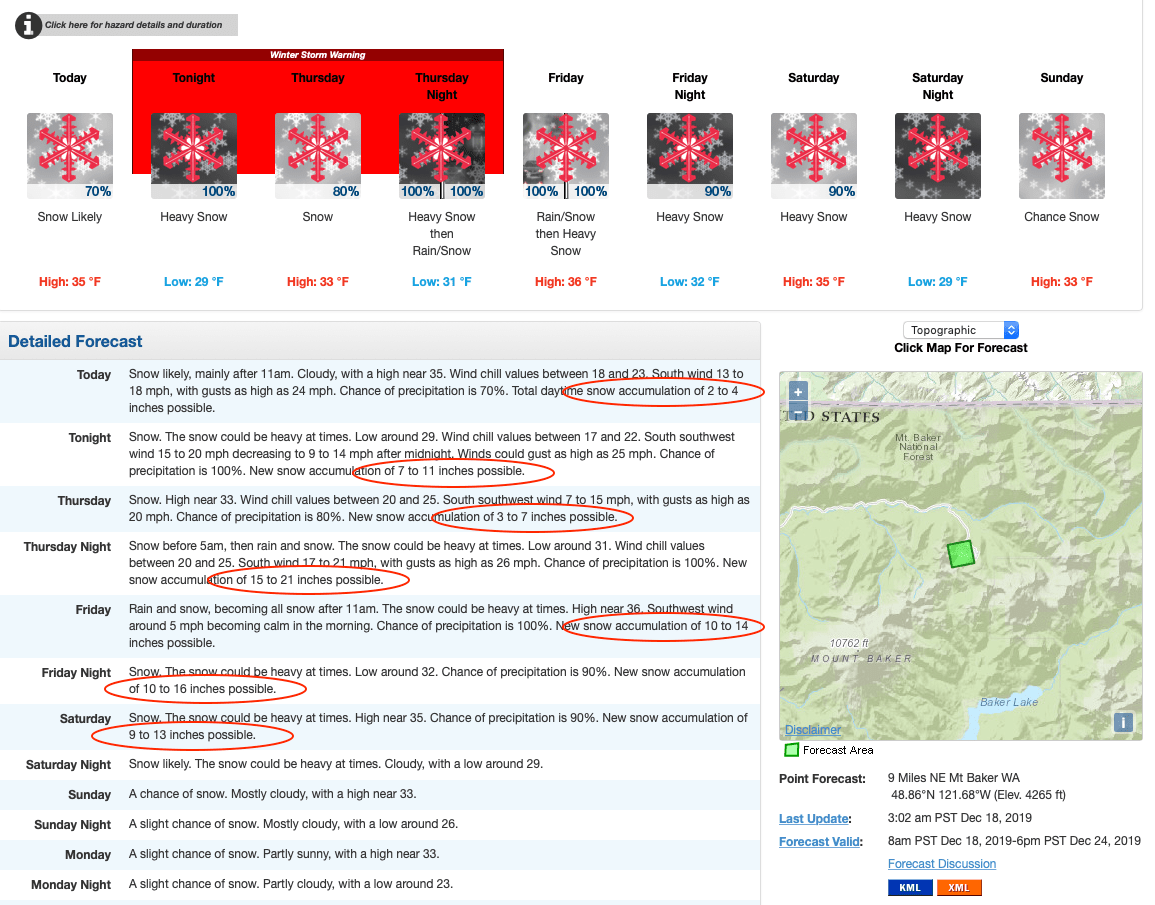
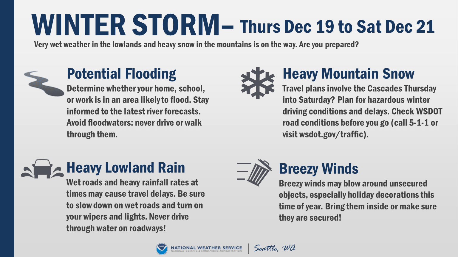
Snow levels will begin around 2,000 feet today but will rise to 3,500-5,500 feet Thursday night. The timing of the increase in snow levels, as well as the location where the heaviest precipitation sets up, will dictate the flooding threat at particular locations. Nonetheless, these rainfall amounts are likely sufficient to lead to flooding impacts on many area rivers, beginning as early Friday morning and continuing into the weekend. The heaviest rainfall will be Thursday night through Friday night. Generally, 3 to 6 inches of rain are expected across the region, with the highest amounts over the mountains.
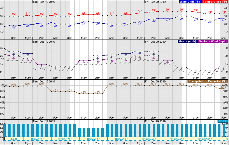
Temperatures will not get much below freezing, hovering in the low 30s, and the highest wind gusts will be about 25-mph.
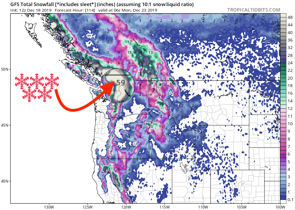
As well as Mount Baker Ski Area, both Crystal Mountain and Stevens Pass will see almost 4-feet and Alpental 3-feet. Looking like, finally, winter has arrived in the northwest.
GFS Snowfall Total Forecast
Other Info
