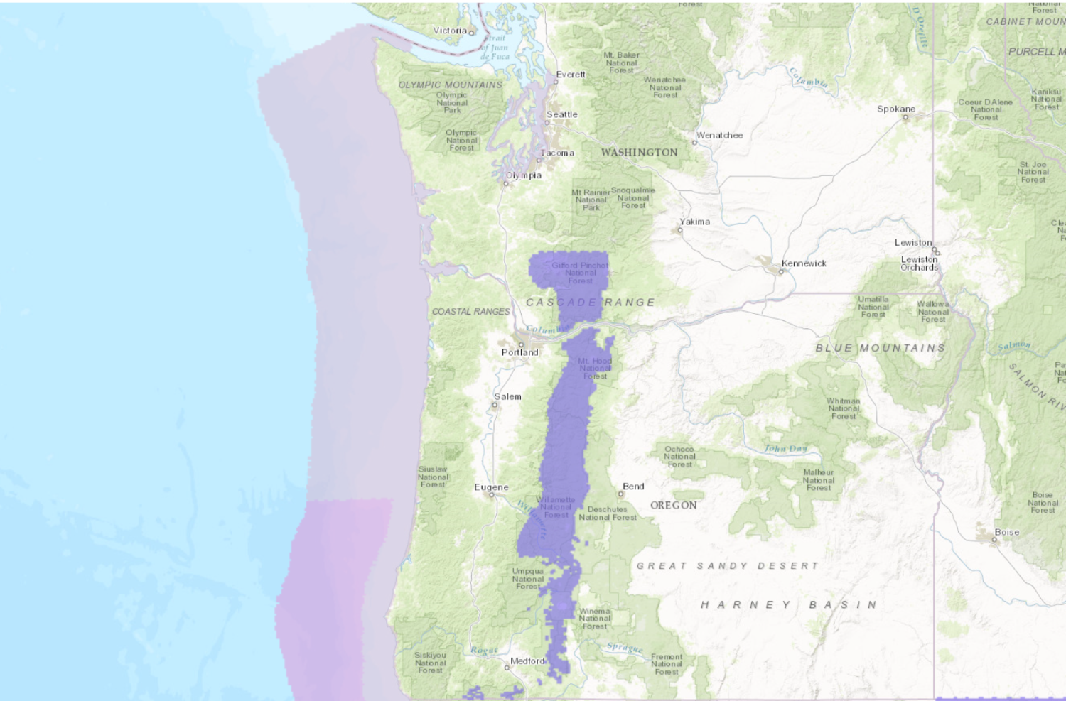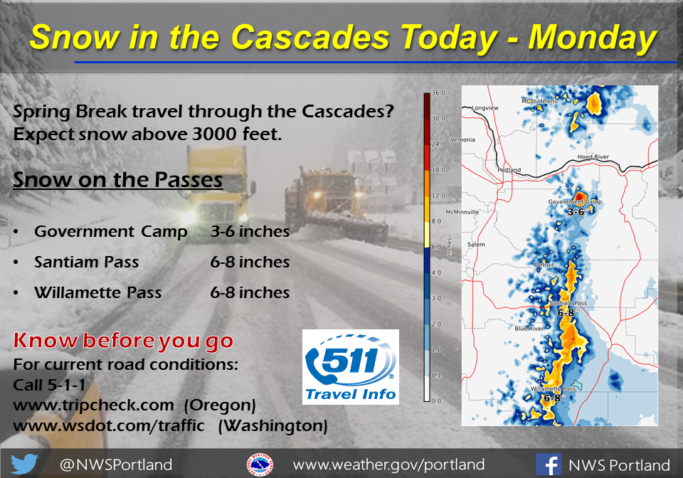
A Winter Storm is expected to continue to hit Oregon and Washington today. It will impact travel on mountain passes and near as heavy snow is expected to fall.
An additional 2-5″ of snow is expected to fall today.


Snow levels are expected to hover around 3,000ft today, which will make for difficult travel conditions on mountain passes. Most of the precipitation from this storm will fall in the form of snow.
Additional Storm Information:


OR/WA Forecast: 2-5″ of Additional Snowfall Above 3000ft
* SNOW ACCUMULATIONS...An additional 2 to 5 inches today, bringing
  storm totals to 4 to 8 inches at pass level and 10 to 15 inches
  for the higher ski resort elevations.
- NOAA Portland, OR


Winter Weather Advisory:
URGENT - WINTER WEATHER MESSAGE
National Weather Service Portland OR
330 AM PDT Mon Mar 27 2017

Northern Oregon Cascades-Cascades in Lane County-
Including the cities of Government Camp, Detroit, Santiam Pass,
McKenzie Pass, McKenzie Bridge, Oakridge, and Willamette Pass

...WINTER WEATHER ADVISORY REMAINS IN EFFECT UNTIL 4 PM PDT THIS
AFTERNOON...

* TIMING...Snow showers, decreasing this afternoon.

* SNOW LEVEL...Around 3500 feet.

* SNOW ACCUMULATIONS...An additional 2 to 5 inches today, bringing
  storm totals to 4 to 8 inches at pass level and 10 to 15 inches
  for the higher ski resort elevations.

* IMPACTS...Roads will become snow covered above the snow level
  and cause difficult driving conditions. Passes are most likely
  to be covered with snow this morning, with some melting possible
  midday into this afternoon.