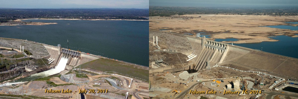
 This picture sums it up: Folsom Lake Reservoir July 2011 and January 2014. photo: NASA
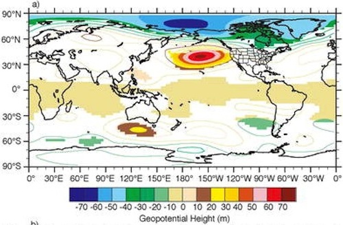
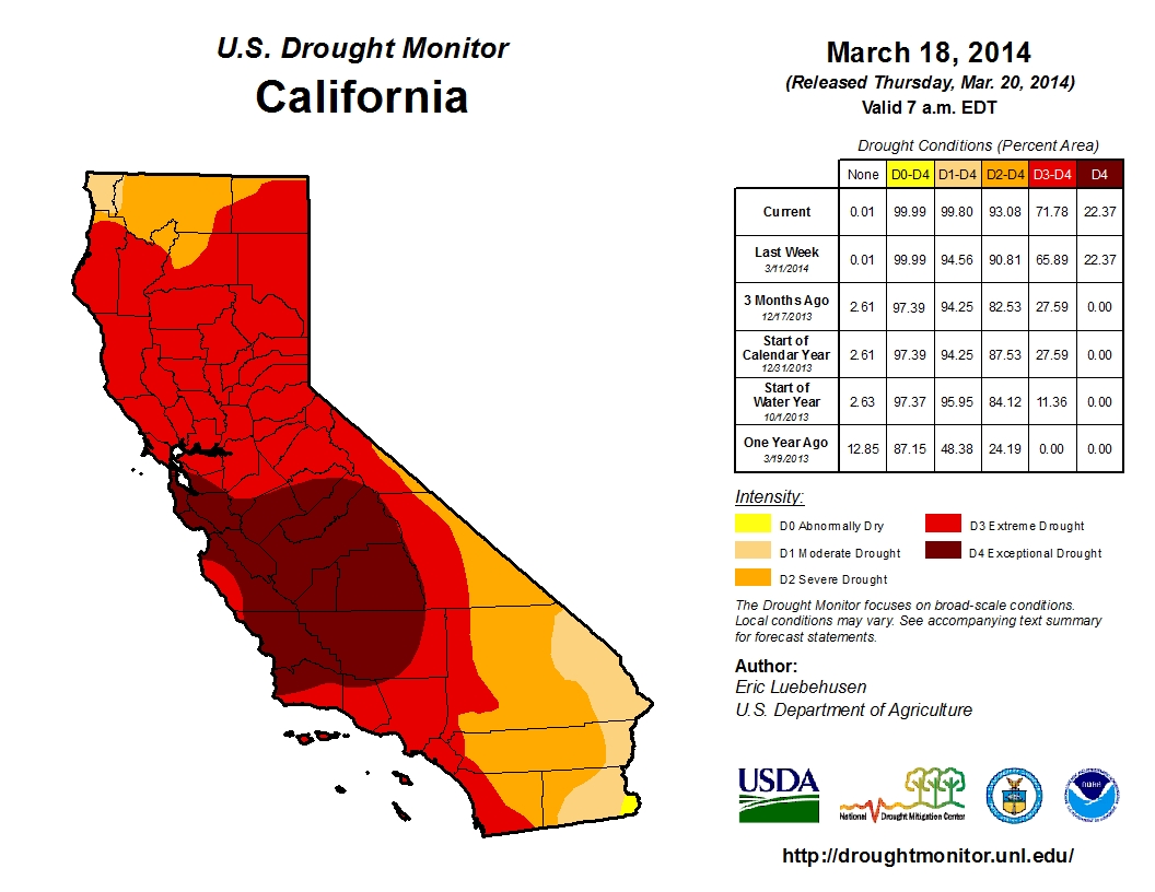
California is currently in the middle of the worst drought in the past 165 years. University of California professor Lisa Sloan used computer models to predict the current drought conditions in 2004. Sloan’s models were general, and predicted the specific conditions driving the current California drought. The model showed that a decrease in arctic sea ice would lead to atmospheric blocking off the coast of California.
 Graphic from Sloan’s paper showing 500mb geopotential height anomalies. 500mb is a pressure measurement usually found around 18,000ft, the altitude at which weather is ‘steered’. The increase in geopotential height reflects an area of high pressure. source: ThinkProgress.org
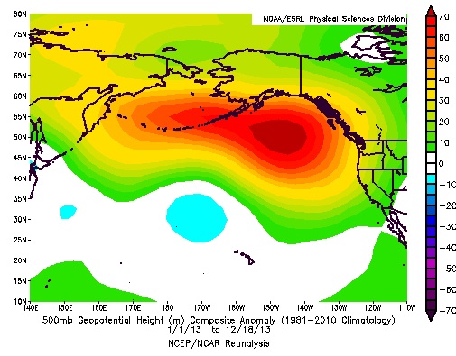
This modeled atmospheric blocking comes in the form of a high pressure zone. This year that is exactly what was observed. With a decrease in Arctic sea ice, the heat transfer from the ocean to the atmosphere increases, creating high pressure zones. The observed high pressure ridge during the 2013/2014 winter was so resilient that researchers called it the ‘ridiculously resilient ridge’, 4 miles high and nearly 2,000 miles long, its location and size closely matched Sloans predictions. As Sloan explains:
“The sea ice acts like a lid over the ocean surface during the winter, blocking the transfer of heat from the ocean to the atmosphere, Sewall explained. Where the sea ice is reduced, heat transfer from the ocean warms the atmosphere, resulting in a rising column of relatively warm air.”

The effects of this ridge were felt nationwide. The high pressure ridge deflected the jet stream, and the incoming weather patterns carried in those winds, diverting rain to British Columbia and Alaska, and even the Eastern United States. The ongoing drought in California is primarily due to lack of rains, associated with atmospheric blocking. However the observed increase in average annual temperatures across California play a minor role in the drought.
Sloan’s predictions are startlingly similar to observed conditions and she foresees that things could get worse in the next few decades. In their climate not all variables were taken into account.
“Why do I say that? (1) we did not include changes in greenhouse gases other than CO2; (2) maybe we should have melted more sea ice and see what happens; (3) these atmospheric and precipitation estimates do not include changes in land use, in the U.S. and elsewhere. Changing crops, or urban sprawl increases, or melting Greenland and Northern Hemisphere glaciers will surely have an impact on precipitation patterns…”
This isn’t proof of a human cause for the California drought, that isn’t how the scientific process works, but the similarities between the atmospheric model and observed conditions cannot be ignored. What is alarming about the modeled conditions is that the model was run with projected ice cover in 2050 (based on a 2002 study by a NASA researcher). With that in mind, what will the future hold for California and the rest of the West Coast? Currently reservoirs are at low levels (animation showing dropping reservoir levels) and the spring has hardly began.

great post.
death to the RRR!!