“LOOKING AHEAD, NO END IN SIGHT TO THE DRY PATTERN. ARCTIC OSCILLATION IS FORECAST TO REMAIN POSITIVE THROUGH THE END OF THE MONTH. THIS WOULD LIMIT ANY ATMOSPHERIC RIVERS FROM REACHING THE WEST COAST. ONLY HOPE WOULD BE FOR THE LESS PREDICTABLE PNA TO GO STRONGLY NEGATIVE WITH COLDER STORMS DROPPING FROM THE NORTH, BUT ITS PHASE IS NOT REALLY ABLE TO FORECAST BEYOND DAY 7.” – NOAA.gov‘s Reno Office
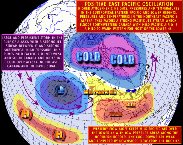
The above image is a depiction of the Eastern Pacific Oscillation EPO in its positive phase.
No real changes, Inside slider for the early morning hours on Thursday. One to three inches, 2″-4″ where the heavier bands set up. Looks like we stay in this inside slider pattern through the holiday. The models were showing a stronger inside slider towards the end of the year, but the ensembles are all over the place so low confidence in that feature for now.
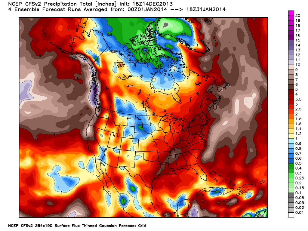
Going back to the previous posts you can see a steady progression from 3″ of liquid to 6″ to the 7″ plus. If this model were to verify at the assumed 10-1 snow ratio that would amount to 70″. Keep in mind snow levels in the Sierra vary dramatically. Unfortunately there is no real signs of a pattern change in January.


Currently, the Climate Forecast Model (CFS) is only showing 2″-3″ of liquid for January! That translates to only 2 or 3 feet of snow in all of January… ugh…
One thought on ““NO END IN SIGHT TO THE DRY PATTERN” – Noaa.gov about Tahoe”