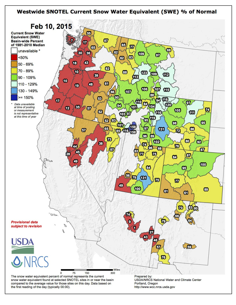
The USDA/NRCS National Water and Climate Center just released this snowpack map yesterday. This map gives us a solid idea of who has snow this year and who doesn’t. The numbers on the map represent the current percentages of average snowpack depth for February 10th.
It’s been a wild year in the West winter. The Pacific Northwest has been enduring torrential rain, California is going through a historical drought, Utah is below average, while Wyoming, Idaho and Montana having been getting tons of snow. Colorado is a mixed bag so far this year with most of the state seeing below average snowpacks.
The real eye openers are these locations:
WESTERN USA SNOWPACK RIGHT NOW:
123% of average snowpack in Western Montana
17% of average snowpack in Northern Washington State
116% of average snowpack in Jackson Hole, Wyoming
28% of average snowpack in Lake Tahoe, California
95% of average snowpack in Central Colorado
10% of average snowpack in Western Oregon
77% of average snowpack in the Wasatch Mountains, Utah