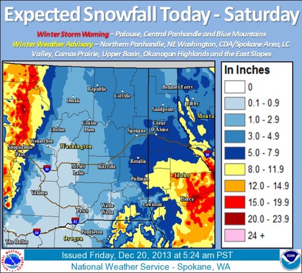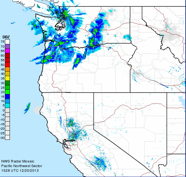
A Winter Storm Warning is in effect for the Northern Cascade mountain range in Washington State today. Mt. Baker ski area is in this zone and is forecasted to get 6-12 inches of snow today.
**Mini Update from NOAA Spokane:
“The storm approaches: Our #WeatherBalloon recorded a 99 MPH wind speed at 36,000 feet this morning.”
Things have been slow even in Washington the past couple of weeks, so this will be a very welcome storm. Another big storm is forecast for Monday.
**Note: Mt. Baker ski area will be Open on Christmas Day for the first time in history!

NOAA, Spokane, WA:
A very moist winter storm will develop over the Inland Northwest today and continue through the night. This system will likely deliver the heaviest snows of the season to many valley locations. The greatest snow accumulations are likely to fall over southeast Washington into the central Idaho Panhandle. The impacts of this storm will generally wane by Saturday except for residual mountain snow showers. Another significant storm will move into the area on Monday, but with milder valley temperatures.
URGENT - WINTER WEATHER MESSAGE
NATIONAL WEATHER SERVICE SEATTLE WA
447 AM PST FRI DEC 20 2013

.OVERVIEW...A FRONTAL SYSTEM WILL BRING SNOW TO THE WESTERN
WASHINGTON LOWLANDS THIS MORNING. THE SNOW WILL CHANGE TO RAIN
OVER THE LOWLANDS BUT WILL INCREASE OVER THE MOUNTAINS.

...WINTER STORM WARNING REMAINS IN EFFECT UNTIL 6 PM PST THIS
EVENING...

* SOME AFFECTED LOCATIONS...THE NORTH WASHINGTON CASCADES FROM
  STEVENS PASS NORTH INCLUDING MOUNT BAKER.

* TIMING...SNOW WILL INCREASE THIS MORNING...THEN TAPER LATE IN
  THE AFTERNOON.

* SNOW ACCUMULATIONS...6 TO 12 INCHES.

* MAIN IMPACT...TRAVEL PROBLEMS FOR PEOPLE DRIVING UP TO MOUNT
  BAKER.

* HAZARD TYPE...SNOW.
Idaho Panhandle about to get pounded once again!