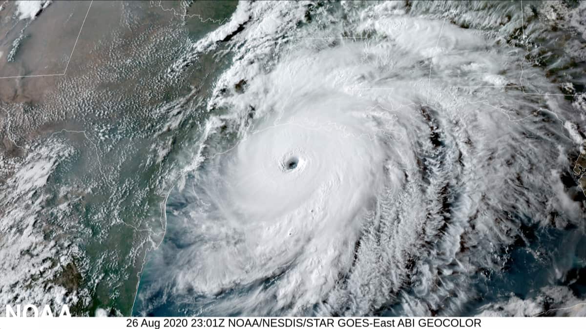
Recent forecasts indicate that the 2021 Atlantic hurricane season may be trending towards increased storminess throughout August and September.
So far, the 2021 Atlantic hurricane season has seen a relatively weak start. There have been four named tropical storms (Ana, Bill, Claudette, and Danny) and one Category 1 hurricane (Elsa), which made landfall in Florida in early July. However, most long-range forecasts made in the spring indicated an above-average hurricane season, yet there have only been five storms this year compared to nine last year. So why are they all so wrong? Well, they’re not wrong—yet.

Simply put, patterns haven’t been favorable for storm development in the eastern Atlantic ocean. However, forecasts indicate that’s poised to change in the next few weeks.
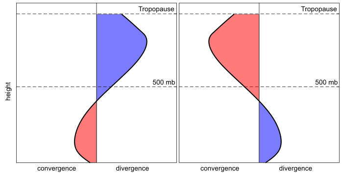
The Madden-Julian Oscillation (MJO) is an alternating weather pattern that repeats about every 30-90 days. The MJO has two main stages: converging and diverging upper-level winds. We’ll get into how these winds affect hurricane development in a minute, but first, we should quickly cover what converging and diverging winds do in the atmosphere.
Upper-level converging winds are when the wind is essentially merging together, and since it’s up near the top of the troposphere it has nowhere to go except down. As it’s forced down towards the surface, it rises in temperature and becomes less likely to condense into a cloud and produce precipitation. Likewise, upper-level divergence occurs when the wind “pulls apart” from itself and spreads out. This creates suction and pulls air from the surface up towards the disturbance. As the air rises, it cools, condenses, and can form clouds and precipitation.
When the MJO is in the diverging upper-level stage, it causes more favorable conditions for upper levels winds to “pull apart” in the applicable area. Naturally, the atmosphere wants to balance it out, so lower-level winds converge and are pulled up to balance out the negative pressure created by the suction. If even a little bit more air is diverging throughout the atmosphere, low-level converging winds may not be able to keep up, and as a result, the pressure drops, forming a low-pressure system.

By now, it may be becoming clear to you how the MJO influences hurricane formation. In an area where the MJO stage creates more favorable conditions for upper-level divergence, the divergence might overpower the lower-level convergence attempting to neutralize the pressure and may increase the likelihood that low-pressure systems spawn. Once a low-pressure system forms, with enough abundant moisture and energy, it can rapidly intensify into a hurricane.
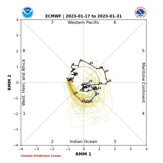
The MJO is broken up into eight phases; eight unique phases of the oscillation where the converging and diverging stages are in different locations. Phases three through five occur when upper-level divergence is favored above the Atlantic ocean, which increases the likelihood that low-pressure systems and subsequent hurricanes may form. In the below animation from Eric Webb, you can see the MJO phase compared to the average cyclone track:
https://twitter.com/i/status/1422196254872805394
Currently, the MJO is in Phase 8. However, forecasts show that it will quickly move into lower phases in the next few weeks. This forecast from the NOAA shows the MJO reaching Phase 2 by mid-August, and since the MJO consistently moves in a counter-clockwise direction, we can presume that it will continue inching towards the Phase 4 epicenter that is ideal for Atlantic hurricane development as September draws near.

Great explanation!
Thanks!