Forecast Summary
A series of systems will make their way through the west and bring much-needed snowfall to Colorado. The first of said systems will move through tonight into Thursday and bring snow to primarily the San Juan Mountains. A second system will move through Friday into Saturday and bring more snow to the mountains, focusing more on northern Colorado. A third and more potent system moves through Sunday into Monday and brings snowfall to most mountains, heaviest will be focused over the San Juan Mountains. More snow is then possible heading into next week as the active pattern continues.
Short Term
Now through Saturday
As mentioned above an active is beginning to develop across the western US and will bring much-needed snowfall to Colorado. Snow will begin to fill in tonight as the first in a series of systems moves through the region. This system will primarily bring snow to the San Juan Mountains as the center of the low skirts by the southern part of the state from west to east. As it does so, moisture will be transported from south to north and direct itself at the San Juan Mountains. Not a lot of snow is expected with this first system but it will be greatly welcomed with how dry it has been thus far. Snow tapers off Friday morning as the system moves off to the east.
Storm #1 Totals:
- Silverton: 2-5″
- Telluride: 2-5″
- Wolf Creek: 3-7″
- Purgatory: 3-7″
The second system will move into the state from the Weest-Northwest and bring widely scattered light snow showers. This second system does not appear to be quite as strong or well organized as the first system but will bring widely scattered snow showers to most mountains Friday afternoon, focusing more so over the northern half of the state. Some areas may not see much of a break between storms as snow showers lingering from the first system continue into Friday afternoon. Nonetheless, snow showers will continue Friday night and into the day Saturday before tapering off Saturday evening.
Storm #2 Totals:
- Steamboat: 4-8″
- Vail: 2-5″
- Winter Park: 2-5″
- Breckenridge: 2-5″
- Abasin: 2-5″
- Aspen: 1-4″
Long-Term
Sunday and Beyond
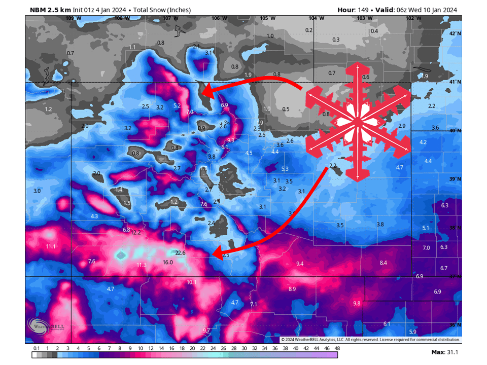
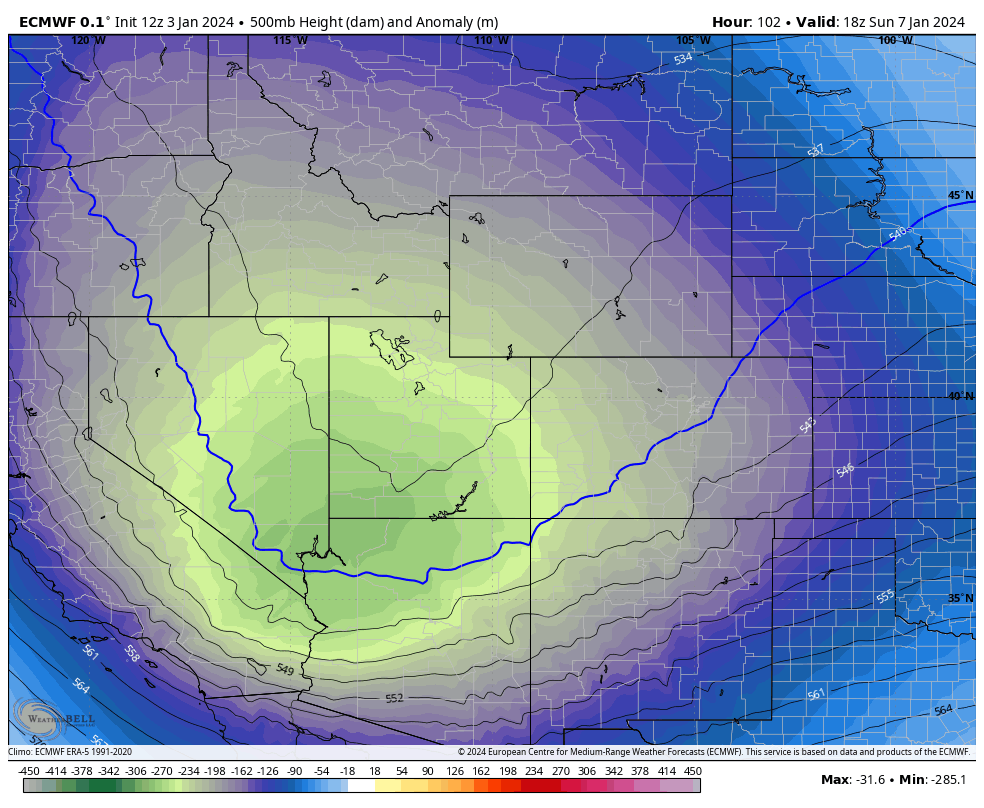
A third and more robust system will move into the region on Sunday and bring a better chance for more heavy snow. Right now the heaviest snow will be focused over the San Juan Mountains as this system takes a more southerly track, but all mountain areas will have the chance to see snow. Current model data indicates resorts in the San Juans have the chance of seeing 8-16″ of snow. This may change over the coming days but it does look very promising.
Extended
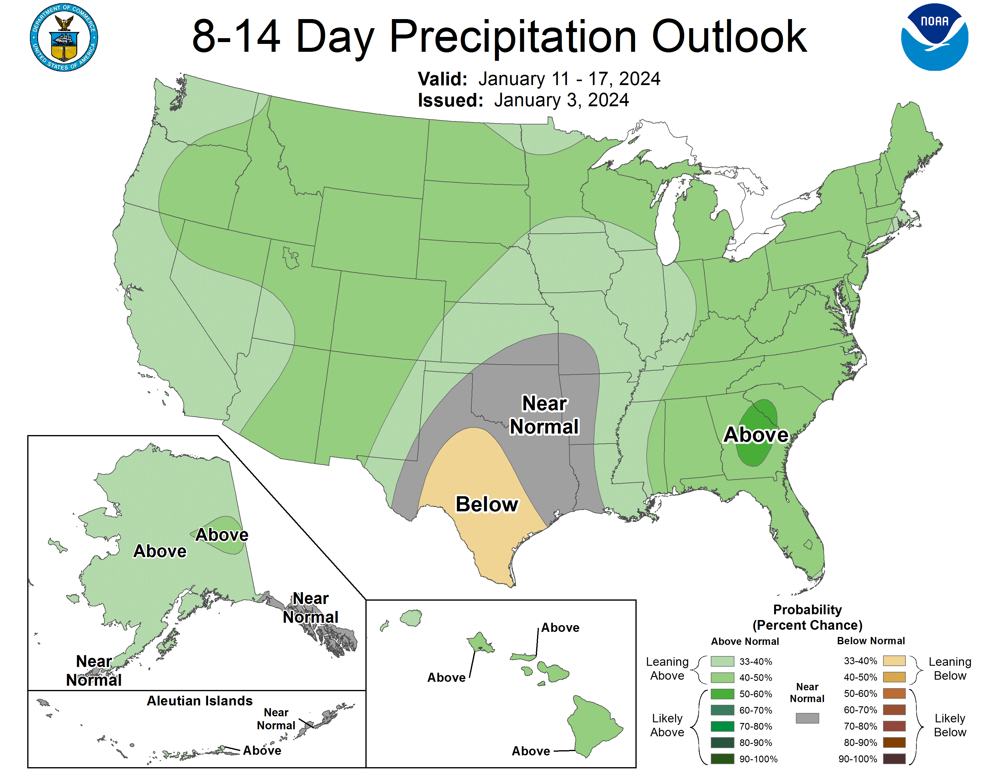
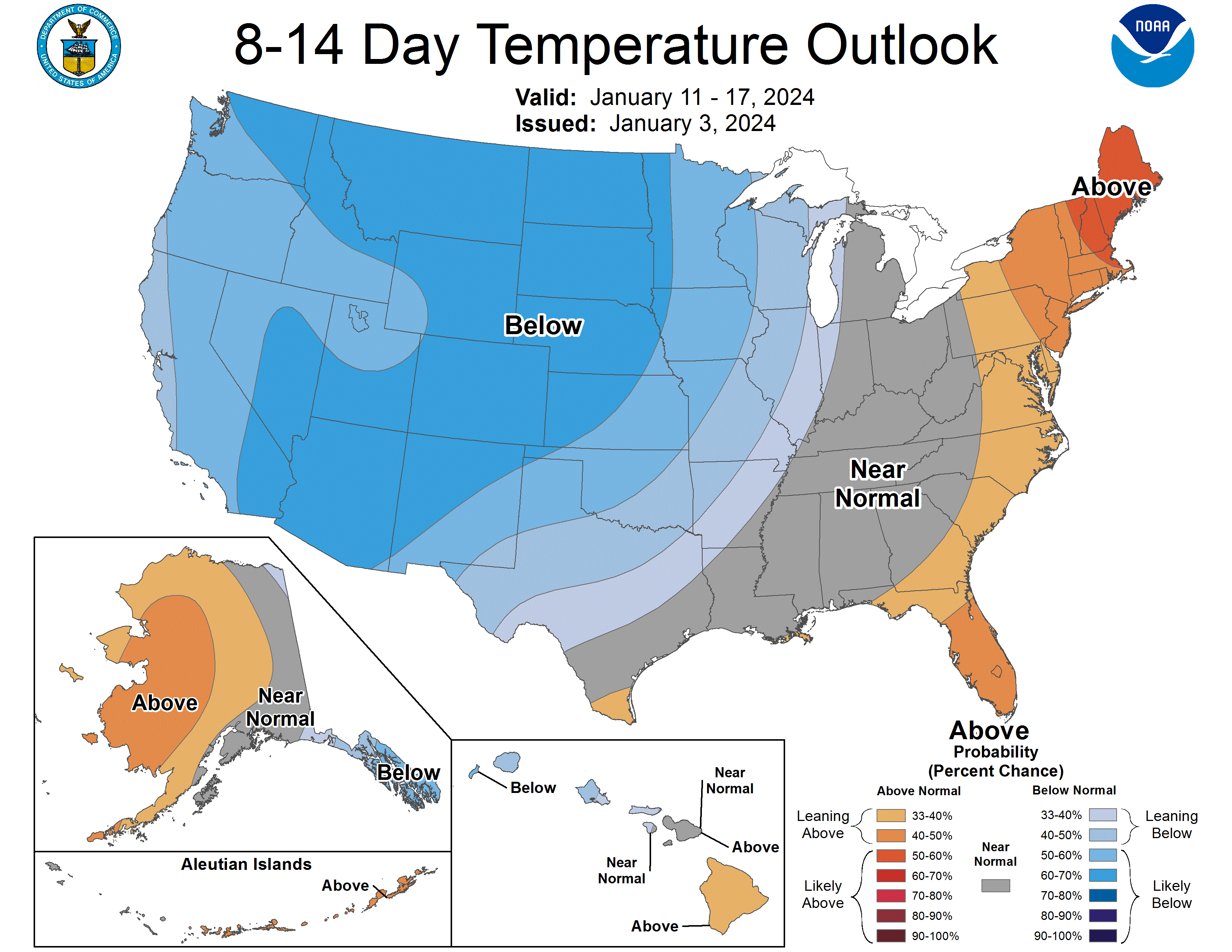
Right now all model indicates this active pattern will continue well into next week. This means there will be more chance for snow for at least the next 7+ days, and possibly even further. Most global ensembles show above-average precipitaion and below-average temperatures for Colorado 8-14 days out.