Forecast by Eric McNamee
Summary:
The ongoing storm over the Sierra Nevada has DUMPED tons of snow.
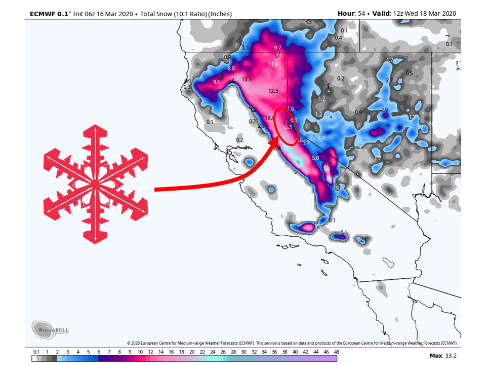
This will continue through Wednesday as an additional 12-18″ of snow will fall in areas around Tahoe before tapering off Thursday.
Another round of snow looks to begin Friday as another storm will move in from the Pacific.
Man, what a past couple of days we have had in the Tahoe area after hardly getting anything during February.
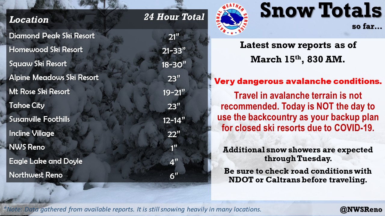
Taking a look at the amount of snow that has already fallen, FEET of snow has been reported in sites around the Tahoe area.
The totals above are from 8:30 am yesterday so higher amounts are likely to be coming out as the day progresses.
Short-Term:
Monday-Wednesday:
Going through the rest of the day today, the closed-low will continue to dig down the coast and shift the main band of moisture further to the south.
This will continue through the day Tuesday and Wednesday before snow tapers off by Thursday morning.
By this time we can see an additional 12-18″ of snow across most locations around the Tahoe area, with higher amounts to the south.
  Moisture continues to flow into the Sierra this morning with snow
  continuing to pile up. The heaviest snowfall today is expected to
  shift south into Mono County as the low pressure continues to
  move south. Another 1-1.5 feet is probable in the high Sierra
  through today with the largest amounts in Alpine and Mono County.
  - NWS, 3/16/20
Avalanche Forecast:
The Sierra Avalanche Center still has the area categorized as “considerable avalanche danger.”
Please make sure to monitor the conditions and stay posted for the latest.
Long-Term:
Conditions will clear out for the most part during the day Thursday with the exception of some scattered showers.
This will continue into the morning of Friday before another storm looks to move into the area Friday night and this weekend.
Totals for this storm are not quite as certain right now but could be decent.
What is certain is an active pattern will persist through at least this weekend and likely into next week.
  There is potential for a moderate storm over the
  weekend into early next week with mountain snow, valley rain or
  snow, and gusty winds but predictability remains low.
  - NWS, Reno, 3/16/20