The Sierra Avalanche Center is reporting a large avalanche on Steven’s Peak in California, following the huge snowstorm over the last few days.
Report below:
The October 24-25 storm event deposited copious amounts of rain followed by 6 to 40 inches of new snow across the forecast area. The areas of the deepest snowpack exist above 7,500′ to 8,000′.
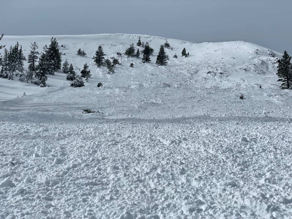
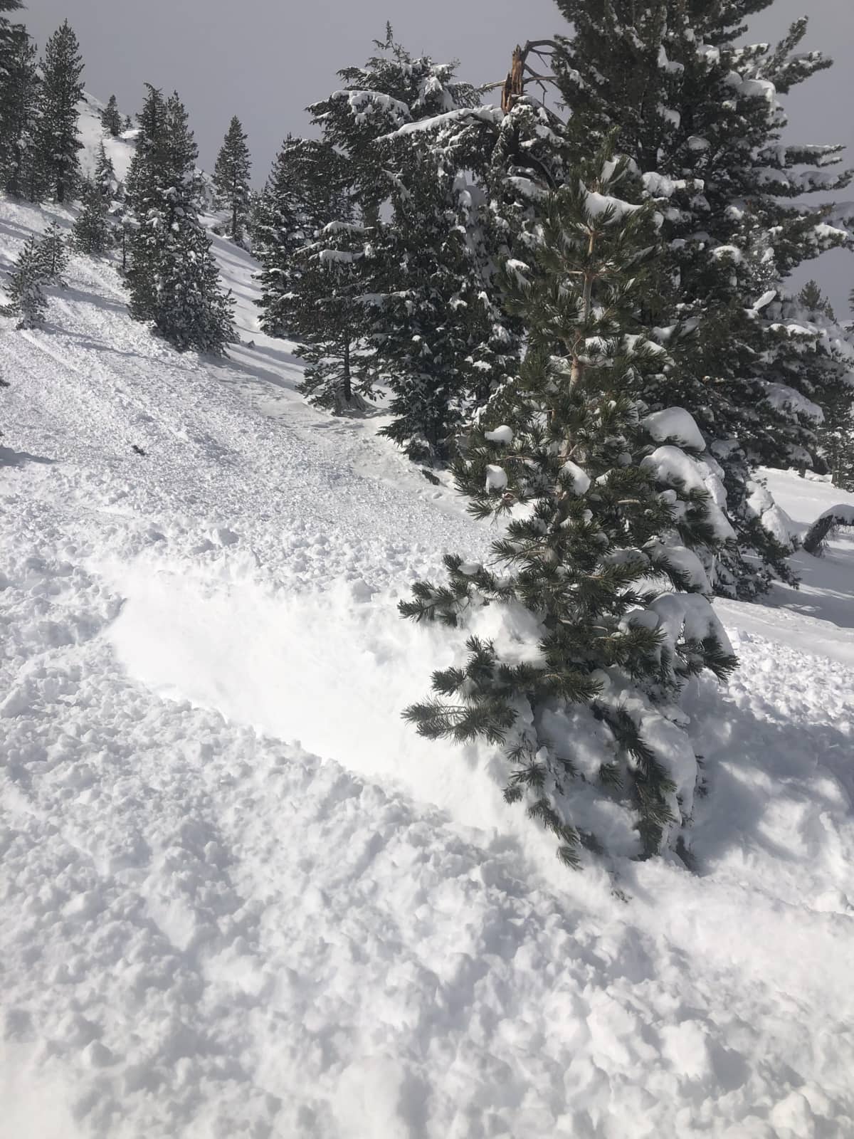
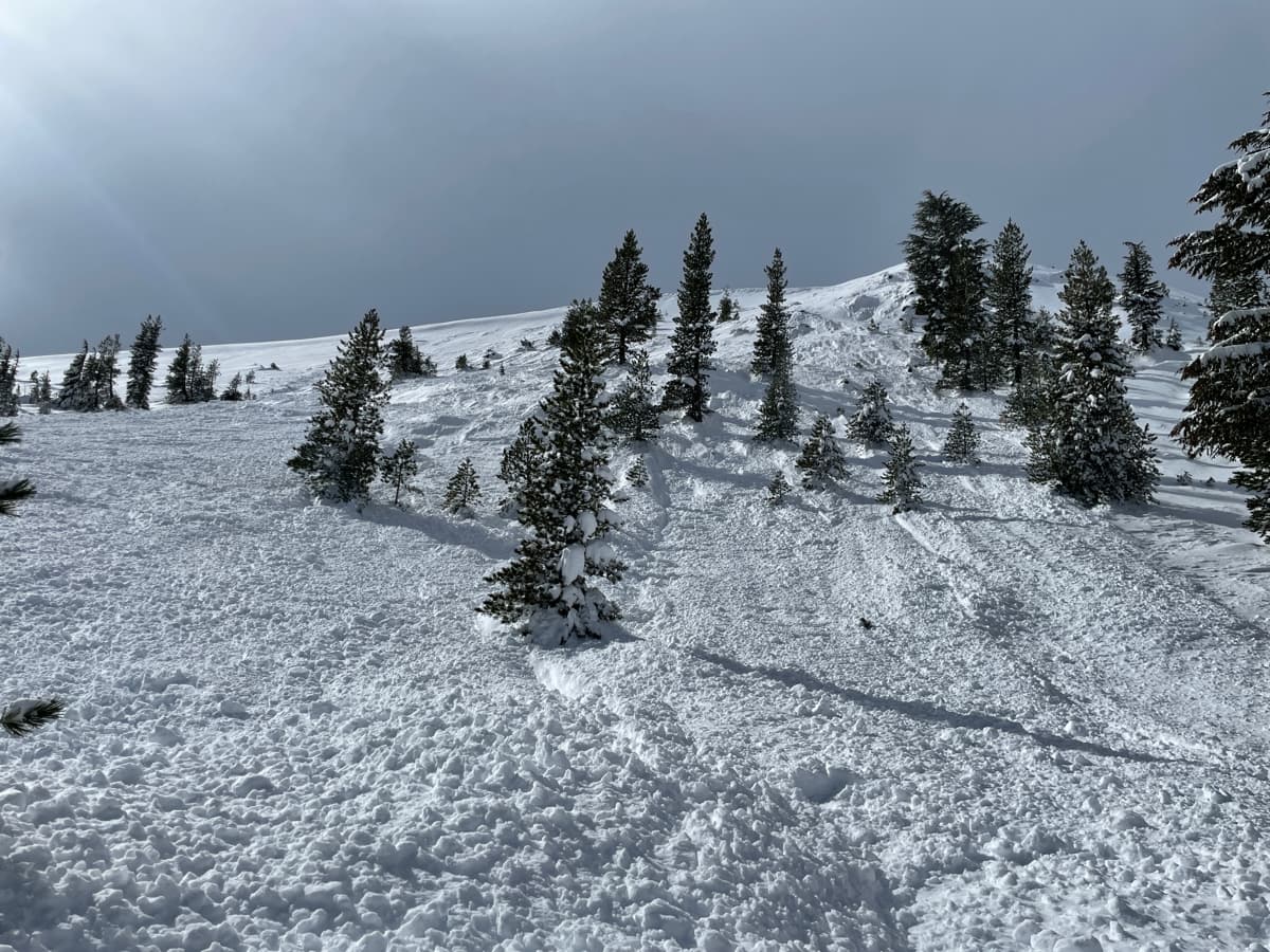
Reports were received on Oct 26 of fresh debris from multiple natural wind slab avalanches on Steven’s Peak (Carson Pass area) on a NE aspect around 8,500′ in near treeline terrain. Continued areas of unstable wind drifted snow (wind slabs) remain a concern along ridgelines, especially in above treeline and near treeline terrain. With very little known about the snowpack at this time, it remains a good idea to move cautiously around, mostly avoiding avalanche terrain where wind drifted snow has deposited. Use clues such as cornice formation, wind pillows, and snow surface texture to help identify the areas to avoid.
The very limited number of observations we have from wind-protected areas below treeline give only low confidence for the absence of any problematic weak layers developing within the snowpack. The layer interface around rain crust(s) in the snowpack warrants continued assessment and monitoring for the development of a faceted weak layer within the snowpack.
Conditions are very exploratory right now with many unknowns. Take the time to gather as much snowpack information as possible while you travel. Remember the proper mindset is to seek out any evidence of instability and weigh that heavily in your decision making, even if it seems like an outlier. Please let us know what you see out there by submitting your observations. Even a photo and simple caption are valuable.
Snowpack details:
- Total Snow Depth: 100cm (40″)
- Persistent Weak Layers: Not observed
Terrain Details
- Terrain: elevations: Near Treeline
- Terrain: aspects: NE
Avalanche Details
- Avalanche Type: Wind Slab
- Failure Plane/Weak Layer: Unknown
- Additional number of similar avalanches: 4
Trigger
- Trigger: Natural
Terrain
- Aspect: Northeast
- Starting Elevation: near-treeline
Size
- Destructive Size: D2 Could bury, injure, or kill a person.
- Relative Size: R3 Medium
- Avalanche Width (Average width): 250ft.
- Avalanche Length (Vertical Run): 600ft.
The avalanche center is still in the preseason startup phase and will not be fully operational until mid-November. This time of year data is very limited. Recent wind slab avalanches occurred naturally at the tail end of this last storm. Slabs of unstable snow associated with wind drifted snow (wind slabs) remain a concern along ridgelines, especially in above treeline and near treeline terrain. It remains best to use an avoidance mindset for travel near or below avalanche terrain at this time. With limited data, there is greater uncertainty and more unknowns about the stability of the snowpack.