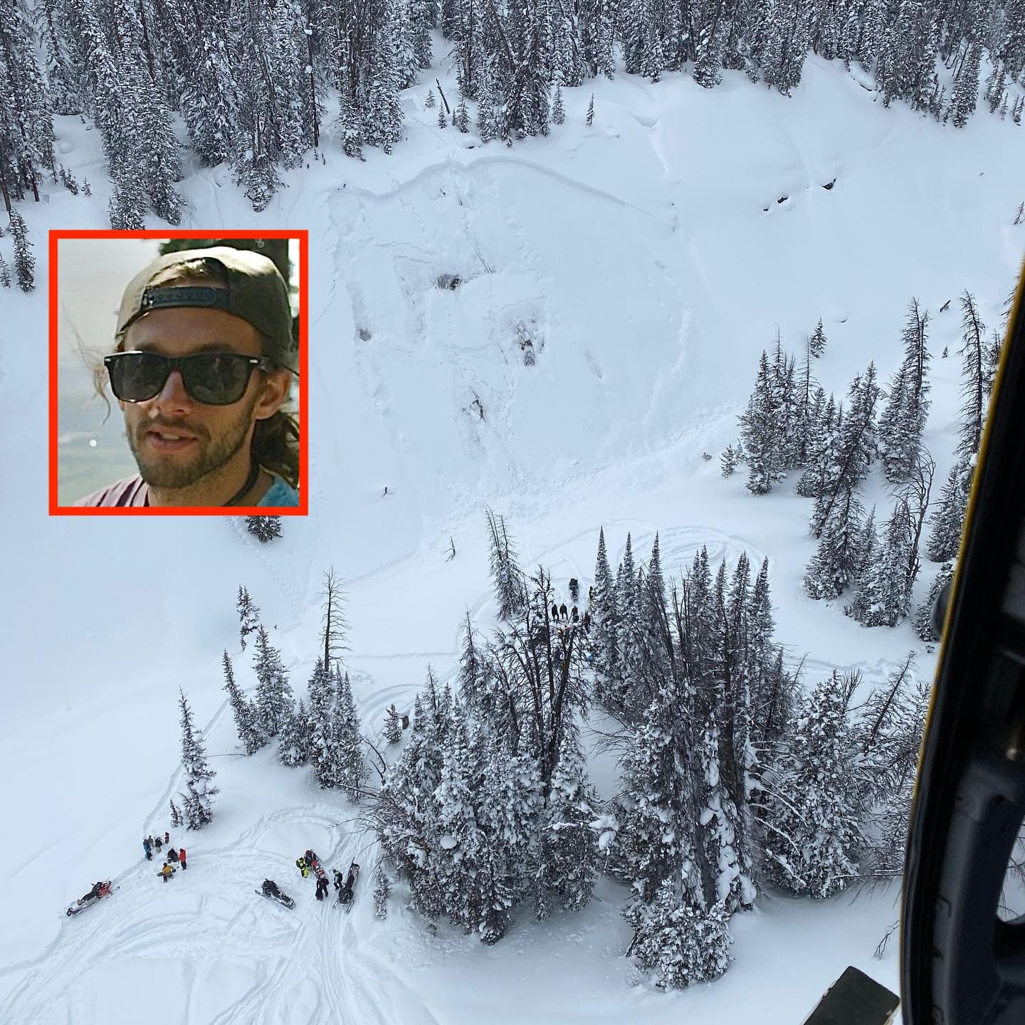
Michael McKelvey, 31, of Jackson, WY, was with a group of snowboarders near Two Ocean Mountain and Wind River Lake in Bridger-Teton National Forest. He hit a jump onto a northeast-facing slope, triggering an avalanche that buried him.
“They built a big jump that landed on the face of a steep ravine. A 5-foot slide broke loose and buried him at the bottom.”
– news release
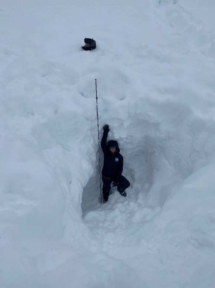
He was quickly located beneath almost 12-feet of snow, via his beacon and a probe, by his party. They dug him out, helped by rescue volunteers who were on a nearby training mission. Although he initially had no pulse, he was revived with an external defibrillator. After being short-hauled out, he was taken to Eastern Idaho Regional Medical Center, where he sadly succumbed to his injuries.
The full report is below:
Avalanche Comments
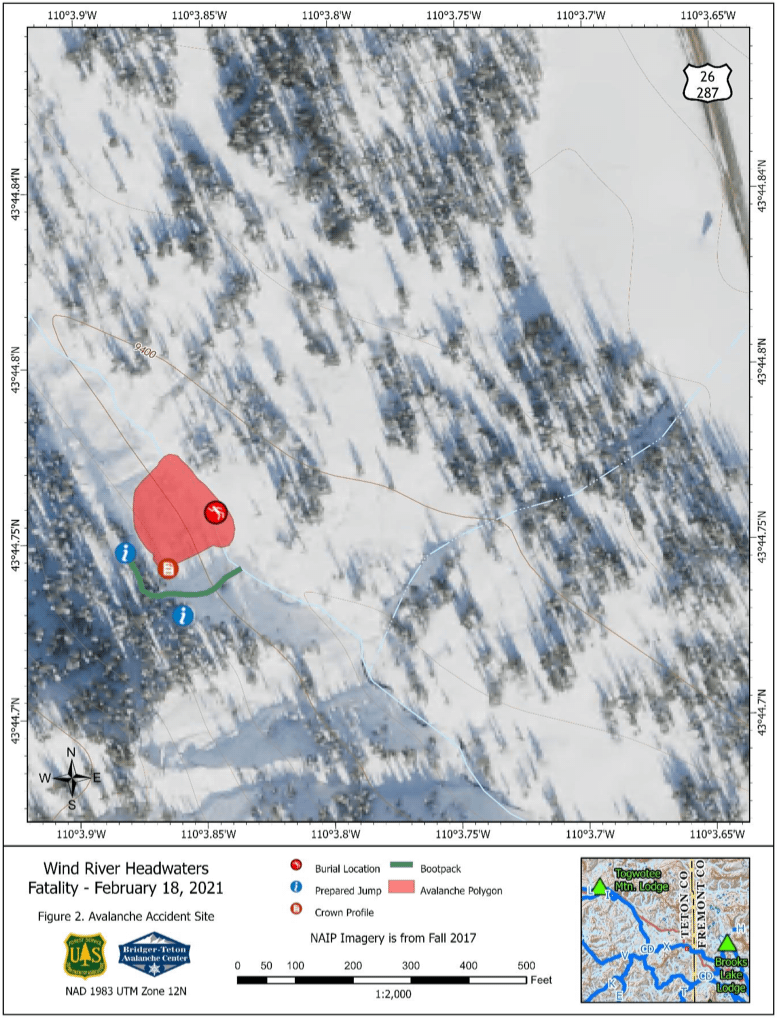
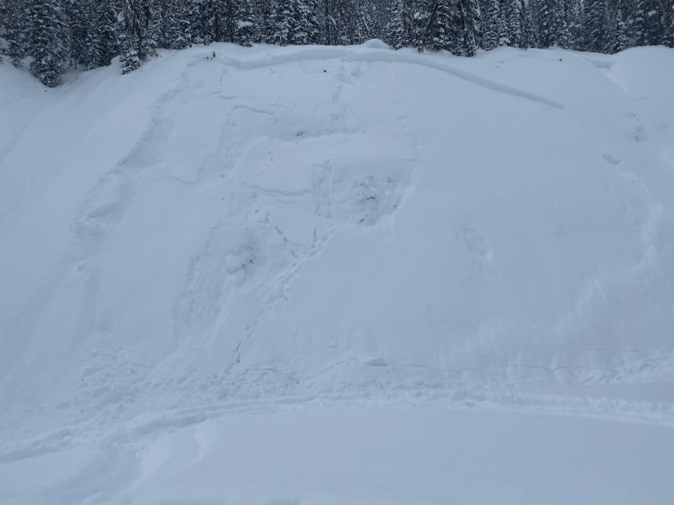
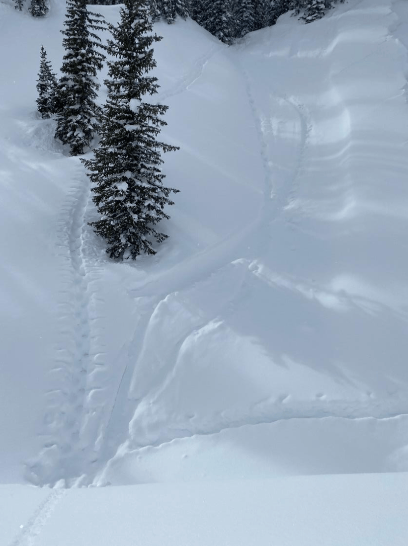
On February 18, 2021, a group of six snowboarders built a jump above a steep bank in the backcountry. At about noon, a 31-year male made the first jump. He landed on undisturbed snow and upon impact triggered a slab avalanche on the 42-degree bank. He was carried to the creek bottom at the base of the bank and was buried under 9 feet of avalanche debris. He was buried head up in a sitting position. The avalanche debris in this creek bottom was up to 17 feet deep.
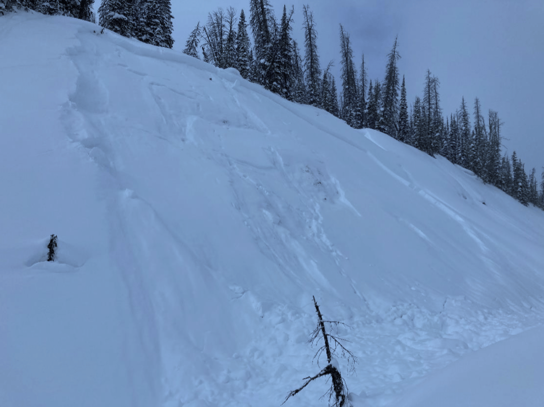
This was a relatively small slab avalanche; however, it was large enough to deeply bury the snowboarder in a terrain trap. The crown was measured to be 3 to 4 feet deep. It was 170 feet wide and ran 180 feet to the base of the bank (100 feet vertical). It failed on a persistent weak layer (SS-ARu-R2-D2-O). This incident occurred on a northeast aspect at an elevation of 9,440 feet.
Backcountry Avalanche Forecast
The avalanche danger scale rating for the Continental Divide/Togwotee Pass forecast area was Considerable (Level 3) for terrain above an elevation of 8,000 feet on February 18. The avalanche advisory listed persistent slabs as one of the day’s avalanche problems on all aspects between an elevation of 7,500 to 10,500 feet. Wind slabs were also listed as an avalanche problem on all aspects above an elevation of 9,000 feet on north through east to south aspects above an elevation of 7,500 feet. This snowboarder triggered a persistent slab avalanche. The potential to trigger a large to very large persistent slab avalanche was likely. On February 18 the general avalanche advisory read:
Yesterday, a snowmobiler was caught and killed in a large avalanche in the Squaw Creek Drainage located in the Grey’s River area southeast of Alpine. The Bridger-Teton Avalanche Center will be conducting an investigation of this accident. Over the past week, there have been many large human-triggered and natural avalanches in the forecast areas as well as a full burial on February 14 south of Spread Creek in the Togwotee Pass area. Above 8,000 feet, backcountry travelers could encounter dangerous avalanche conditions today, and when traveling in avalanche-prone terrain are likely to trigger large to very large avalanches. Heightened avalanche hazards exist below an elevation of 8,000 feet where the avalanche hazard is rated as moderate and human-triggered avalanches are possible on some steep avalanche terrain. Expert snowpack and terrain analysis skills are essential for safe travel in avalanche terrain, and if triggered slides could run long distances.
The persistent slab avalanche problem description read:
At the higher elevation, humans could trigger large to very large slab avalanches on persistent weak layers of faceted snow. These dangerous avalanches could be up to four feet deep and could run long distances. At the lower elevations, below an elevation of 8,000 feet, small to large slab avalanches up to 2 feet in depth could be human triggered on steep avalanche prone slopes.
Weather Summary
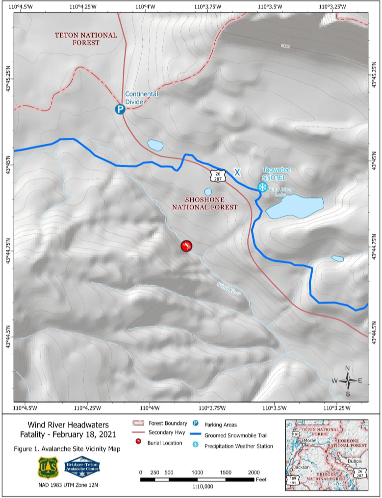
The Togwotee Pass Snotel site is located 1,700 feet in a northeast direction from the accident site. Data from that station was used to determine the weather conditions at the time of the accident. Skies were partly to mostly cloudy on February 18. Winds were light. The air temperature at the Snotel site was 6 degrees F at 5 am on the morning of February 18. Maximum and minimum air temperatures at that site for the 24-hour period from 5 am on February 18 to 5 am on February 19 were 14 and 5 degrees F, respectively.
Snowpack Summary
Data from the nearby Snotel site is used to monitor the development of the snowpack structure in this area. This data is monitored by the avalanche center daily from October 1 until the end of May. BTAC personnel visited the accident site on February 19. During this visit, they conducted a snow pit profile and snowpack structure tests.
This area received some early-season snow. In late January the snowpack was still shallow and was mostly comprised of weak faceted snow crystals. During the period from January 27 until the date of this accident the area received five feet of new snow. Two feet of that fell during the week before the accident. This area received about an inch of new snow during the 24 hours preceding the accident and a total of five inches of new snow during the preceding 48 hours.
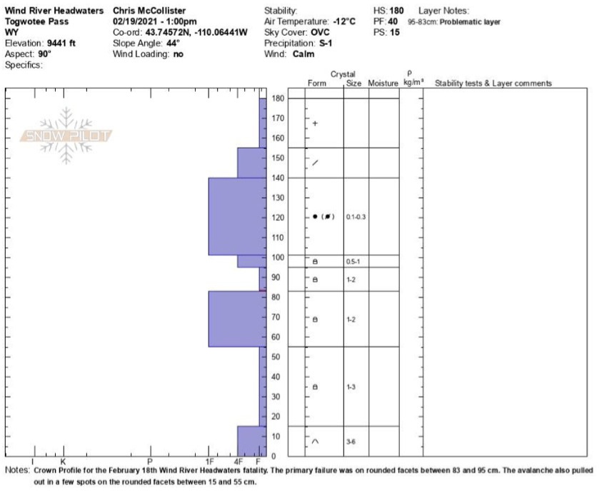
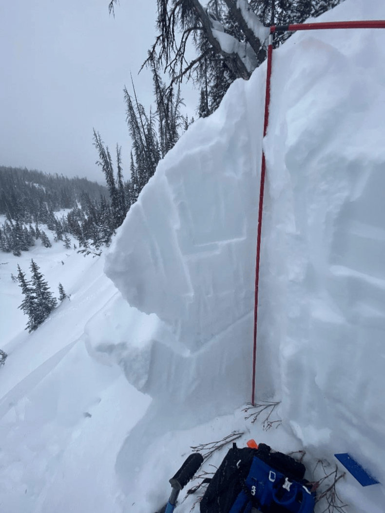
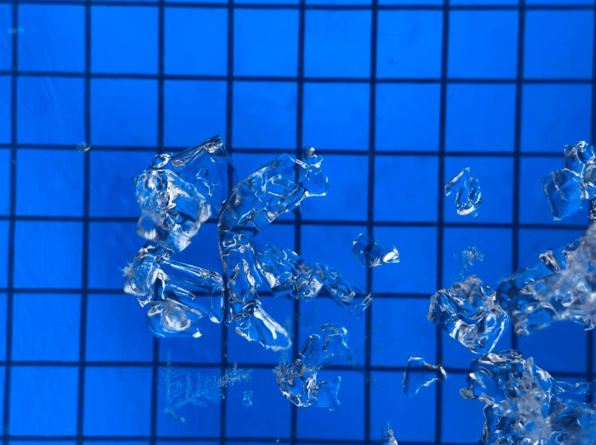
A crown profile was done on the looker’s right side of the avalanche. There, the height of snow was 71 inches. There were five distinct layers of faceted snow that were all in the process of rounding in the lower 40 inches of the snowpack. The layer that failed was at the bottom of a fist hard layer with 1-2 mm crystals at a height of 33 to 37 inches above the ground surface. The bed surface was also comprised of 1-2 mm crystals with 1 finger hand hardness. In a few areas, the avalanche also broke through the bed surface down to 1-3 mm fist hard snow at a height of 6 to 22 inches above the ground surface. The snow from 40 inches above the ground surface to the top of the snow surface all fell since January 27th. It transitioned from a 1 finger slab with 0.1-0.3 mm rounds to 4 finger decomposing particles to fist hard new snow at the top.
Events Leading to the Avalanche
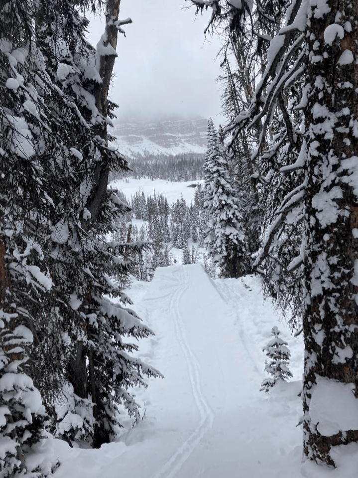
The accident site is located 2,500 feet south-southeast a plowed parking lot on the top of Togwotee Pass. This group was comprised of snowboarders who were experienced Park and Pipe workers at a local ski resort. Members of the group visited this area on the previous day and had built a prepared jump and used that jump at a nearby location on a steep creek bank. They had been to this area earlier in the season for the purpose of building and using a prepared jump. The creek at the base of this bank is the headwaters of the Wind River.
On the day of the accident, they snowshoed over to the area, ascended the bank, and built a new jump at a location that was 150 feet northwest along the creek bank from the jump they had used the previous day.
It was reported that all members of the group had some avalanche training. At least one person in the group had read the morning avalanche hazard forecast for that area.
Rescue Summary
The group watched the avalanche happen and immediately went into rescue mode. The buried snowboarder was wearing an avalanche transceiver and the other members of the group had transceivers, probe poles, and shovels. They quickly homed in on the location of the buried man. Their transceiver readings indicated he was deeply buried. Initial probing efforts determined he was likely buried deeper than the length of the probes. They shoveled and probed until they got confirmation from the probing efforts that their friend was beneath them. They continued to dig until they uncovered the man. He did not have a pulse and they began CPR.
A passing snowmobiler saw what was happening and called Teton County Search & Rescue (SAR) at 12:04. A SAR team happened to be doing an on-snow training session on snowmobiles near the parking lot on top of the pass. They responded immediately and arrived at the accident site at 12:32. They provided medical assistance and helped administer CPR. A SAR helicopter arrived on-site and was used to short-haul the patient to a waiting ambulance at 14:09. He was then transported to the Jackson Hole Airport and life-flighted via a fixed-wing aircraft to Eastern Idaho Regional Medical Center (ERMAC) in Pocatello, Idaho. A medical helicopter was unable to get from Idaho to the accident site due to bad weather. CPR was continued on the patient during the short haul process and during the entire travel period. The patient was declared to be deceased upon arrival at the ERMAC facility. The cause of death was determined to be asphyxia. An autopsy was not conducted.
Comments
All of the fatal accidents that we investigate are tragic events. We do our best to describe each one to help the people involved and the community to better understand them. We offer these comments in the hope that they will help people to avoid future avalanche accidents.
This accident occurred on a steep but short slope above a creek bed. The first person on the slope triggered a slab avalanche on a persistent weak layer and was deeply buried in a terrain trap at the base of the slope. His companions were prepared with avalanche rescue gear and conducted a quick and efficient rescue. Due to the depth of burial, he did not survive.
Avalanche Details
- Location: Togwotee Pass
- State: Wyoming
- Date: 2/18/2021
- Time: Noon
- Summary Description: 1 snowboarder caught and killed
- Primary Activity: Prepared Jump
- Primary Travel Mode: Snowboard & Snowshoes
- Location Setting: Backcountry
Number
- Caught: 1
- Partially Buried, Non-Critical: 0
- Partially Buried, Critical: 0
- Fully Buried: 1
- Injured: 0
- Killed: 1
Avalanche
- Type: SS
- Trigger: AR – Snowboard
- Subcode: u (unintentional)
- Size – Relative to Path: R2
- Size – Destructive Force: D2
- Sliding Surface: O – Persistent Weak Layer
Site
- Slope Aspect: Northeast
- Site Elevation: 9,440 feet
- Slope Angle: 42 Degrees
- Slope Characteristic: Steep Creek Bank, Terrain Trap
List of Attachments:
Figure 1 – Accident Site Vicinity Map
Figure 2 – Accident Site Topographic Base Map Figure 3 – Site Photograph
Figure 4 – Site Photograph
Figure 5 – Site Photograph
Figure 6 – Site Photograph
Figure 7 – Site Photograph
Figure 8 – Site Photograph
Figure 9 – Snow Pit Profile
Figure 10 – Snow Crystal Photograph
Figure 11- Snow Crystal Photograph

This accident site was investigated by Lisa Van Sciver and Chris McCollister. Information was provided by Teton County Search & Rescue volunteers, the Teton County Coroner, and members of the party. This report was produced by Bob Comey and Chris McCollister from the Bridger- Teton Avalanche Center.