Brought to you by Mono County Tourism
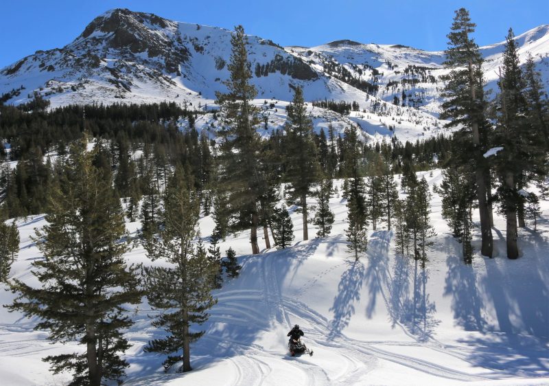
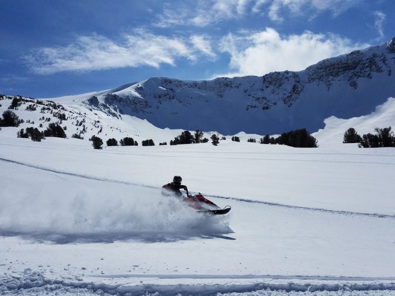
When winter takes hold in the Eastern Sierra, the Bridgeport Winter Recreation Area (BWRA) becomes a popular destination for backcountry enthusiasts. Powderhounds flock to this area during the cold winter months, usually with snowmobiles. Shortly after you turn onto Highway 108 (Sonora Pass), the snow starts, and the journey begins. Located seven miles up the snow-covered highway, the BWRA is the gateway to remote and technical terrain in the heart of the Sierra.
The Bridgeport Avalanche Center (BAC) is a brand new non-profit program dedicated to sharing field observations and snowpack summaries in the region. I had a feeling the BAC would be familiar with the Bridgeport Winter Recreation Area in particular, so I reached out to them. Join me as I chat with Joe Soccio and Andrew Irvin about trailhead access, favorite routes, and planning your day in the Bridgeport Winter Recreation Area this season.
Backcountry Beta with Bridgeport Avalanche Center
Joe Soccio is a ranger for the Bridgeport Ranger District and Bridgeport Avalanche Center’s Avalanche Specialist. He was kind enough to reply to me and coordinate a phone call with his friend, Andrew Irvin. Andrew is a Natural and Cultural Resource Manager for the U.S. Marine Corp Mountain Training Center and the President of the Friends of Bridgeport Avalanche Center non-profit group.
After introducing ourselves and talking about that crazy storm in October, we delved into details about this unique trailhead. Joe has been with the Forest Service for three years and manages the area. He had all the information about accessing the trailheads and preparing for a day at the BWRA.
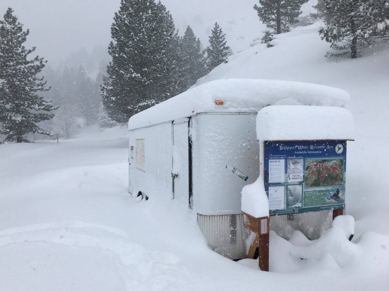
“You drive out to Highway 108 and go past the marine base to People’s Gate Trailhead. This is actually seven miles from the BWRA trailhead. You stop there and unload your truck, trailer, and sled. Everybody’s beacons are on, there’s a beacon checker at the trailhead. There’s a free permit station, so just fill out a quick permit.”
Joe highlighted the QR codes that can be found at the trailheads. You can scan these QR codes and get the most recent BAC snowpack summary on your phone. While the summaries aren’t daily, he said they provide some hazard awareness for folks going into the BWRA.
The permit Joe also mentioned is entirely free and easily accessible. You can fill it out at the trailhead or online before your trip. Online permits and information can be found on the Humboldt Toiyabe National Forest website and the Bridgeport Avalanche Center website.
So we have found the first trailhead, we are geared up, beacons on, sleds warmed up. Now what?
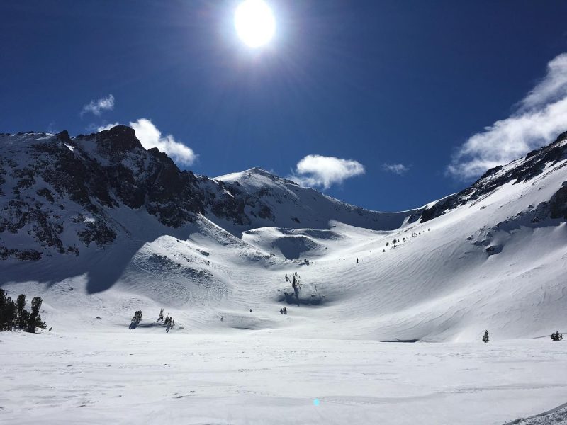
“So once everybody is kinda geared up, you take the one and only groomed trail, which is Highway 108, to the entrance of the BWRA. The BWRA is near Leavitt Lake Rd and from there it is all off traill– it’s all powder riding. This area includes the Leavitt glacial cirque, the Sonora Pass area and Levitt meadows south of 108”
When I asked them what their favorite route in the area was, Joe laughed and turned it over to Andrew, who he deemed as the better rider. I was excited to hear Andrew’s response; I can only imagine the backcountry adventures these two have been on.
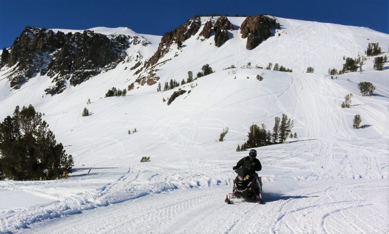
“I really enjoy doing the Sierra Crossing”
The Sierra Crossing was a route designated by the Forest Service with consultation from the Fish and Wildlife Service and the Pacific Crest Trail. The Sierra Crossing goes from Sonora Pass, crosses the PCT briefly, then provides access to several drainages called the Upper Sardine area.
Andrew described what the terrain looks like on the Sierra Crossing Route. As I envisioned a day in the BWRA, I quickly got the itch to return to this area during powder season.
“You can climb something about 700 ft. straight up called the Elevator Shaft, which is about 30-35 degrees. Yeahhhhh! Really get ya goin’ there! Then down the other side of that to the Koenig and Latopie Lake area near Leavitt Lake. If you’re a hybrid skier, you can ski 1500 ft lines, spines, huck cliffs, waterfalls, you name it. The snowmobiling back in that area is also much more technical and steeper.”
He elaborated on how the Sierra Crossing allowed riders from the other side of the pass (Pinecrest and Strawberry) to directly access the BWRA through Sonora Pass, saving them about 7-8 miles of road travel. The BWRA was also the first federally designated winter motorized recreation area in 2009 under the Omnibus Public Land Management Act. This allowed the use of snowmobiles in the area.
Important Note: The BWRA is managed by the Forest Service and has specific opening and closing dates. Opening and closing dates for the BWRA will be updated both on the Bridgeport Avalanche Center website and the Humboldt-Toiyabe National Forest website.
We continued to chat about the BAC being entirely new and all the hard work they have put into it. The BAC website provides snowpack summaries, field observations, and weather forecasts for readers to consult before venturing into avalanche terrain. Before entering the BWRA, check the BAC site to understand current conditions.
“It’s been fulfilling work and is something that has needed to happen in the community for quite some time. It is a remote area, but it gets so much use.” – Andrew Irvin
Lastly, I asked if they had any advice or mantras for backcountry skiers out there that they would like to share. They left me with some true and simple words that we can all remember in the backcountry.
“I would go with the ‘Know Before You Go’ mantra. Get the gear, get the training, get the forecast, and get out of harm’s way.” – Joe Soccio
After chatting with these two, it was clear that there was something special about this area. The remoteness, the terrain, it all sounded like a dream. For those looking to get deeper into the backcountry this winter, the Bridgeport Winter Recreation Area might be the perfect trailhead to try.
Quick Travel Tips:
- The small town of Bridgeport offers all the travel necessities you need, such as gas, food, and beers, and inexpensive lodging.
- The area does offer some self-contained, dispersed camping nearby. Check out how to Camp Like a Pro in the Eastern Sierra and stay in tune with the current openings, restrictions, and maps. The Bridgeport Ranger Station also offers info and maps as well. Please respect natural areas and keep rowdiness to a minimum.
- Need some coffee and a snack for the road home? Try Walker Coffee Company in Walker (North of Sonora Pass). I am always a fan of a good Dirty Chai.
Nearly all of this Chris Benchetler film was filmed at Bridgeport Recreation Area:
https://youtu.be/hqtDehAtAN8
Used sleds to access. Lots of guys use it for filming or just having fun doing labs with your friends.
Isn’t it great that the Sierra Club and Winter Wildlands just sued the forest service and shut down about 1/2 the terrain there? You might ask why did they do that? The answer is they are selfish idealists who like to shove their ideals on the country. The scary part is they have the money, political power and attorneys to do it.
Lots of professional athletes and skiing enthusiasts use braaap to access terrain. A large % of the ski videos you watch every year use braaap and choppers to access their terrain to get the shots.
They don’t just float up there like magic fairies despite all your liberal delusions.
Once you successfully transition america from fossil fuels to renewables you are allowed to talk about this. Until then you’re just a typical hypocrite who drives cars, flies in plans, and uses roads to get everywhere.
Thought this was about skiing not about a braaaap party on public lands.
There is so much more of this terrain that could be explored an utilized. Unfortunately enviro’s have closed and banned the use of 8,500,000 acres of land like this in the Sierra’s. They work very hard and spend a lot of money every year to close the few remaining areas like this. Very greedy rich selfish people who think their views of the world are the only ones that should be exercised.