Report from Sunday, November 6, 2022
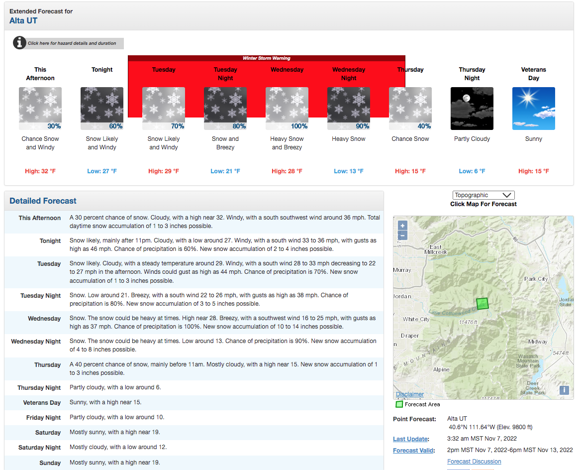
The Snow Gods have been good to us. As of Nov. 7, Wasatch snow depths range from 1′-3′ or deeper, and there’s a storm rolling in as I write this that’s forecasted to drop an additional 12-24″ of powder snow this week. The last two weeks of preseason skiing have been phenomenal, and yesterday was no exception.
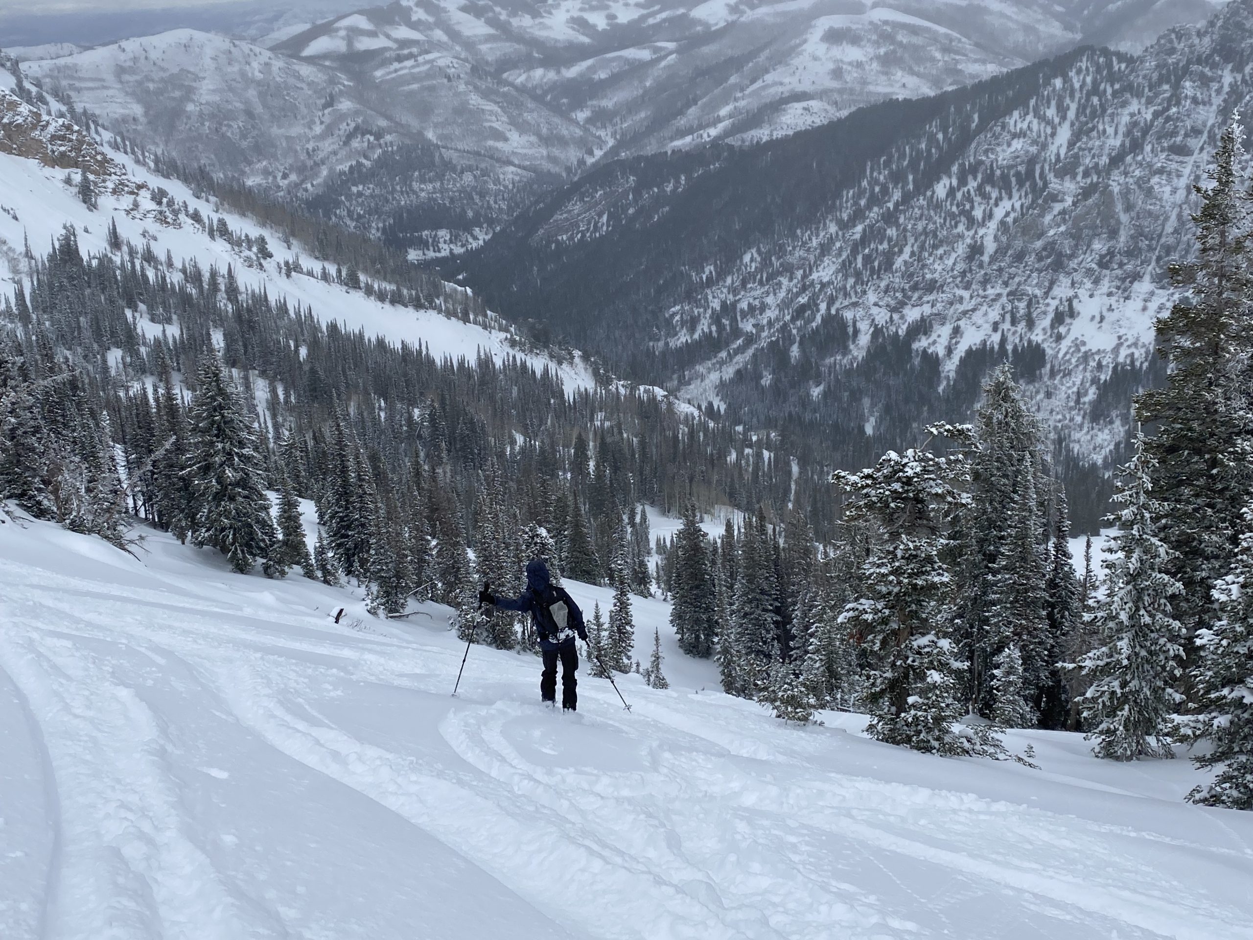
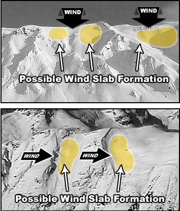
The avalanche danger was considerable. About 8″ of new snow had landed overnight after an already snowy week, and high westerly winds were loading upper-elevation slopes. So we chose a mellow, low-angle, east-facing bowl that topped out at around 10,000′ in Big Cottonwood Canyon.
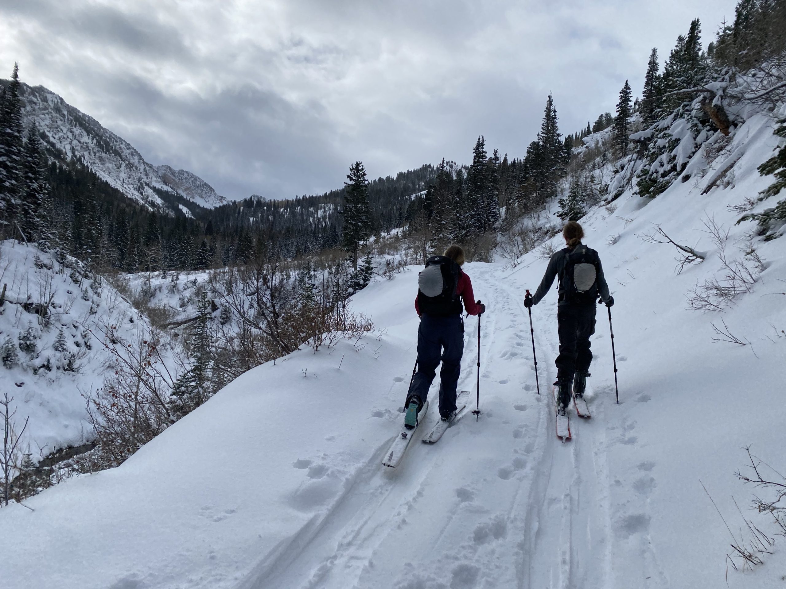
Breaking trail at around 9 in the morning, the snow felt good. The forest was silent and draped in frosty, sparkly white. Clouds were concealing the sun, which popped out and said hi a couple of times but remained relatively hidden throughout the day. Temperatures were in the upper 20s and winds were generally low.
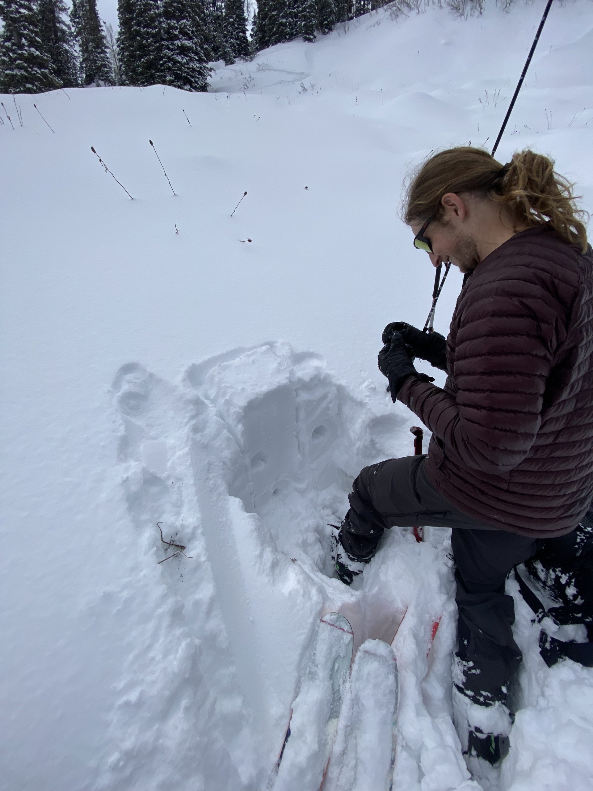
On the way to the top, we stopped and dug a pit. The snowpack looked happy and healthy: snow depth was about 2.5′ at 9,500′, with a decreasing hardness level from the bottom layer upwards. The very bottom layer was about finger hardness, the middle layer from last week’s storms about hand hardness, and then 8″-10″ of new fluffy snow was sitting on top, all of it appearing to bond together well.
Former UAC Forecaster Mark White posted an observation on his blog about the snow on Sunday in the same area we skied in, writing:
“Todays travel was up Cardiff from BCC, to Ivory Flakes, which is E facing and just under 10,000ft in elevation. There was 2 inches new damp snow at 7’200 ft and maybe 5 around 10,000. The snow up high was dense and surfy keeping you off the rocks for the most part but the surface was getting damp later in the day under 9,000ft due to warm temperatures and a bit of mist or light rain. The snow pack in general has settled out to a right side up compressed, damp at the ground state, which in my book is a really good start. The storm only produced 8 inches at the most and not the 16~20 predicted. The only instabilities noted were dry snow sluffs on Cardiac Ridge and below the Ivory Rock Slabs. You could make a snowball from the surface snow at 9,500ft and it seemed like the light density from Wednesday’s storm has been compacted in the terrain covered and is not going to be a factor in stability, especially after a very warm day tomorrow before the next storm. So far so good, praying we get the 2 feet predicted for midweek.”
By noon, we were at the top of our line. A few speedy mountain freaks sped past us on the skin track and we weren’t the first to drop in, but that was ok because there was plenty of powder to go around.
And it was good powder.
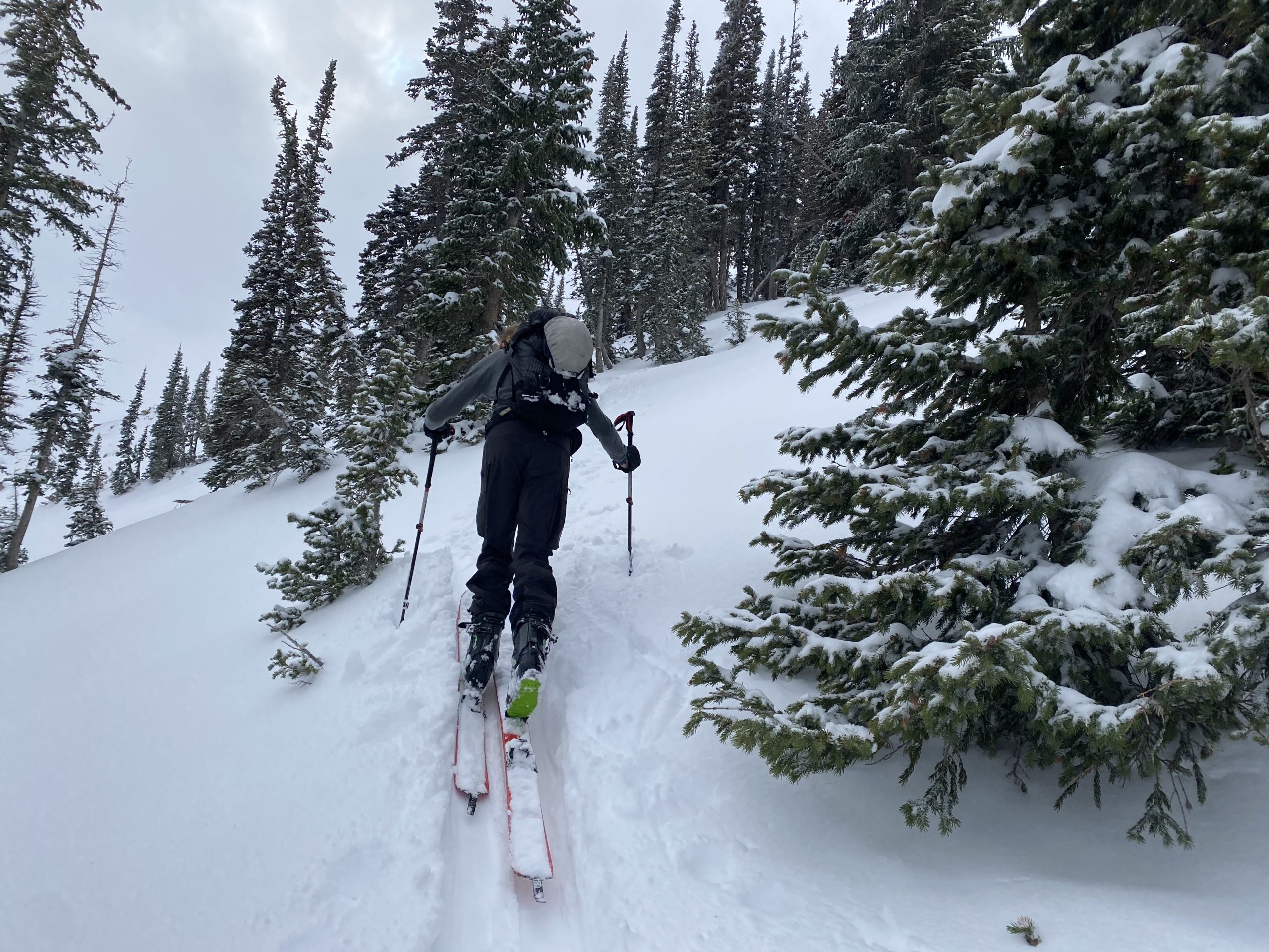
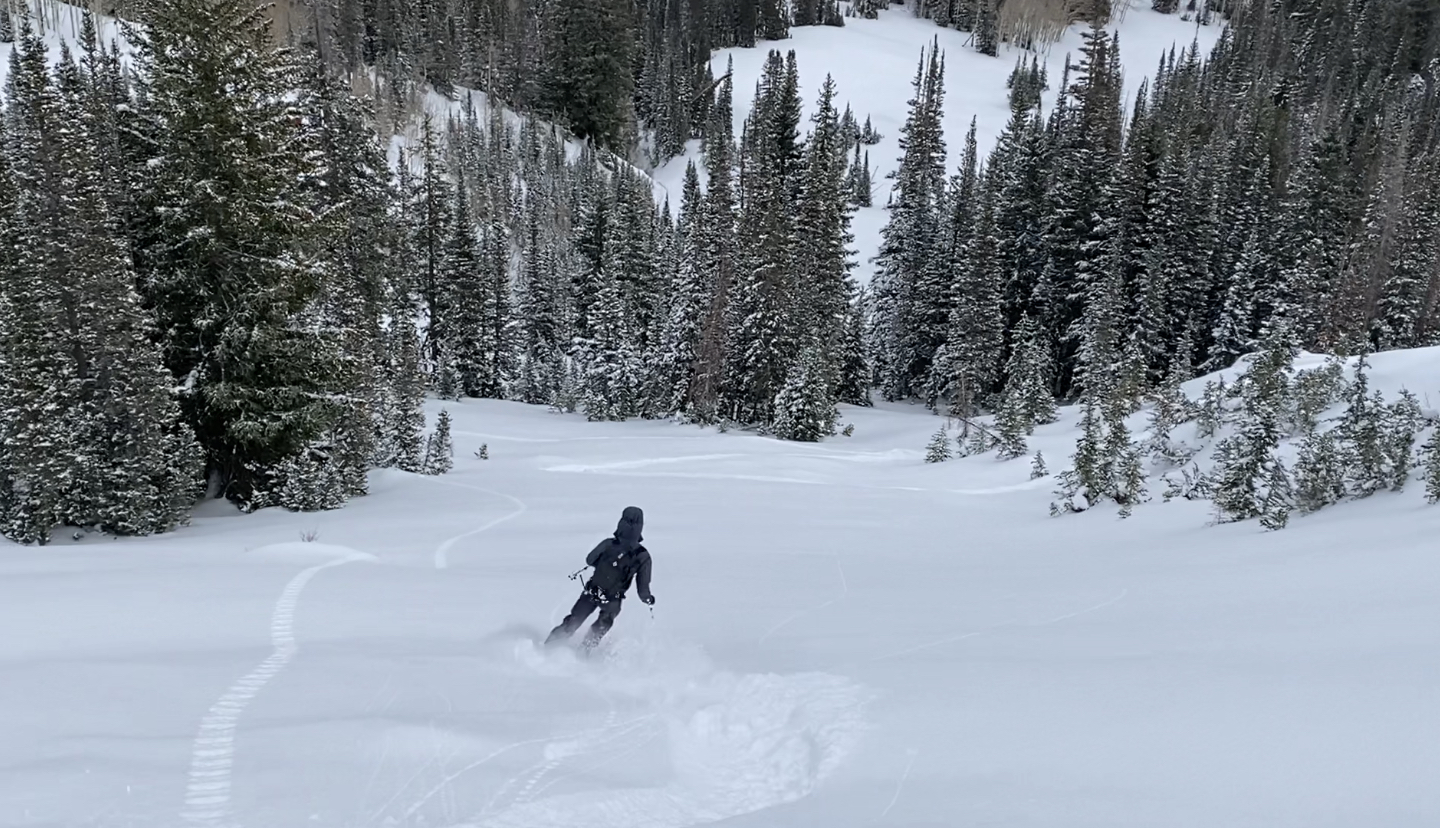
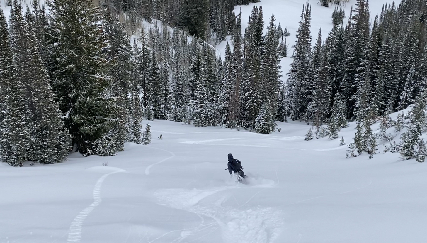
My touring partner Landon dropped first. I didn’t hear any gut-wrenching clanking or scratching so I knew his line was free of rocks—a real concern in the early season. I dropped next, putting my tracks next to his.
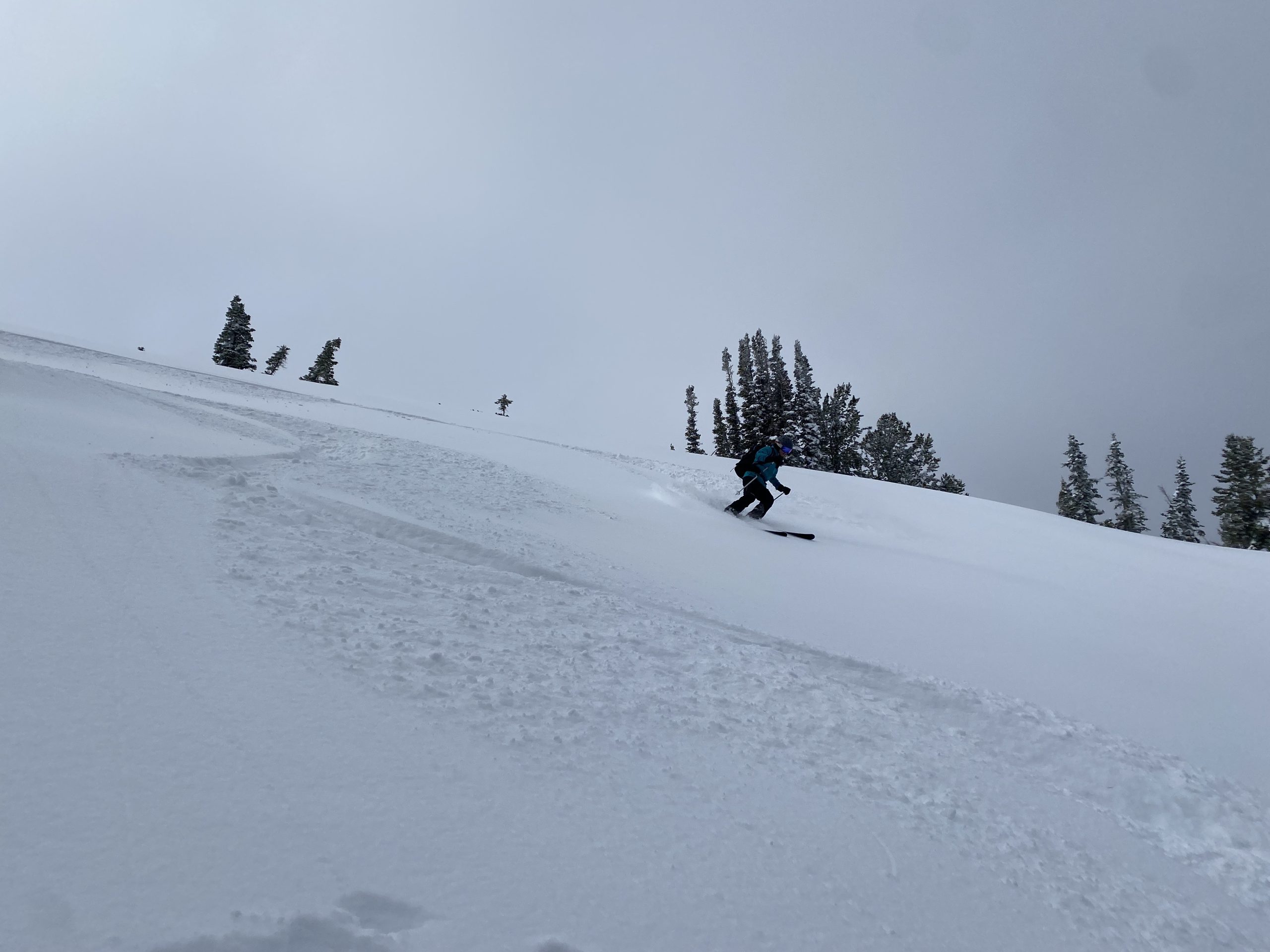
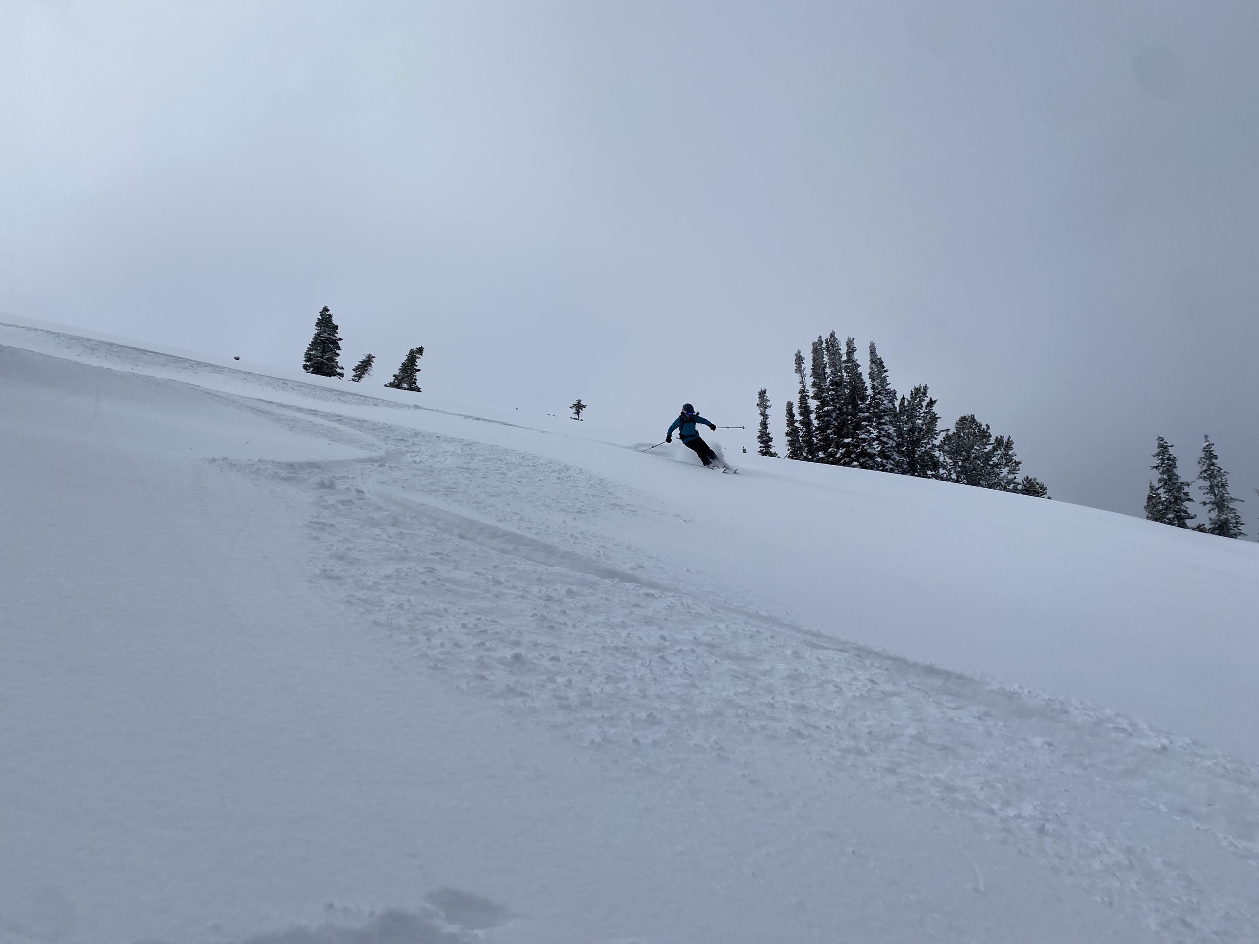
The snow was exceptional. It had slightly more water content in it than what the Wasatch normally gets—12% density snow compared to the typical 8%—but it skied well as ever. Good base building snow. It was smooth, floaty, and surfy; the type of snow you can just point it downhill and relaxxxxxxx.
We flowed hard down the line, surfing open fields of powder and popping off snow-pillowed boulders into great, rock-free landings. The run boosted our confidence and we wasted no time before hiking back up for another lap.
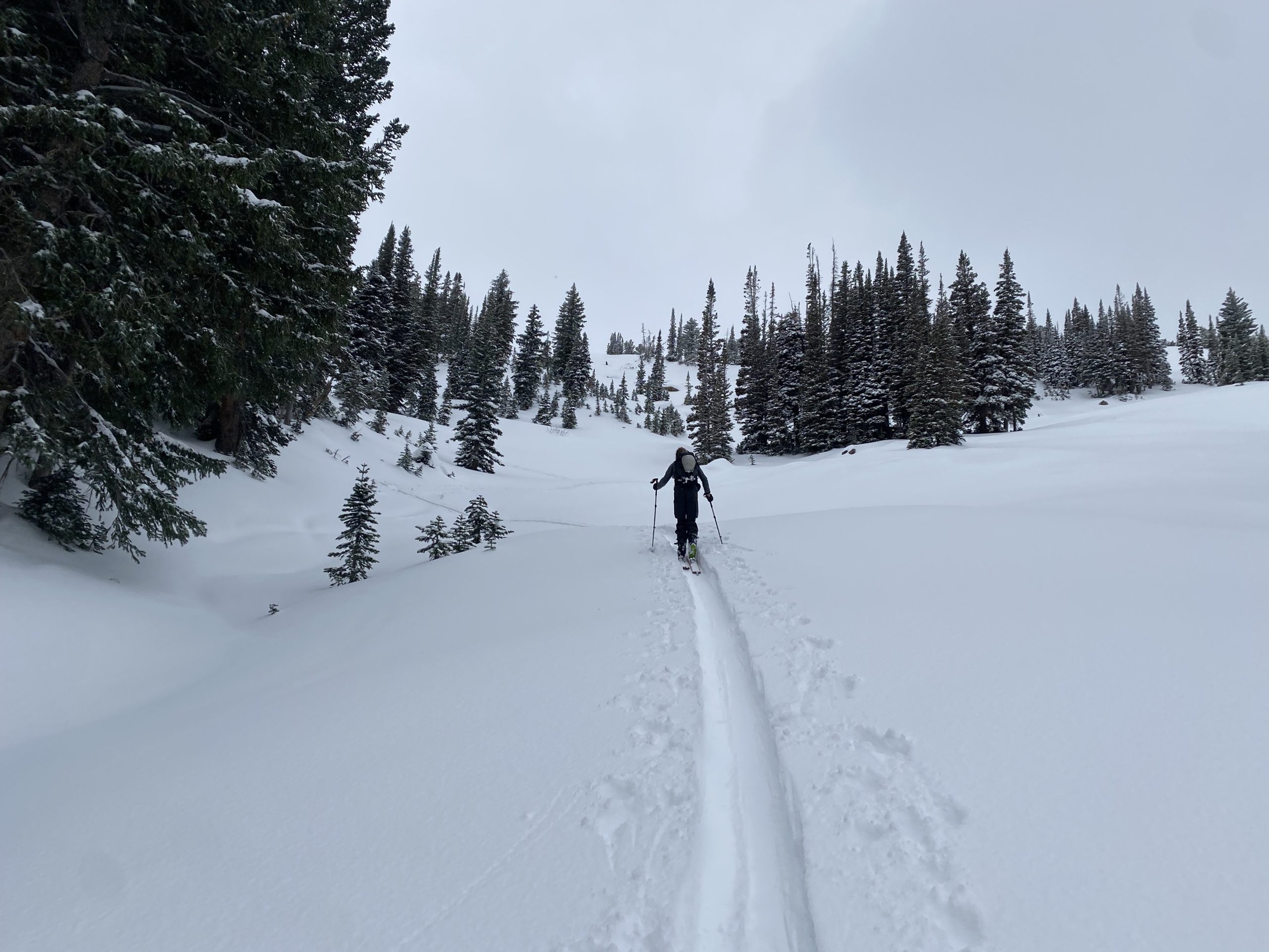
There was an open, untouched field of virgin pow just skier’s left to the one we had dropped in that we set our marks for. A short hike back up and we picked what appeared to be the most hazard-free line in terms of avalanche danger and hidden rocks.
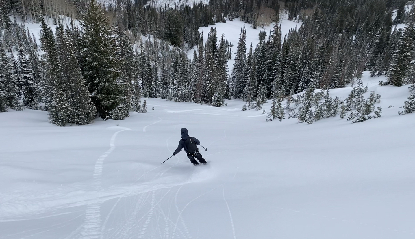
With only a few other parties out there with us, the day’s powder buffet was delicious. We took our second line all the way down the road and back home. Our bellies were full, our appetites quenched. I feel like I say this a lot, but these were definitely some of the best turns I’ve ever made this early in the year.
And it’s only going to get better this week…
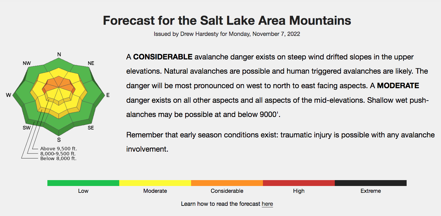
Avalanche Forecast
Weather
Photos