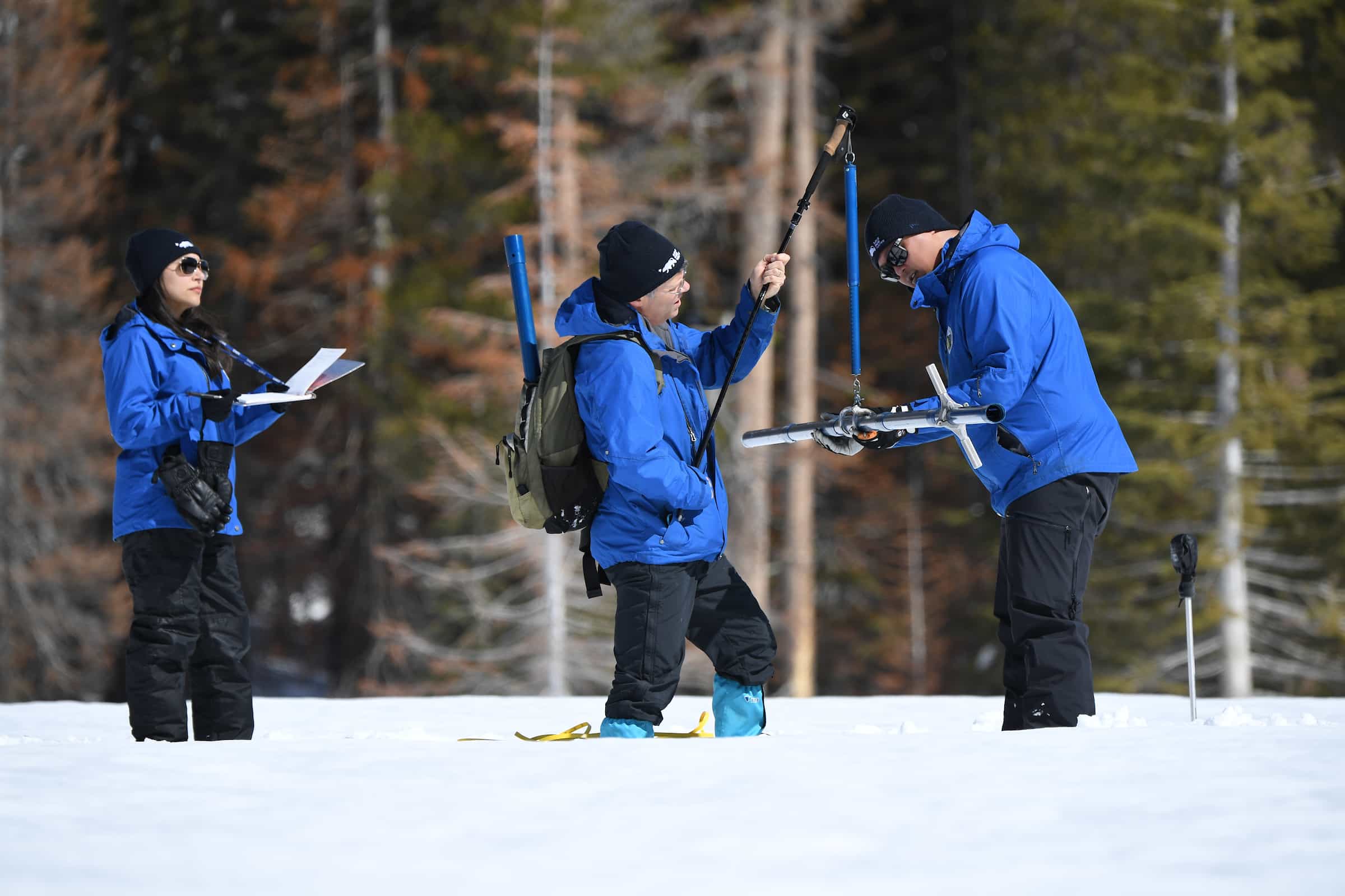
The California Department of Water Resources (DWR) conducted the third snow survey of the season at Phillips Station on Friday, March 3rd, 2023. The manual survey recorded 116.5 inches of snow depth and a snow water equivalent of 41.5 inches, which is 177 percent of the average for this location on March 3. The snow water equivalent measures the amount of water contained in the snowpack and is a key component of DWR’s water supply forecast. DWR’s electronic readings from 130 snow sensors placed throughout the state indicate the statewide snowpack’s snow water equivalent is 44.7 inches or 190 percent of average for this date.
“Thankfully the recent storms combined with the January atmospheric rivers have contributed to an above-average snowpack that will help fill some of the state’s reservoirs and maximize groundwater recharge efforts. But the benefits vary by region, and the Northern Sierra, home to the state’s largest reservoir Lake Shasta, is lagging behind the rest of the Sierra. It will also take more than one good year to begin recovery of the state’s groundwater basins.”
– DWR Director Karla Nemeth
Although the statewide snowpack is currently just behind the record snow year of 1982-83, the snowpack varies considerably by region. The Southern Sierra snowpack is currently 209 percent of its April 1 average and the Central Sierra is at 175 percent of its April 1 average. However, the critical Northern Sierra, where the state’s largest surface water reservoirs are located, is at 136 percent of its April 1 average. With one month of the traditional wet season remaining, DWR is providing updated runoff forecasts to water managers and is closely monitoring spring runoff scenarios and river flows to ensure the most water supply benefits from this year’s snowpack while balancing the need for flood control.
“The recent storms over the past week broke a month-long dry spell in a dramatic way. We are hopeful that we will see more cold storms to add to our snowpack for the next month and help set up a long, slow melt period into spring.”
– DWR’s Snow Surveys and Water Supply Forecasting Unit Manager Sean de Guzman
DWR will host a virtual media briefing via Zoom with DWR experts today at 1:00 p.m. to expand on the impacts of the snowpack results, discuss what the results mean for the state’s water supply, and take media questions. Credentialed media can register for the media briefing here.
To ensure water supply managers have the most current forecasts of snowpack runoff, DWR is utilizing the best available technology to collect the most accurate snow measurements. DWR’s Snow Surveys and Water Supply Forecasting Unit is utilizing Airborne Snow Observatory (ASO) surveys across 12 of California’s major snow-producing watersheds to collect data on the snowpack’s density, depth, reflectiveness, and other factors down to a 3-meter resolution. These flights, which utilize LiDAR and imaging spectrometer technology, provide DWR with more information on water content than ever before, which is then fed into advanced physically based and spatially explicit models to generate the most accurate water supply runoff forecasts possible. These forecasts are used to develop the Bulletin 120 for forecasted spring run-off to determine water allocation and stream flows for the benefit of the environment.
While winter storms have helped the snowpack and reservoirs, groundwater basins are much slower to recover. Many rural areas are still experiencing water supply challenges, especially communities that rely on groundwater supplies which have been depleted due to prolonged drought. It will take more than a single wet year for groundwater levels to substantially improve at a statewide scale. Drought impacts also vary by location and drought recovery will need to be evaluated on a regional scale and will depend on local water supply conditions.
On February 13, Governor Newsom issued an Executive Order directing state agencies to review and provide recommendations on the state’s drought response actions by the end of April, including the possibility of terminating specific emergency provisions that are no longer needed, once there is greater clarity about the hydrologic conditions this year.
Californians should still continue to use water wisely so that we can have a thriving economy, community, and environment. DWR encourages Californians to visit SaveOurWater.com for water-saving tips and information as more swings between wet and dry conditions will continue in the future.
DWR conducts five media-oriented snow surveys at Phillips Station each winter near the first of each month, January through April, and, if necessary, May. The next survey is tentatively scheduled for April 3.

All that drought quenching water is going to be flushed out to the ocean here in the next couple months.
Thanks to CA’s radical enviroMENTALISTS they have not built a new dams in over 60 years in that state.
CA doesn’t know how to do water or electrical engineering anymore.
The state is governed by a bunch of fairy tail stories relying on the infrastructure built 2-4 generations ago.
CA is going to have a rough go the next 20-40 years.
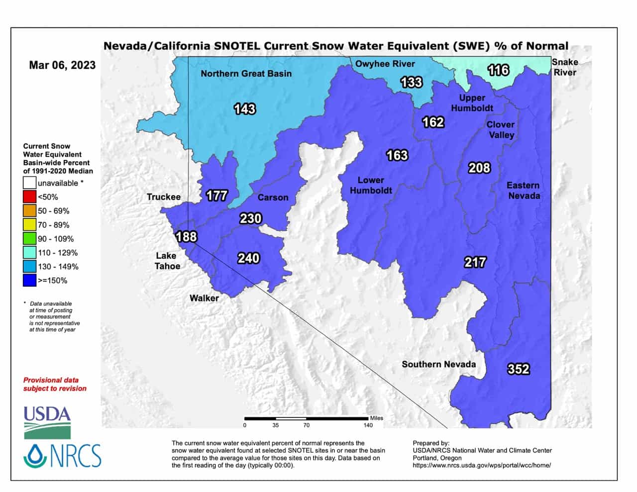
Also the map above and the data above is for water in the Great Basin. None of that flows into CA. It all flows into NV. Doesn’t surprise me a Californian doesn’t know where their water comes from.