Brought to you by Monarch Mountain
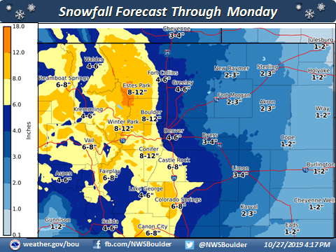
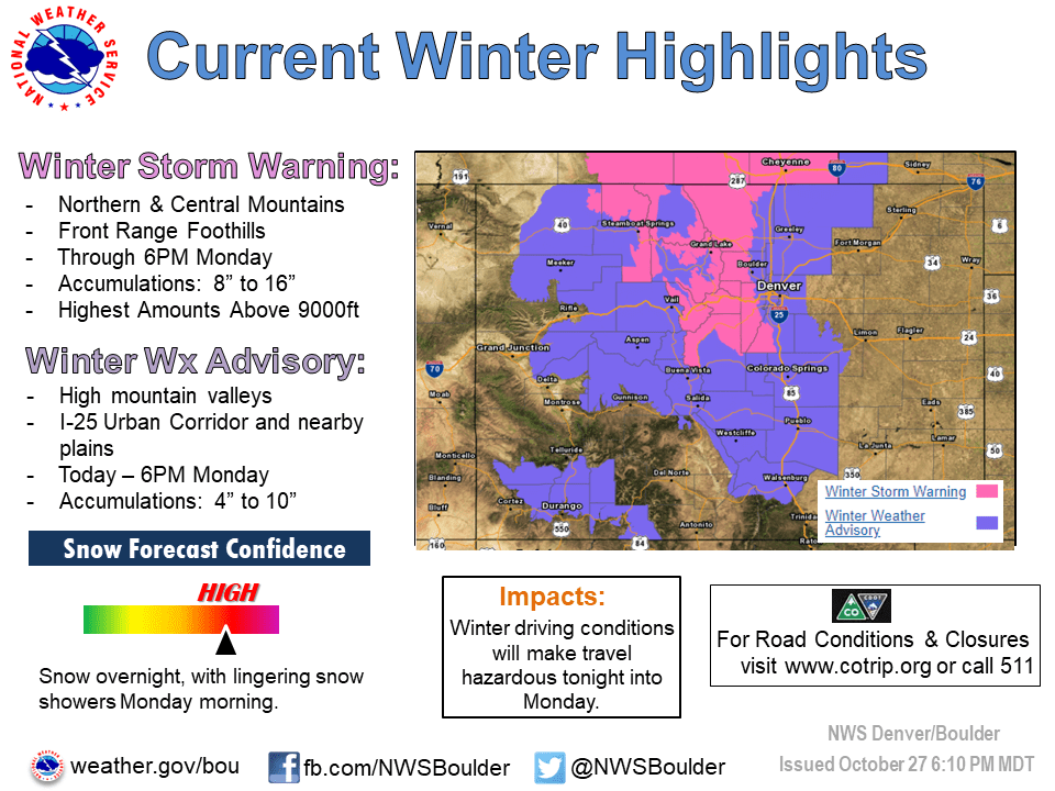
The NOAA has issued a winter storm warning for areas of Colorado until 6 pm Monday evening. Many areas could wake up to decent accumulations Monday morning, with snow forecast to continue throughout the day, and in to mid-week.
...WINTER WEATHER FOR NORTHERN COLORADO TODAY THROUGH MONDAY...

.A winter storm system developing over the Rocky Mountain West
will bring snowy weather to the mountains and plains through
Monday morning. Snow will be the heaviest tonight and through
early Monday morning, including the morning rush hour commute.
Most of north central and northeast Colorado will see hazardous
road conditions with icy and snowpacked roads. Heavier snow is
already developing over portions of the Denver Metropolitan area
this evening and will continue through the night.

* WHAT...Snow, moderate to heavy at times tonight and early
Monday morning. Storm totals of 8 to 16 inches by Monday
afternoon, heaviest over the mountains of Larimer and Jackson
counties and the Front Range foothills.

* WHERE...The Front Range Foothills, Rocky Mountain National
Park and the Medicine Bow Range and Rabbit Ears Pass.

* WHEN...Until 6 PM MDT Monday.
Winter Park, Vail, Breckenridge, Keystone, Loveland, and Wolf Creek are likely to see the highest amounts. The second bout of heavy snow will begin again on Tuesday evening into Wednesday, with a further 6″ or so expected in most areas.
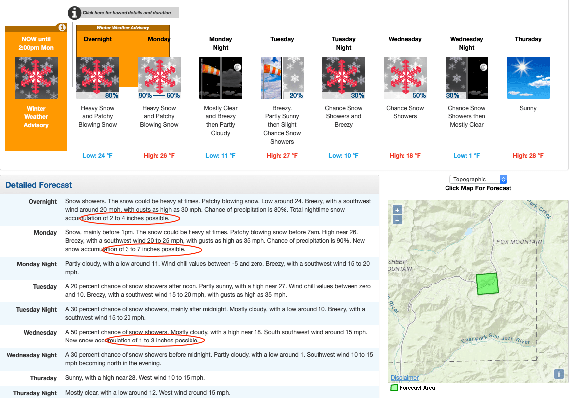
Accompanying this storm will be low temperatures, dropping to low teens, and breezy conditions.
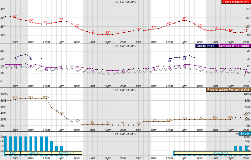
With most resorts already making snow, and many resorts set to open in the next 2 or 3 weeks, this snow is setting Colorado up with a great base to start the season with. Start the lifts!
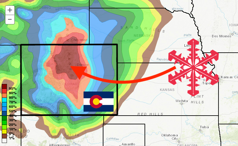
GEM 5-day snowfall forecast model
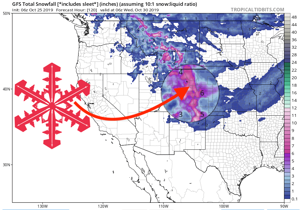
Other info
