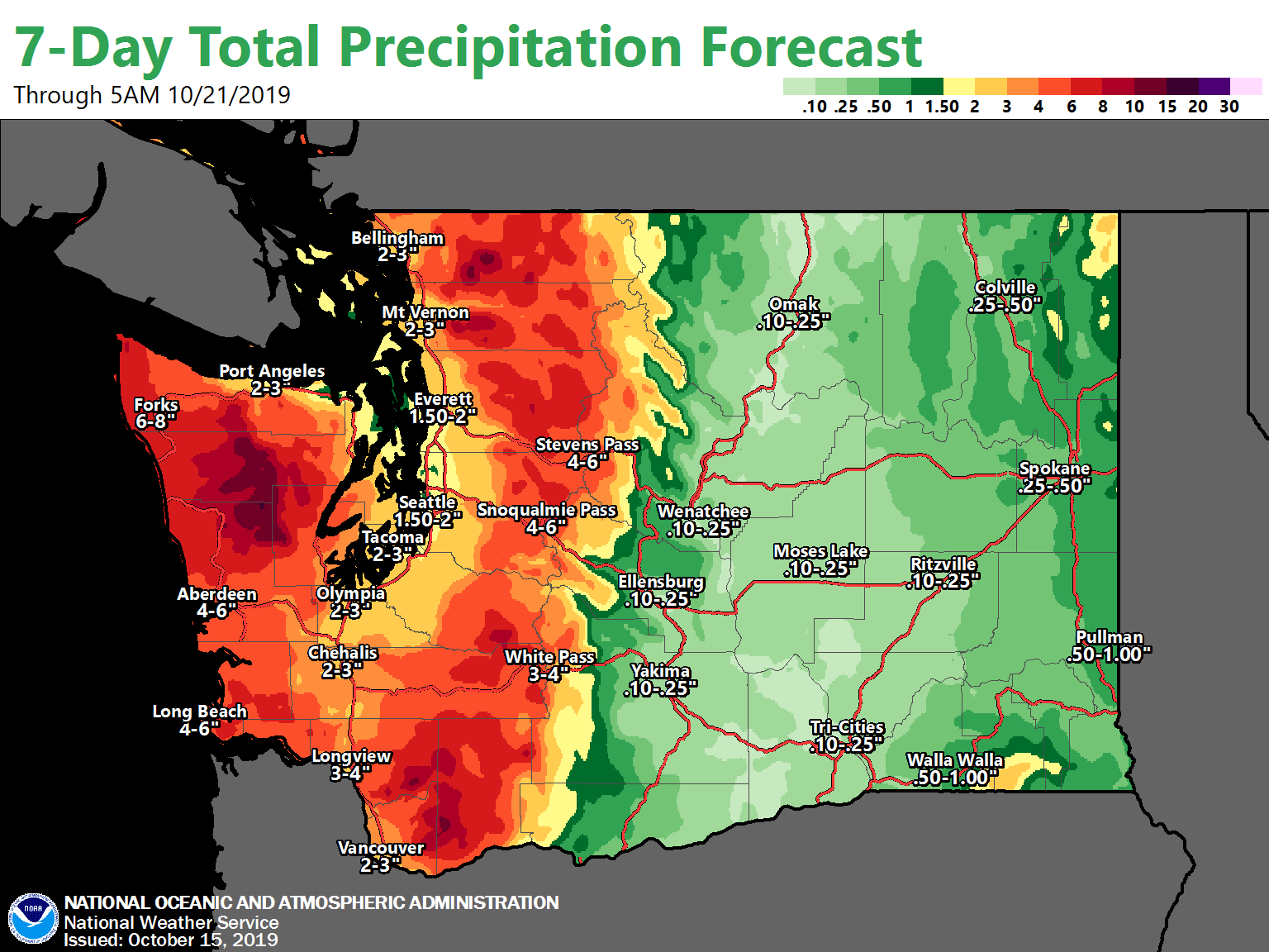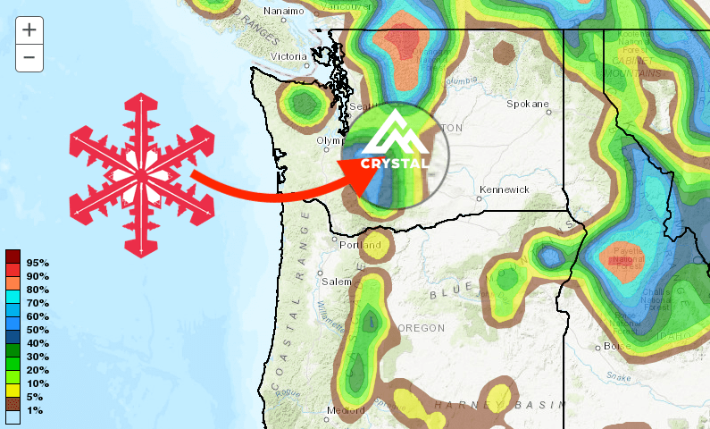
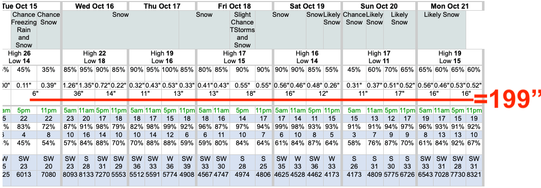
A system will move into the Pacific Northwest this week, with many areas of the Cascades set for some serious snowfall. According to the NOAA, 14er Mount Rainier from 12,762-feet and above could receive almost 200-INCHES (if my math is accurate!). Crystal Mountain Resort could receive up to 32-inches and snow down to the base, and Mount Baker Ski Resort 27″.
- Related: Spokane, WA Receives First September Snow in Almost 100-YEARS and Lowest High Temperature Since 1881
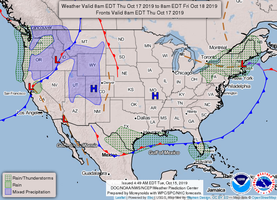
SYNOPSIS...A frontal system will approach Western Washington
this afternoon and move inland during the afternoon and evening
hours. A series of systems will follow and make their way through
the region throughout the remainder of the week, keeping the
pattern wet and unsettled.
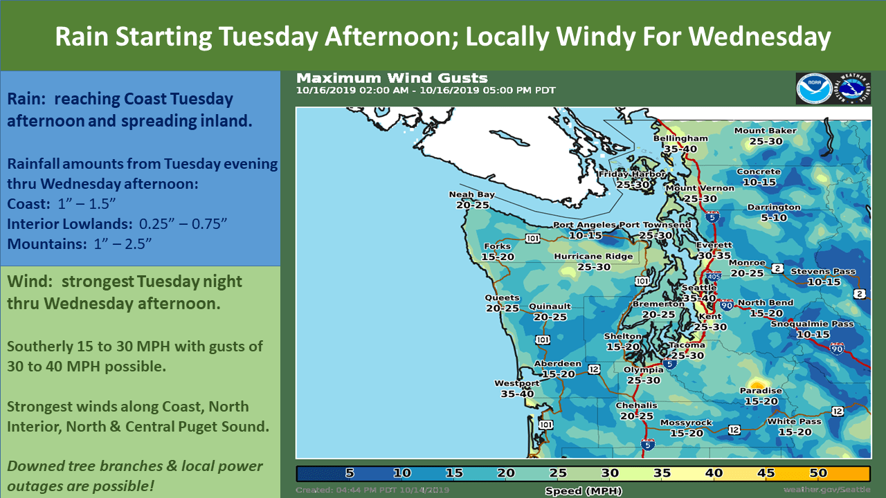
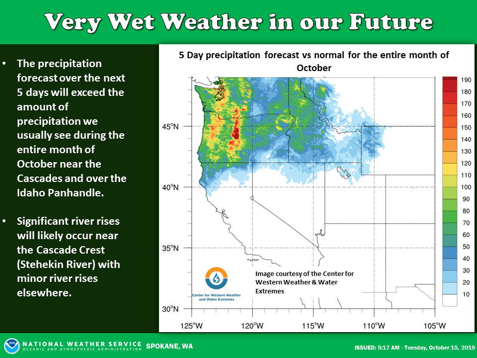
The rest of today and early Wednesday will remain dry and warm, then the weather will turn much wetter care of a persistent atmospheric river. Expect periods of very wet weather from Wednesday through Saturday, especially over the Idaho Panhandle and near the Cascades.
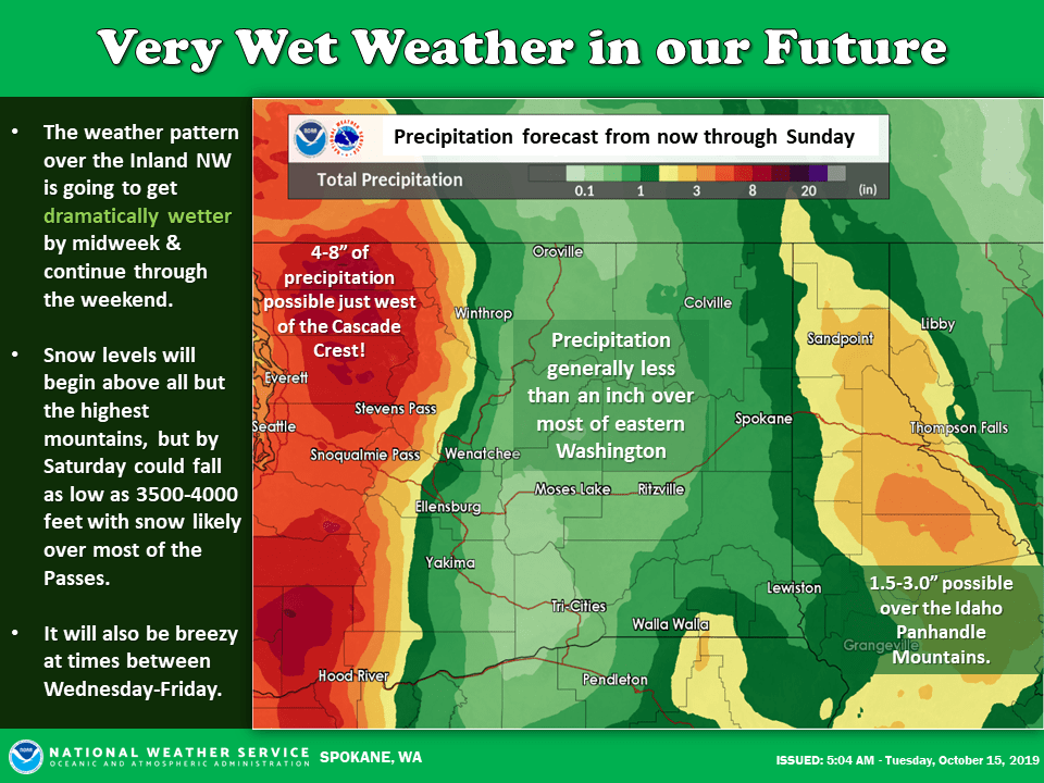
Most of the precipitation will fall as rain, however by Saturday, snow levels could fall as low as 3500-4000′ impacting most of the area passes. Crystal Mountain will see snow begin Wednesday night and continue through the weekend, with Friday and Saturday seeing particularly heavy snowfall.
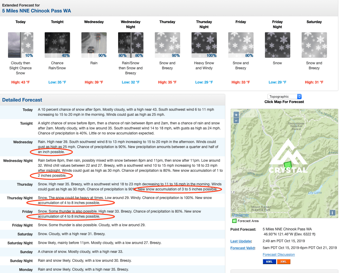
Temperatures won’t drop much below 30ºF, lows of 27º and highs of 35º, so expect heavy wet snow.
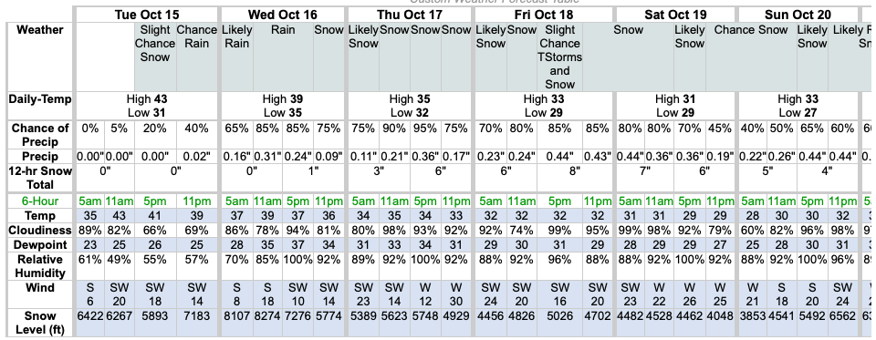
Snow levels may drop as low as 3,500-feet but expect the bigger totals to be above 5,500-feet. Below these levels, very heavy rain is expected, measurable in inches! A month’s worth of rain could fall this week.
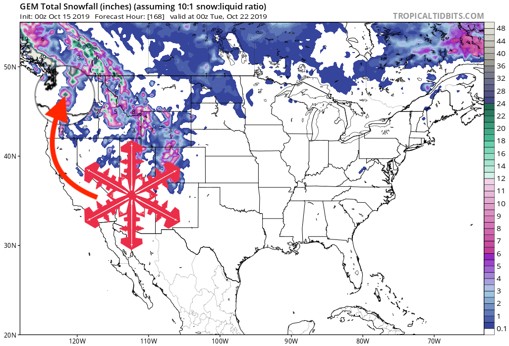
GEM 7-Day Snowfall Forecast Model:
Other Info:
