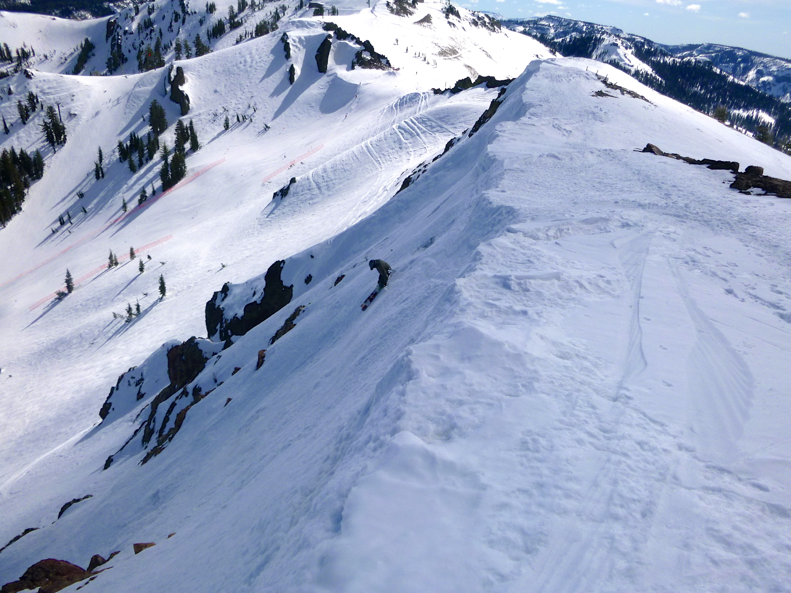
 This is a shot of Idiots at Alpine last January. We received a series of Sierra cement slab type storms followed by a week of blower pow during Christmas which made for a great start to our season last year. We had 50% of normal snowfall for the season by the end of December. Now here we are, we haven’t had a significant series of storms since December 2012.
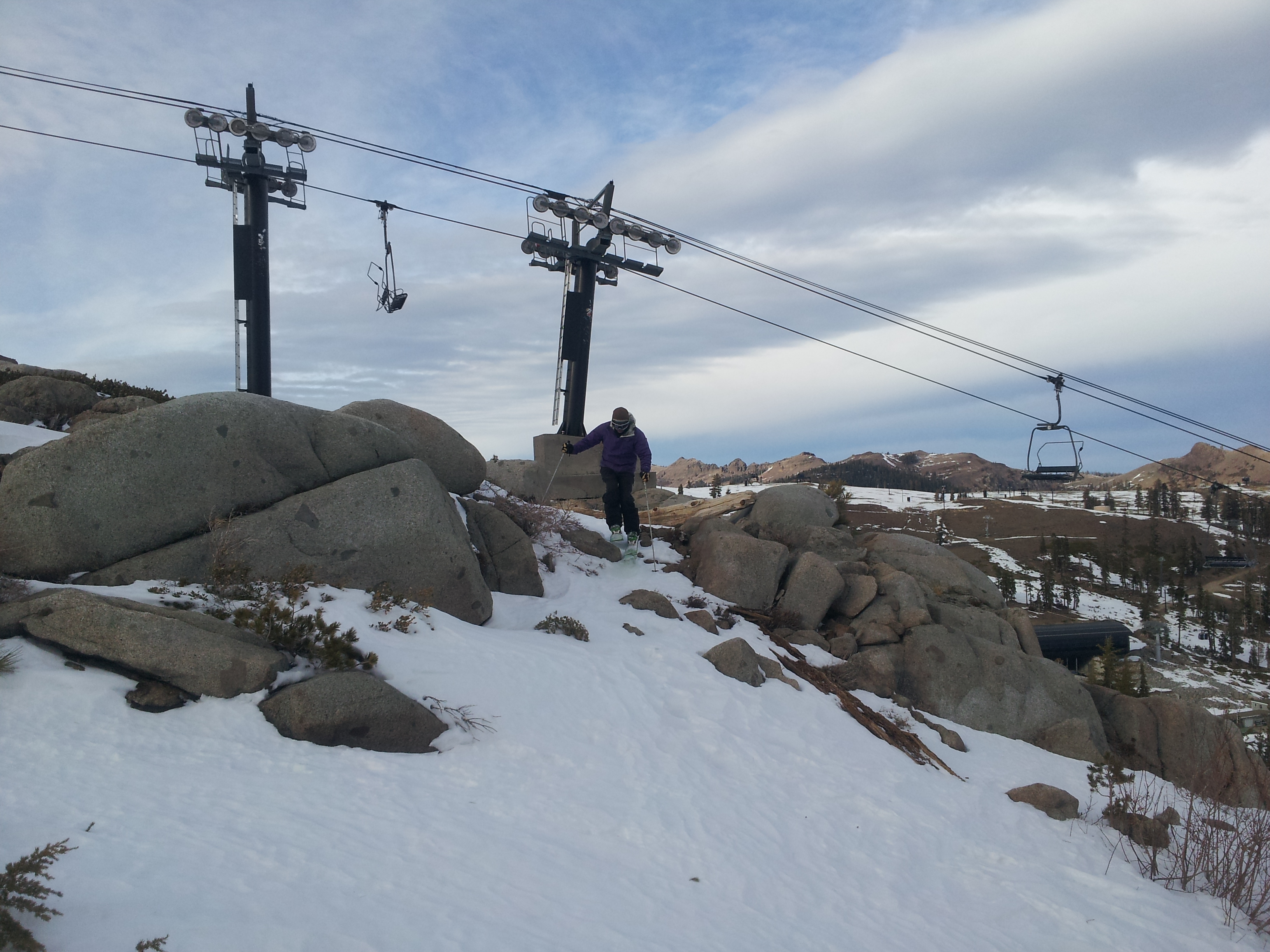
Here is a picture under the Siberia chair on January 6th 2014.
As far as the weather is concerned there are a few shortwaves that are expected to affect are region between now and the 13th of January. It looks like the first wave breaks apart as it hits the ridge, the next wave splits, another wave brushes us to our north. A shortwave for next weekend, exact track still uncertain, either it misses us to our north or best case scenario we get 2 inches of snow.
Not to beat a dead horse but in my last post, which feels like a year ago, I claimed I wasn’t buying into a pattern change for this time frame. The models were struggling with the position of the ridge, Gulf of Alaska or Siberia. Everything has been off set to the west this entire year, with zero teleconnections to support a major pattern change it was pretty easy to pick the right scenario. The ridge set up over Siberia, with a relatively short long wave pattern that allows a ridge to get locked off of our coast once again.
Essentially this is the same pattern we have been stuck in since November, and it is an incredibly hard pattern to dislodge in January. The ridge off our coast keeps shifting between 120W-140W and re-amplifying, instead of pinching off to the north (allowing under cutting) and retrograding which was it’s most current prediction for this next week. Once again our best case scenario, we were going to squeak a couple of transitions storms,with claims of up to a foot as we shift from one dry pattern to another. Well so much for the foot, I will be surprised if we get the two inches. Either way at the least, we’re looking at two more weeks of drought conditions.
Signs of a Strengthening Jet Stream?
Here is what appears to be the good news. It seems like the long wave pattern is lengthening. The strong East coast trough moved out into the Atlantic leaving a ridge behind for the East coast. This pattern appears to repeat itself around the 21st of January which is a sign of a lengthening long wave pattern. In normal circumstances an East coast ridge normally means a West coast trough. In addition the Atmospheric Angular Momentum (AAM) is on the increase. http://ggosatm.hg.tuwien.ac.at/rotation.html Here is a depiction of the cause and effect of Atmospheric Angular Momentum. As the AAM increases so does the strength of the jet stream. There are signs of this happening in the long range models.
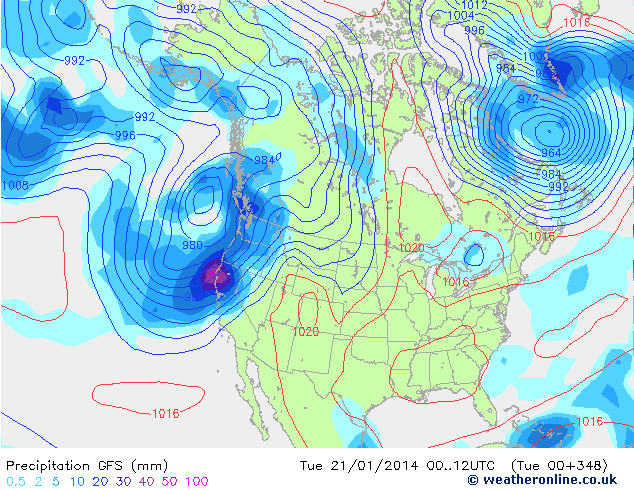 Here is a run from the GFS for January 21st.
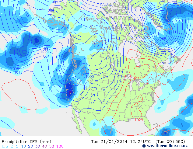 This is the following day January 22nd.
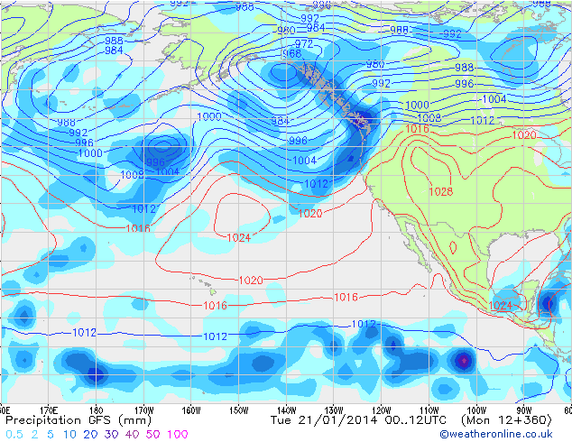 This is a view of Pacific of the GFS for January 21st. Notice how the ridge is flattening off our coast and the central axis is forming at 150W. That is 5 degrees west of our sweet spot.
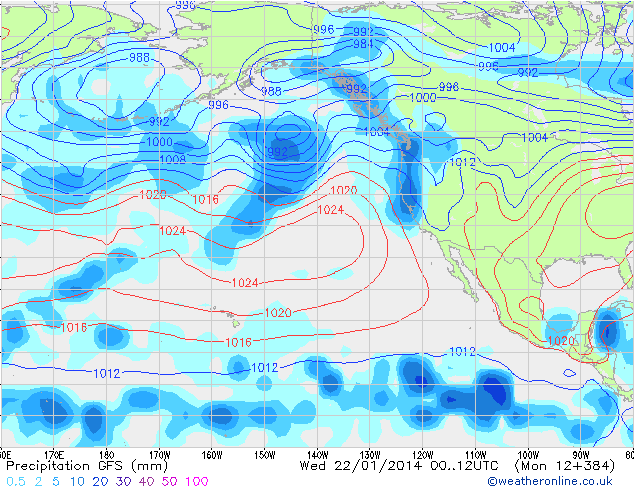
Here is a shot of the GFS for January the 22nd, notice how the ridge continues to flatten and retrograde. If your’e paying real close attention you noticed the timing difference between the north east Pacific model and the North American model. I hate to come out with it but I think the changes might take a few days or up to a week longer then this current outlook. Don’t be surprised if we have to start talking closer to the 28th vs the 21st as we get skunked this week.