A strong winter storm system is making its way into the East Coast today. It is expected to drop snow and sleet along with some ice accumulations.
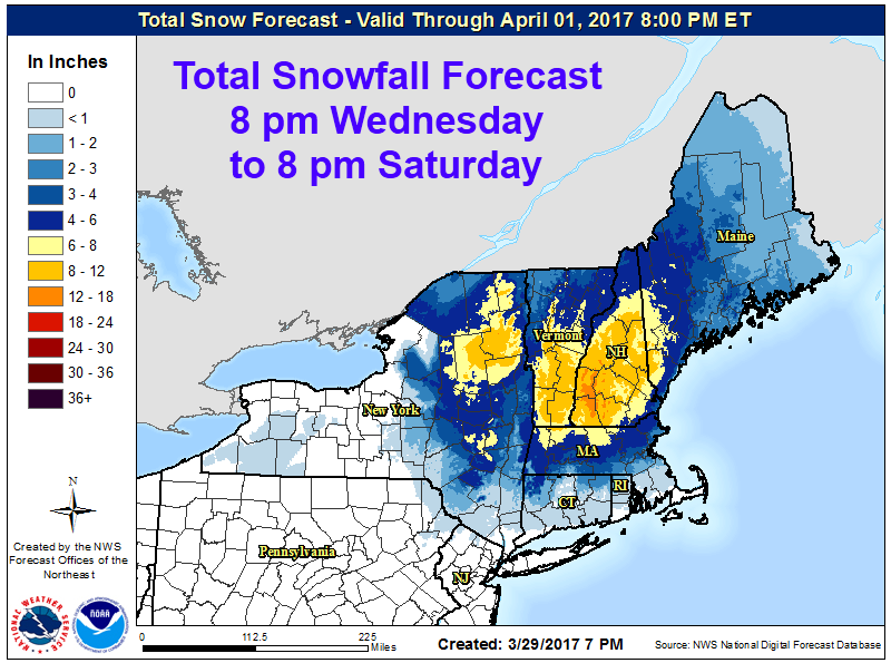
8-12″ of snow forecasted to fall in Vermont Today-Tomorrow.
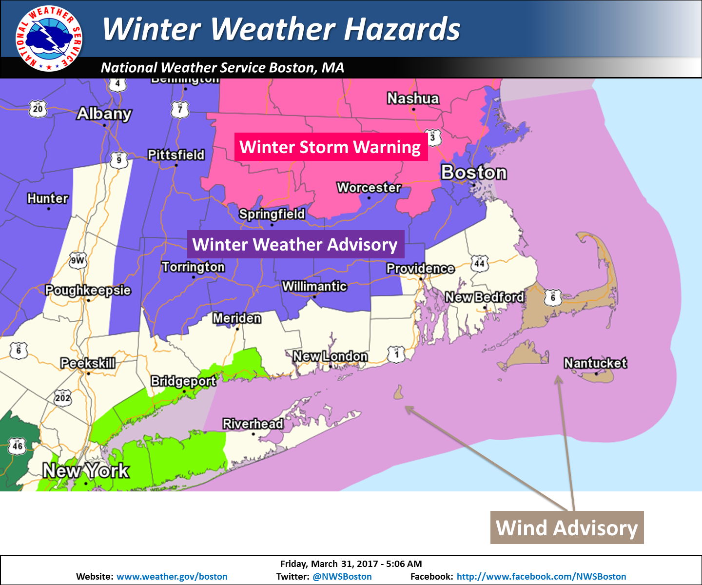
NOAA Has Issued Winter Storm Warnings For:
- New York
- Massachusetts
- Vermont
- New Hampshire
- Maine

The highest snow accumulations will occur over 1000ft, but lower elevations will still see some heavy snowfall.
Additional Storm Information:
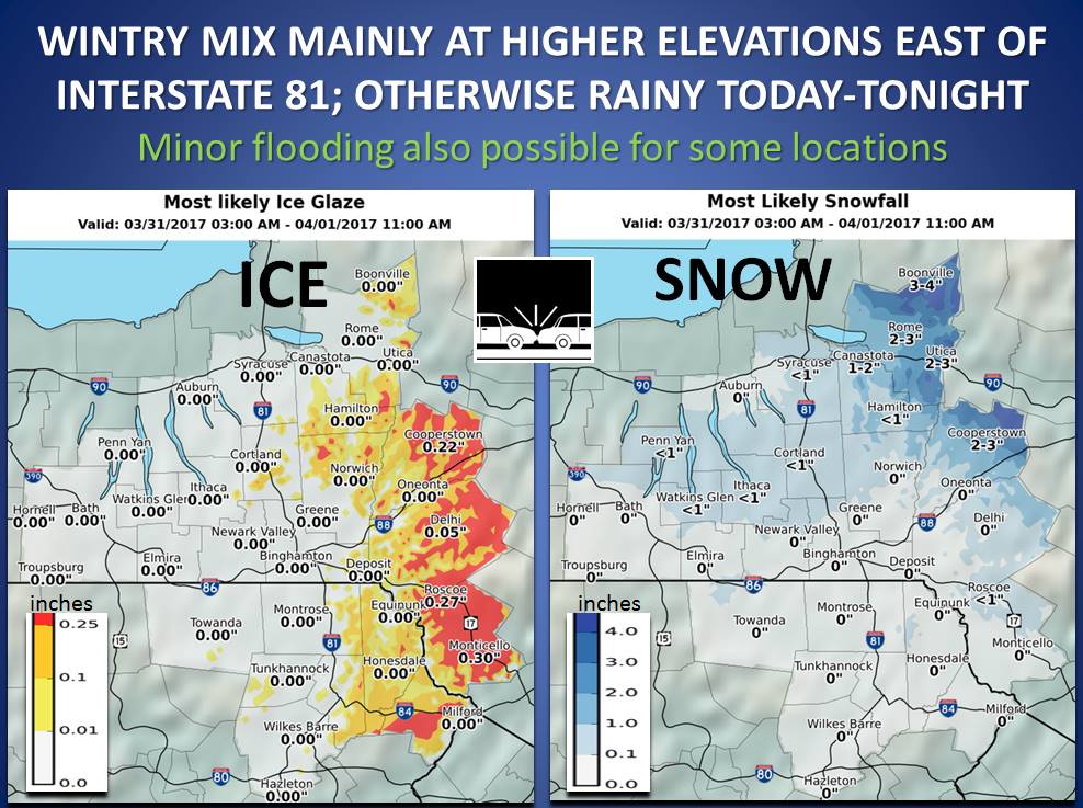
New York: 4-8″ of Snow Today-Saturday
* Accumulations...4 to 8 inches in Orange, Washington and
  Caledonia Counties. 6 to 10 inches in eastern Rutland, Windsor
  and Essex Counties with a mix with sleet expected tonight into
  Saturday morning. The greatest accumulations will occur above
  1000 feet.
-NOAA Binghamton, NY
Massachusetts: 6-9″ of Snow Today-Saturday
* ACCUMULATIONS...6 to 9 inches of snow and sleet with the highest
  amounts near the New Hampshire border in far northeast
  Massachusetts.
- NOAA Boston, MA
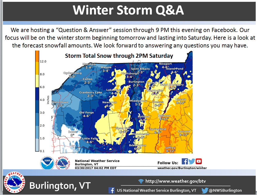
Vermont: 8-12″ of Snow Today-Saturday
* Accumulations...Snow accumulation of 8 to 12 inches.
- NOAA Burlington, VT
New Hampshire: 6-10″ of Snow Today-Saturday
* Accumulations...Snow accumulation of 6 to 10 inches.
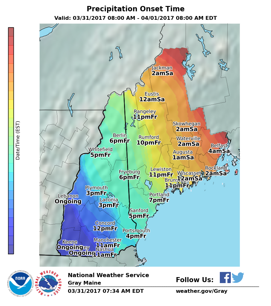
- NOAA Grey, ME
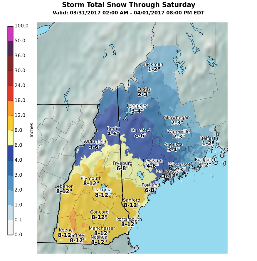
Maine: 6-10″ of Snow Tonight-Saturday Night
* Accumulations...Snow accumulation of 6 to 10 inches.
- NOAA Grey, ME


Vermont Winter Storm Warning:
Winter Storm Warning
URGENT - WINTER WEATHER MESSAGE
National Weather Service Albany NY
422 AM EDT Fri Mar 31 2017

Western Windham-Eastern Windham-
Including the cities of Stratton, Londonderry, Brattleboro,
Guilford Center, West Brattleboro, and Bellows Falls

...WINTER STORM WARNING REMAINS IN EFFECT UNTIL 5 PM EDT
SATURDAY...

* LOCATIONS...Windham County of Southern Vermont.

* HAZARD TYPES...Snow and sleet.

* Accumulations...6 to 12 inches of snow and sleet.

* TIMING...Snow will continue to develop through this morning.
  The snow will then mix with sleet at times beginning this
  afternoon, with steady precipitation continuing into Saturday
  afternoon.

* IMPACTS...Heavy, wet snow and sleet will have the potential to
  result in power outages. Snow and ice covered roadways will
  potentially make travel dangerous.

* Visibilities...Occasionally less than a mile in heavier
  snowfall.

* Temperatures...In the lower 30s.

* Snowfall Rates...Up to an inch per hour at times.