
This article was originally published on earthobservatory.nasa.gov
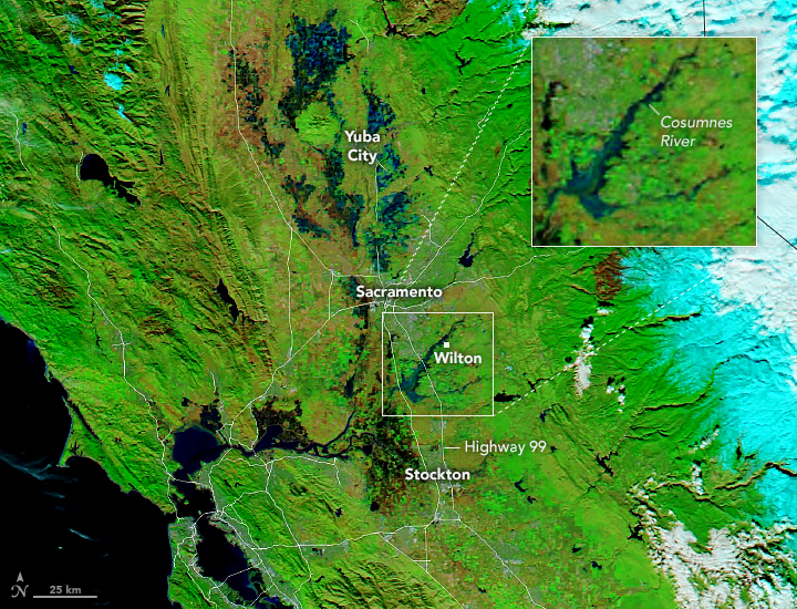
Heavy rain hit parts of central and northern California on New Year’s Eve 2022, flooding communities near San Francisco and Sacramento. Water breached levees along the Cosumnes River near Wilton, California, flooding numerous roads including Highway 99—a major thoroughfare in the Central Valley. Wilton and other nearby farming communities were issued evacuation orders.
The Bay Area National Weather Service measured 5.5 inches (14 centimeters) of rain in downtown San Francisco on December 31, 2022, the second wettest day in more than 170 years of record-keeping. This daily total is about half of the city’s expected rainfall for the entire month of December. Toward the northeast in Sacramento County, some areas recorded up to 4 inches (10 centimeters) of rain within 24 hours, according to the National Weather Service.
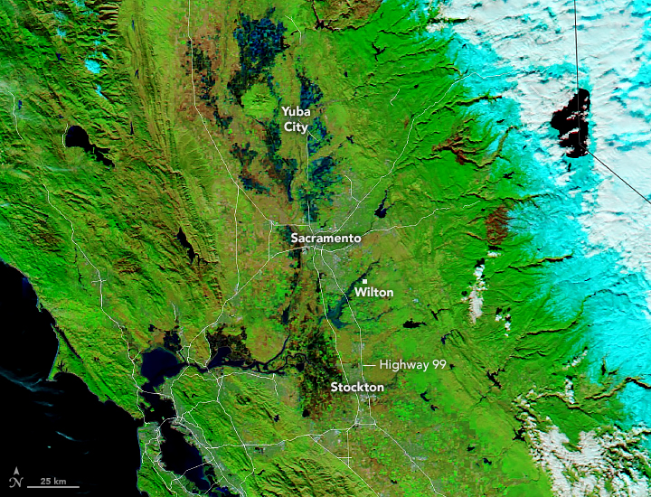
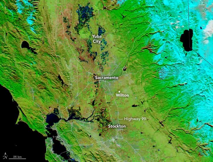
The flooding that ensued is visible in the false-color image (right) acquired on January 1, 2023, with the Moderate Resolution Imaging Spectroradiometer (MODIS) on NASA’s Aqua satellite. Water appears light to dark blue. Vegetation is green and bare land is brown. For comparison, the MODIS image from December 16, 2022 (left) shows the same area prior to the intense rainfall.

Near Wilton, levees of the Cosumnes River have been breached. The Sacramento County Office of Emergency Services urged residents of Wilton, California, to evacuate on December 31, 2022, but changed the order a few hours later to shelter-in-place due to treacherous road conditions in the area. As flooding moved southwest along the Cosumnes River on January 1, residents of Point Pleasant were ordered to leave their homes and move livestock.
Emergency personnel rescued people from roofs of cars, and several people in Wilton were stranded in their homes. Hundreds of people in Sacramento County were still without power as of the morning of January 3, 2023.
Crews of the Cosumnes River Levee District are working to fix the levee breaches as more rain is expected to hit Sacramento County’s already saturated soils starting on January 4.
NASA Earth Observatory images by Lauren Dauphin, using MODIS data from NASA EOSDIS LANCE and GIBS/Worldview. Story by Emily Cassidy.
The pasted photo doesn’t have a left and a right. The original article had a photo with a “slider” that can be swiped to see before and after. You may be able to embed the link.