No volcano is more iconic in the Pacific Northwest than Mount St Helens or Loowit (Smoking Mountain), as the Cowlitz and Yakima nations know it. This active volcano sits 130 miles from the Pacific Ocean in Washington state, making it one of the closest Cascades volcanoes to the ocean. Mount Baker (Koma Kulshan) is the nearest volcano to the ocean. I digress. Let’s carry on to the topic of discussion.
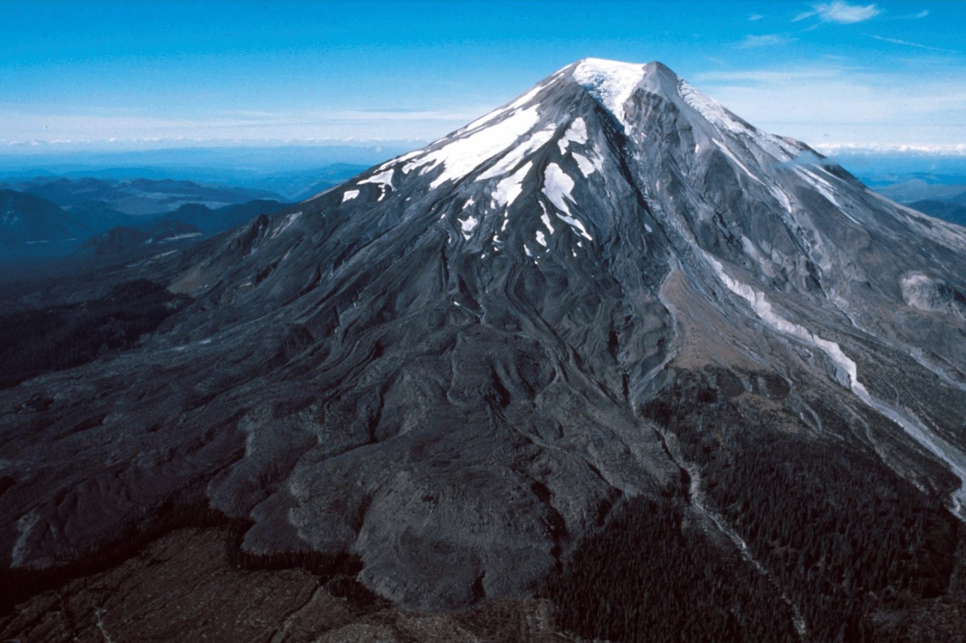
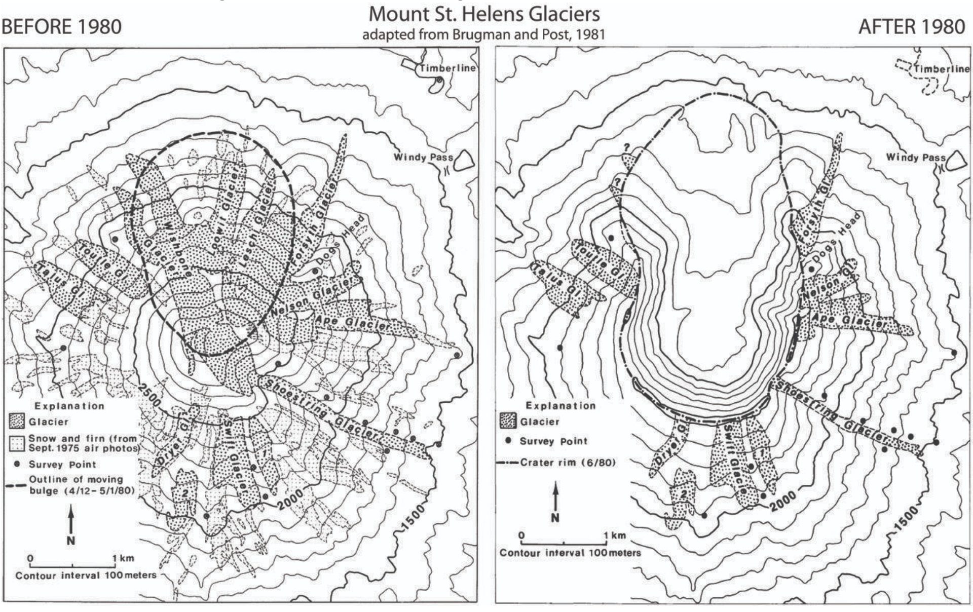
Before the May 18th, 1980 cataclysmic eruption, Mount St. Helens’s (Loowit) contained 11 named glaciers (Wishbone, Loowit, Forsyth, Leschi, Nelson, Ape, Shoestring, Swift, Dryer, Talus, & Toutle). Of these 11 glaciers, the largest glacier(s) extended approximately 1.5 miles from the summit crater. Upon further investigation, no specific names of the glaciers were mentioned in the research. However, judging by the USGS image below, I’d theorize the largest glacier radiating from the ice-filled summit crater on the flank of the Loowit more than likely was a combination of Wishbone, Loowit, and Leschi glaciers. All of these resided on the north flank of the mountain.

After the eruption, it was reported that the volcano had lost approximately 70% of its glacier mass coverage. You can see why it created one of the largest ever recorded landslides in documented history. For context, the bulk of the glacier volume resided on the north and northeast sides of the volcano. These areas on most high cascade volcanoes typically receive less impact from solar radiation thus making it a solid area for the snow not to melt out as quickly and accumulate over time.
Shockingly enough, data seems to be non-existent on locating and finding information on each glacier’s health status before and after the eruption, which doesn’t surprise me since the scientific community didn’t truly begin to research and understand this volcano until after the May 18th, 1980 eruption. The one glacier with the most extensive research behind it is the Crater Glacier. I will briefly shed light on this glacier-growing enigma.

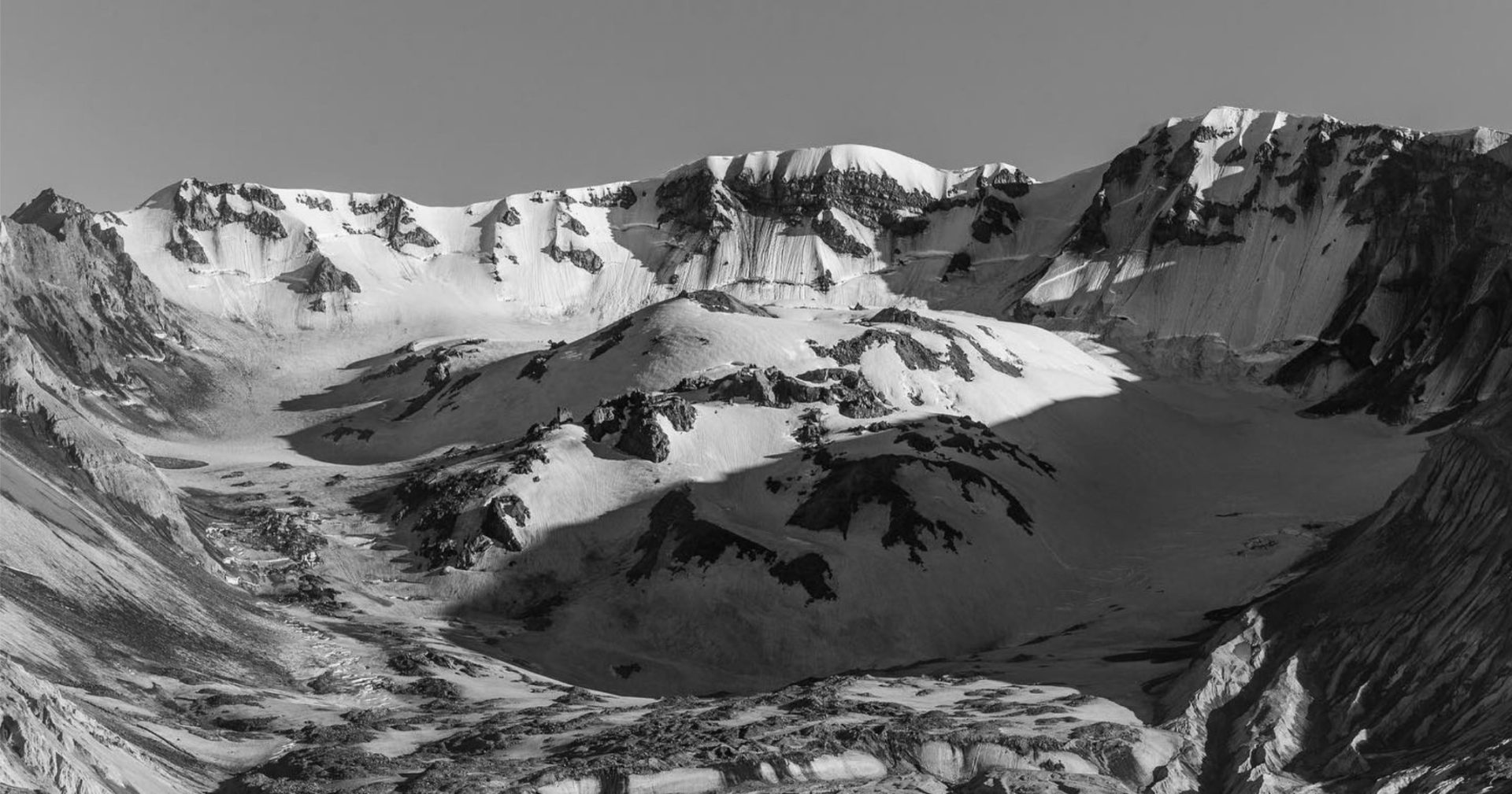
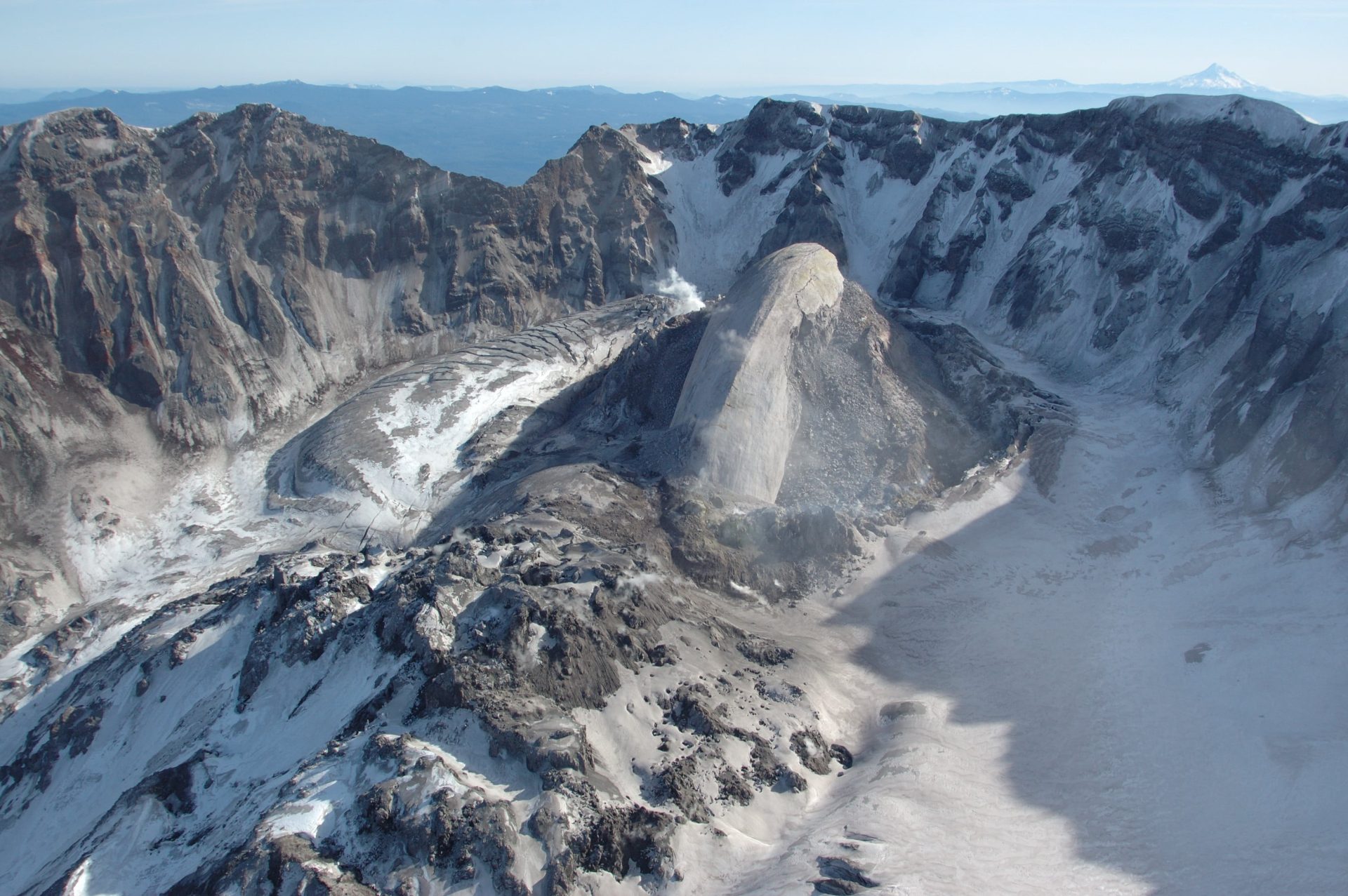
Crater Glacier came into existence after the May 18th, 1980, eruption on the north-facing side of the crater. In time, heavy amounts of snow coupled with rock fall debris led to a huge build-up of snow and rock between the 1980-1986 lava dome and the crater walls. What’s immediately striking is that Crater Glacier sits at around 6561 ft (2,000 m). For perspective, this glacier would not thrive on your typical Cascade mountain. This glacier was officially observed in September 1996. 10 years later, the glacier was eventually coined the name “Crater Glacier” by the US Board on Geographic Names. To make this even more perplexing and “defy all odds” type of scenario, Crater Glacier survived the 2004-2008 eruptive period. In a world where most glaciers are receding, it would appear this glacier is from a different planet.

Fresh and newly discovered glaciers have emerged on the crater wall above Crater Glacier. There also have been observations made of two new rock glaciers to the north of the eastern stretch of Crater Glacier as well as one north of the western stretch. Interestingly enough, the western and eastern sides have merged with the Crater Glacier wrapping completely around the lava domes!
To drive home the increased size of the Crater Glacier, the USGS Cascade team noticed that the VALT seismic measurement equipment on the crater floor of Mount St. Helens was becoming less and less distant from the glacier itself, thus showcasing the steady growth of this ever-expanding glacier. This VALT machine was in place for 16 years. It has now been relocated to a new place within the volcano. Time will tell when this seismic measuring has to be relocated. Events like this showcase the evolution and dynamic environment of this powerful force of mother nature!
With what has been shared above, do you think other past glaciers like the Shoestring, Dryer, Toutle, Ape, Nelson, and Talus Glacier will return to life in time?

Sources: https://www.usgs.gov/volcanoes/mount-st.-helens/science/glaciation-mount-st-helens