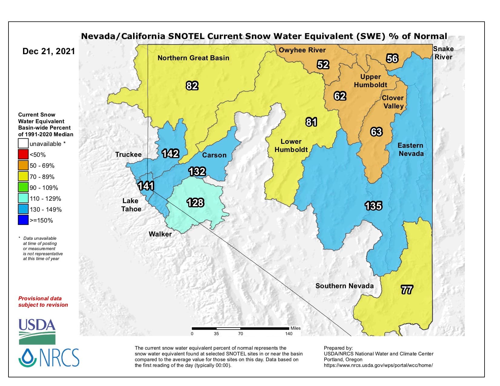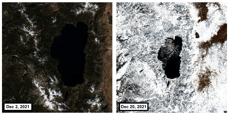
Last week’s huge storm that dumped feet of snow on California certainly made a visible difference to the snowpack. Check out these two satellite images of Lake Tahoe taken a little more than two weeks apart.
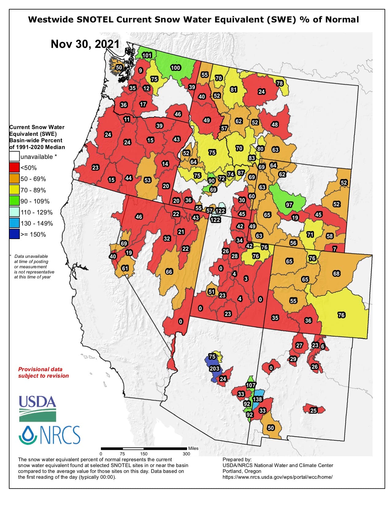
After a historic storm dumped feet of snow on California at the end of October, allowing several resorts to open early, November and the first half of December were extremely dry.
Last week’s storm dumped over five feet of fresh snow on most ski resorts, resurrecting the season. And there’s even more in the forecast––the next storm could dump up to 100″ on ski areas.
DecemBURIED!