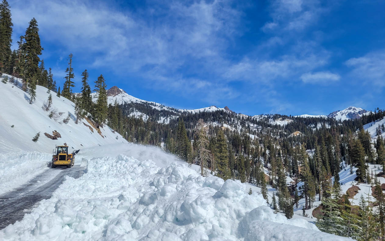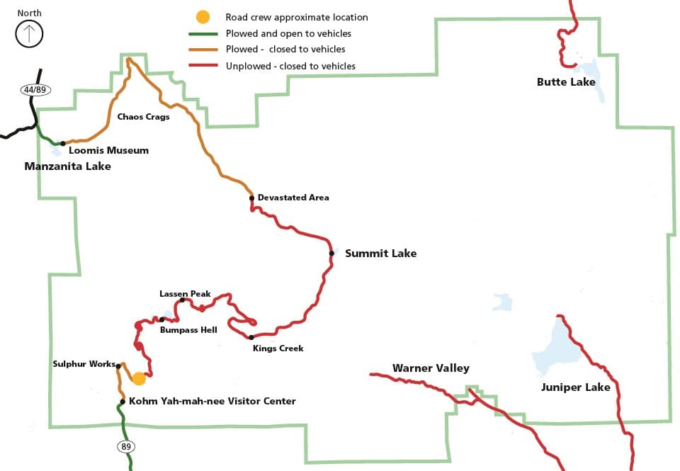
Crews in Lassen Volcanic National Park, CA, have managed to clear snow from the park highway between Kohm Yah-mah-nee Visitor Center and Windy Point (1.5 miles).
To accomplish the annual feat of clearing snow from the 30-mile park highway, the park uses three bulldozers to push snow off the road and two rotary snow blowers to clear the last 2-3 feet. Snow depth is lower-than-average and is ranging between 6 and 8 feet in the Southwest Area.

The 30-mile Lassen Volcanic National Park Highway traverses avalanche-prone slopes with up to 2,000-foot drops and can hold a snowpack up to 40-feet deep. Snow clearing operations usually begin in March or April and continue for about two months before the highway is entirely open.
Once a section of road is cleared, it remains closed to vehicles until the last layer of snow and ice melts and all road preparations (e.g., signs, shoulder grading) are complete. At that time, the section may open to vehicles. Visitors can enjoy hiking or biking sections of the highway once they are cleared of snow and before they open to vehicles.
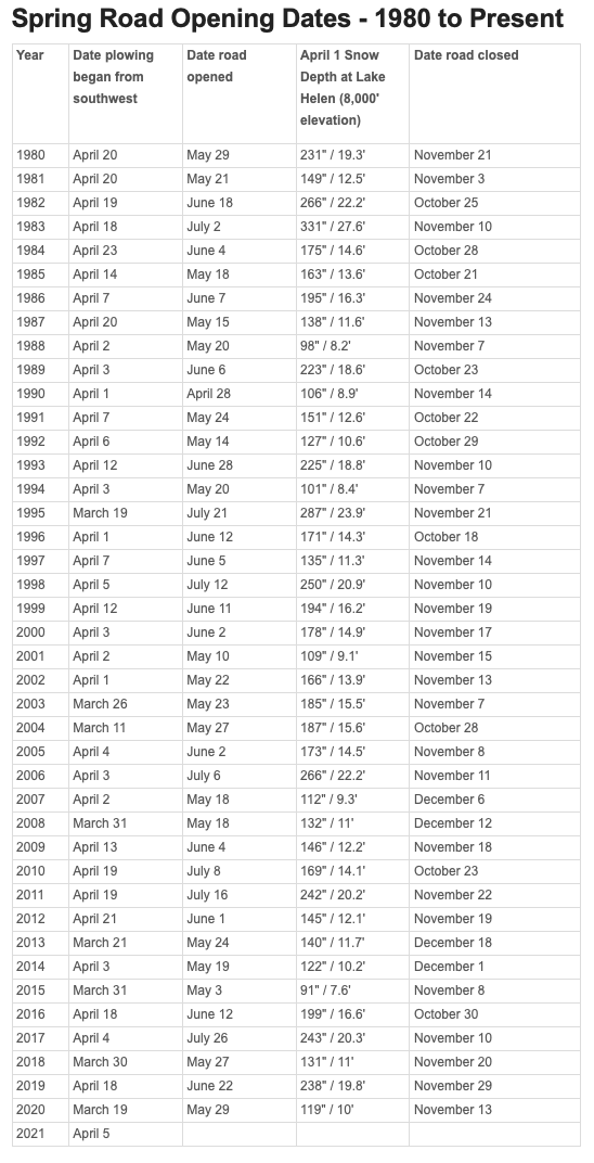
Road crews begin clearing snow from the park highway in March or April, depending on snow depth and weather forecasts. It is impossible to predict when the highway will be open to through traffic because weather and other delays can significantly affect the clearing process. The chart below provides the opening and closing dates of the park highway since 1980. The park does not clear snow from Butte Lake, Warner Valley, or Juniper Lake Roads. The paved sections of Warner Valley and Juniper Lake Roads are maintained by Plumas County and are usually not plowed.
Snow clearing operations occur in the following order:
- Manzanita Lake Area between Loomis Plaza and Devastated Area (10 miles).
- Southwest Area between Kohm Yah-mah-nee Visitor Center and Lassen Peak (8 miles).
- Devastated Area to Lassen Peak (12 miles).

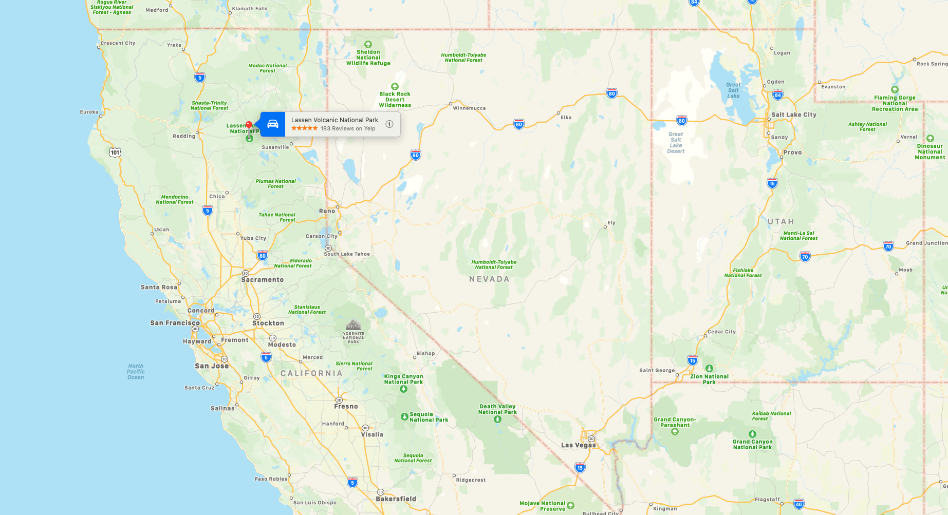
Lassen Volcanic National Park is in northeastern California. The dominant feature of the park is Lassen Peak, the largest plug dome volcano in the world and the southernmost volcano in the Cascade Range. Lassen Volcanic National Park is one of the few areas in the world where all four types of volcano can be found—plug dome, shield, cinder cone, and stratovolcano.
