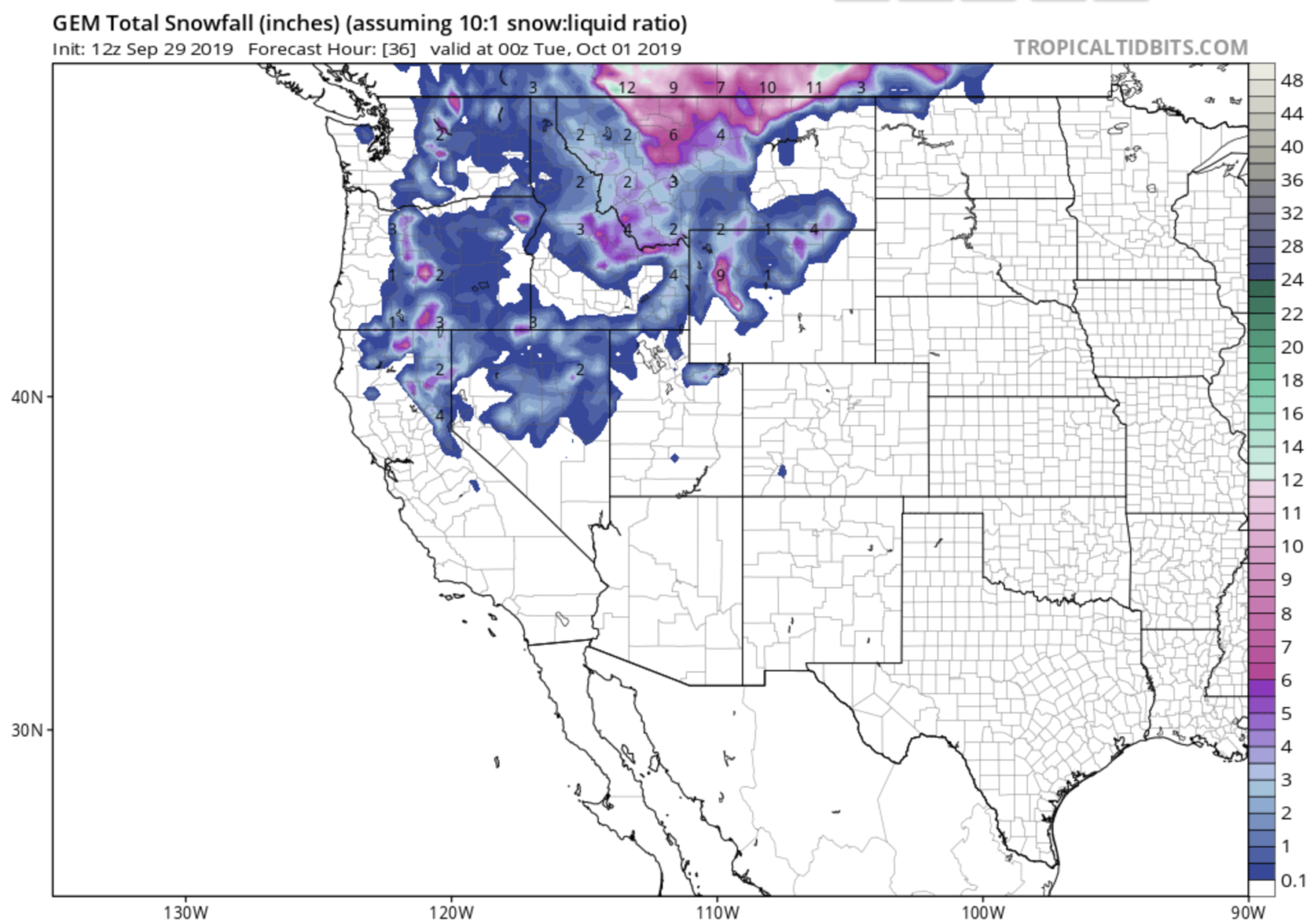
Montana’s governor Steve Bullock issued a “Winter Storm Emergency” for Montana yesterday due to the “historic early season storm” that is currently slamming into Montana.
“With an unprecedented winter storm throwing our state a surprise in September, state and local governments are working closely together to protect the health and safety of Montanans and our top priority is making sure that happens. Montanans should heed all warnings from state and local officials, travel safely, and be cautious during this time.” – Governor Bullock, 9/29/19
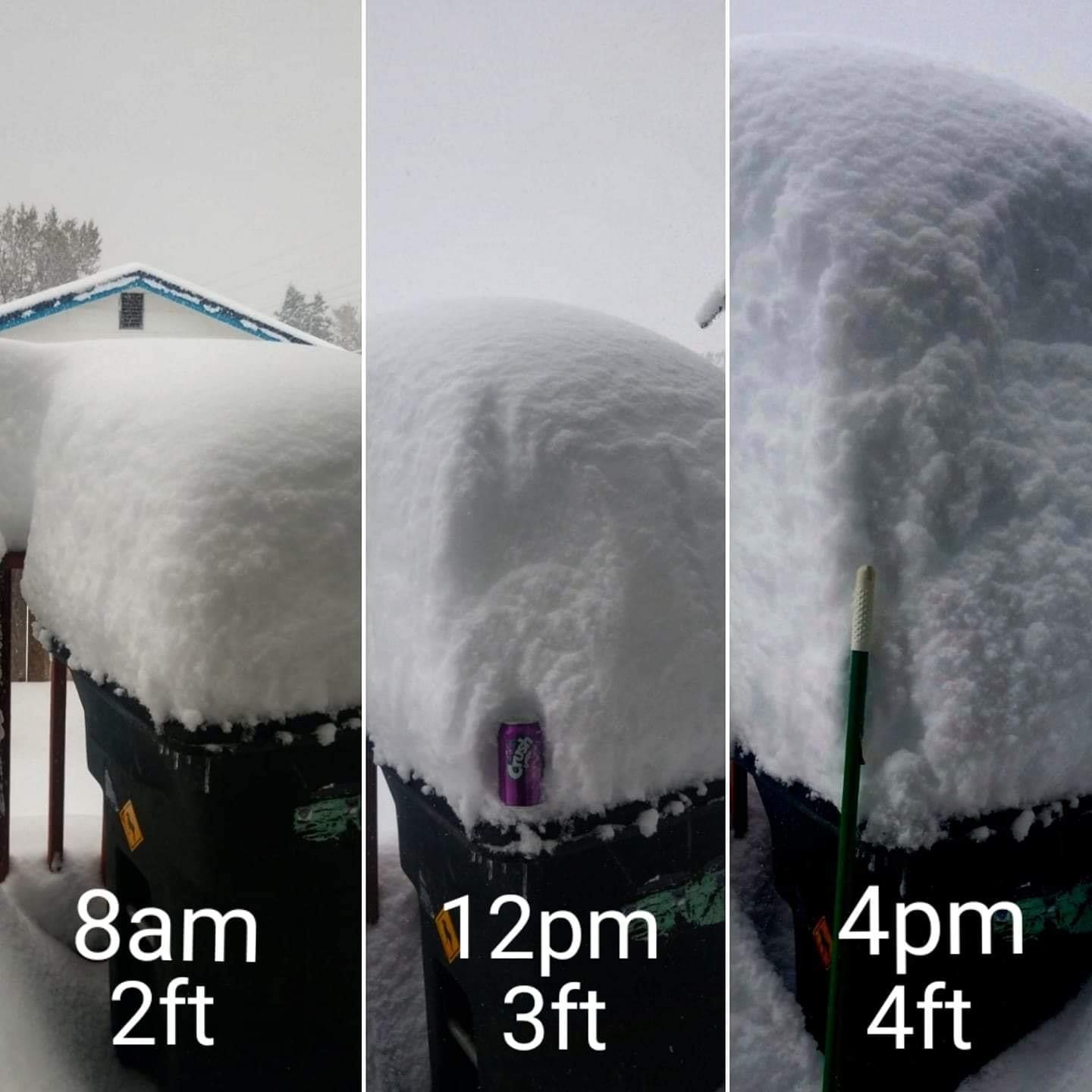
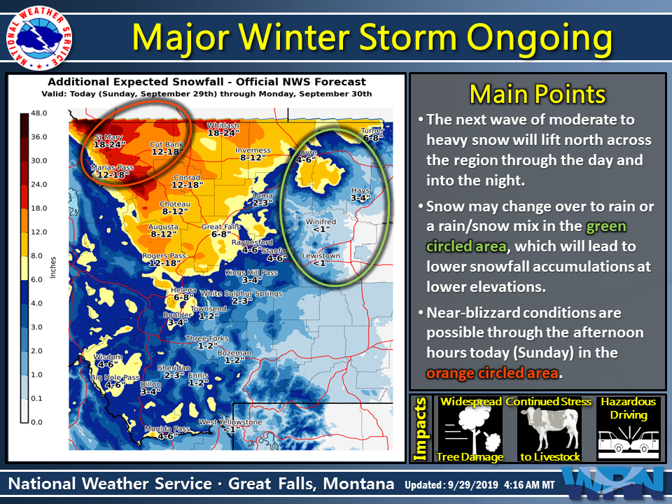
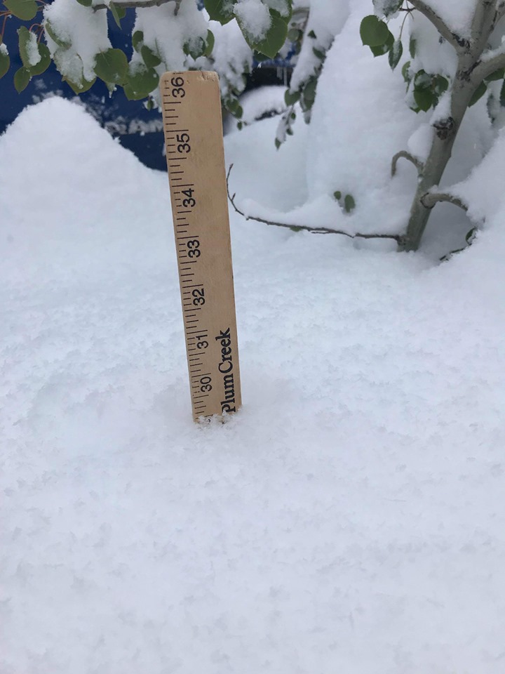
Up to 4-feet of snow had already fallen as of 4pm on Saturday in some northwestern Montana locations and there is another 1-2 feet of snow forecast today via hourly snowfall rates of up to 2″ per hour and blizzard conditions at times.
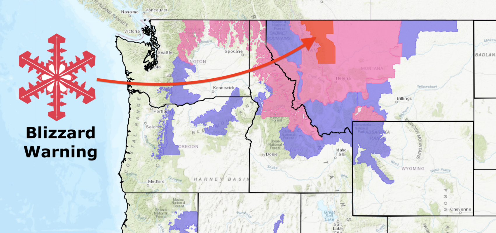
Blizzard Warnings, Winter Storm Warnings, & Winter Weather Advisories are all currently in effect for Montana today through tomorrow.
“Hourly snowfall rates of 1-2” per hour will be possible along and northwest of a Great Falls to Havre line at times this morning and into the afternoon, which will significantly reduce visibilities. In addition, strong northerly winds over portions of the Hi-Line and Rocky Mountain Front may cause near-blizzard conditions at times.” – NOAA, Great Falls MT, 9/29/19
The emergency was declared in Montana in response to “heavy wet snow, high winds have downed trees and power lines resulting in road closures, emergency travel conditions, intermittent cellular service and power outages.”
“The emergency order allows the utilization of all necessary state government services, equipment and suppliers to further the efforts of local governments in protecting the health and safety of Montanans. With the order, state resources can be mobilized to impacted counties with eligible expenses for emergency protective measures and debris removal.” – Montana Governor’s Office
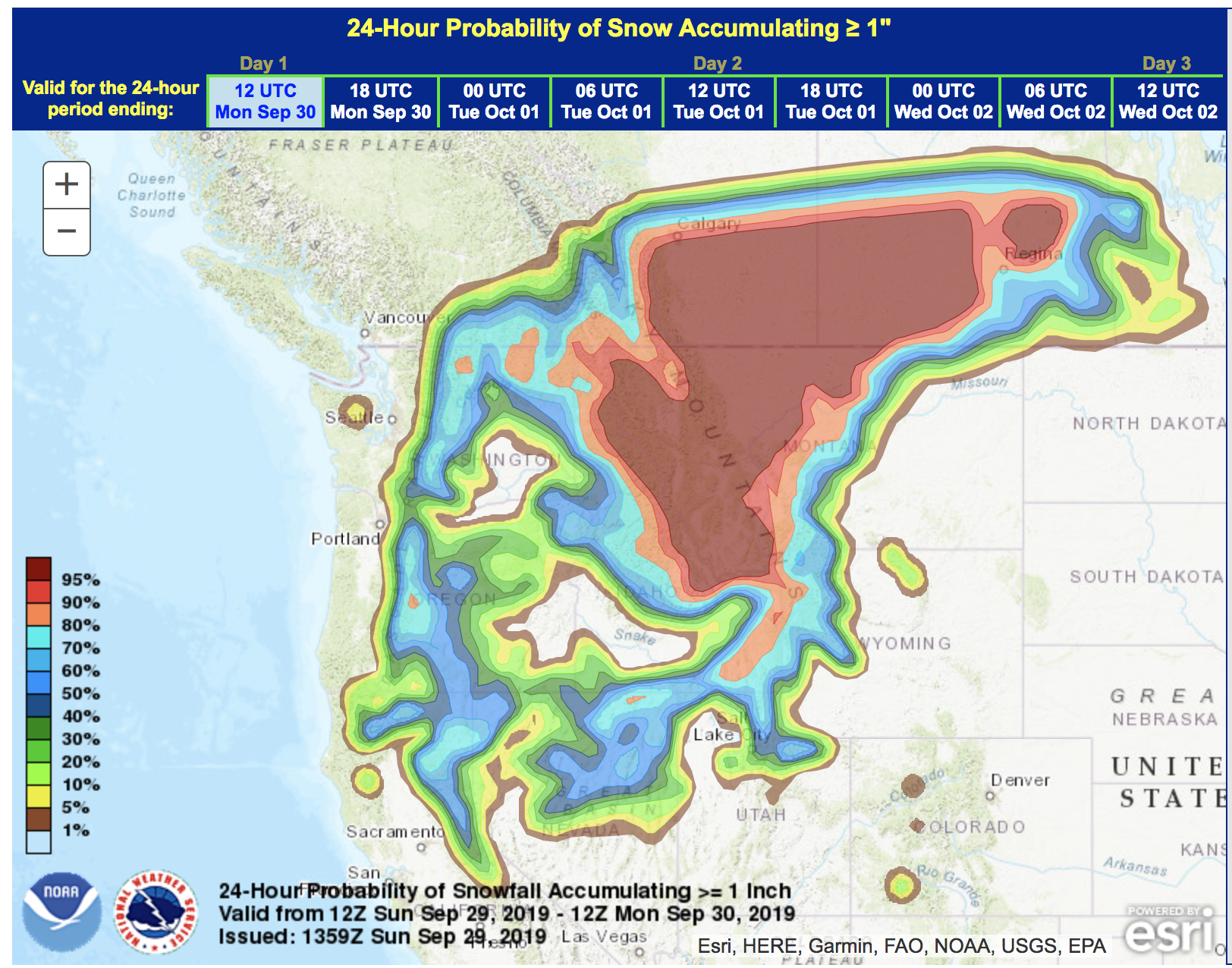
Northwestern Montana is forecast to see another 8-24″ of snow in spots today and tomorrow.
* WHAT...Heavy snow occurring. Additional snow accumulations of
8 to 15 inches at lower elevations, up to 2 feet in the
mountains and immediate foothills of the Rocky Mountain Front.
Winds gusting as high as 50 mph.

- NOAA, Great Falls MT, 9/29/19
A Blizzard Warning is now in effect in northwestern Montana that is calling for 3-10″ of snow, blizzard conditions, and very high winds.
* WHAT...Blizzard conditions occurring. Additional snow
accumulations of 3 to 10 inches. Winds gusting as high as 55
mph.

- NOAA, Great Falls MT, 9/29/19
GOVERNORS OFFICE OF MONTANA PRESS RELEASE:
Governor Bullock Declares Winter Storm Emergency in Montana
Governor Steve Bullock today issued an executive order declaring an emergency in Montana due to a severe early season storm. Areas hardest hit include Cascade, Flathead, Glacier, Lake, Lewis and Clark, Lincoln, Pondera, and Teton counties and the Blackfeet Indian Reservation. The Blackfeet Indian Reservation, Glacier County, and Pondera County have issued local emergency declarations.
“With an unprecedented winter storm throwing our state a surprise in September, state and local governments are working closely together to protect the health and safety of Montanans and our top priority is making sure that happens,” Governor Bullock said. “Montanans should heed all warnings from state and local officials, travel safely, and be cautious during this time.”
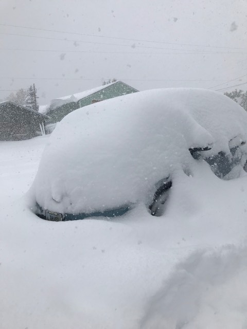
The storm brought heavy, wet snow with accumulation amounts up to three feet in some locations. High winds have downed trees and power lines resulting in road closures, emergency travel conditions, intermittent cellular service and power outages. Unseasonably cold temperatures will delay snowmelt in some areas and bring the end of the growing season for some agricultural producers. The storm also has the potential to cause flooding in Montana.
“We were fortunate to receive several days of notice from the National Weather Service – which did a good job predicting the size and magnitude of this storm,” said Governor Bullock.
State agencies were able to preposition equipment and prioritize road clearing in cooperation with local jurisdictions. Given the proximity to Glacier National Park, the Blackfeet Nation has a shelter on standby for stranded motorists.
The Montana State Emergency Coordination Center is working with all counties in the storm path to identify needs to critical lifeline services such as energy, communications, transportation, and emergency food, water, and shelter services. The State Emergency Coordination Center continues to receive declarations of emergencies from local and tribal jurisdictions.
The emergency order allows the utilization of all necessary state government services, equipment and suppliers to further the efforts of local governments in protecting the health and safety of Montanans. With the order, state resources can be mobilized to impacted counties with eligible expenses for emergency protective measures and debris removal.
BLIZZARD WARNING:
* WHAT...Blizzard conditions occurring. Additional snow
accumulations of 3 to 10 inches. Winds gusting as high as 55
mph.

* WHERE...Northern Rocky Mountain Front, Eastern Glacier and
Southern Rocky Mountain Front.

* WHEN...Until 6 PM MDT this evening.

* IMPACTS...Travel is not recommended. Widespread blowing snow
could significantly reduce visibility. Snow drifting in blowing
snow is blocking roadways..

* ADDITIONAL DETAILS...Travel should be restricted to emergencies only.
If you must travel, have a winter survival kit with you. If you get
stranded, stay with your vehicle.
The latest road conditions for the state you are calling from can
be obtained by calling 5 1 1.
WINTER STORM WARNING FOR MONTANA:
* WHAT...Heavy snow occurring. Additional snow accumulations of
8 to 15 inches at lower elevations, up to 2 feet in the
mountains and immediate foothills of the Rocky Mountain Front.
Winds gusting as high as 50 mph.

* WHERE...Glacier, Toole, Liberty, Pondera, Teton, and Northern
Lewis and Clark Counties.

* WHEN...Until 6 AM MDT Monday.

* IMPACTS...Extreme impacts will continue. Some tree damage will
be possible due to the heavy, wet snow falling onto trees with
foliage. Additional power outages are possible. Agricultural
interests; outdoor recreational interests, including camping
and hunting activities; and travel will also continue to be
negatively impacted.

* ADDITIONAL DETAILS...Near blizzard conditions are possible at
times through Sunday afternoon, especially along and northwest
of a Heart Butte, to Cut Bank, to Sweet Grass line.
