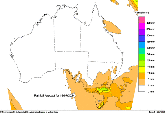
A much-needed snow front is forecast to move across the Australian Alps in the next seven days, bringing approximately 38 cm (15 inches) of snowfall to Australian ski resorts. The Australian Bureau of Meteorology (BOM) forecasts a low pressure system to move in from the south, bringing the majority of snowfall on Monday and Tuesday next week. The snowline is anticipated to drop from initially 1,200 meters (3,937 feet) to around 900 meters (2,953 feet). This coul,d mean snow could be falling as low as Jindabyne which is situated at 915 meters (3,117 feet).
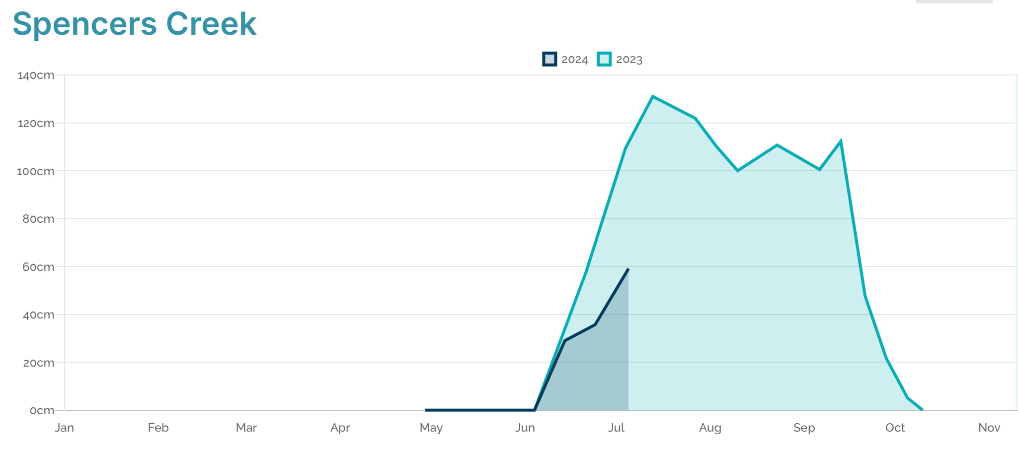
The start of the 2024 Australian ski season has been a bit lackluster, with only 59.1 cm (23.3 inches) of snow depth currently measured at Spencer’s Creek. Last year about double the snow depth was recorded at the same week of the school holidays, and 2023 was considered to be a below average season in terms of snow depth. To be fair, last year in the second week of July the maximum snow depth of the season was recorded and early season snow is not a reliable indicator for the remainder of the season. In 2017 and 2019, snow depth in early July was comparably low and both seasons saw above 2 meters (6 feet) of snow depth at peak.
There is a potential that the cold front will stay for longer and bring snowfall well beyond the next seven days, but weather models more than a week out become less reliable. Some models anticipate another 50-60 cm (20-24 inches) for the following week from July 20-26. We will update our readers accordingly as the weather pattern moves across the Tasman Sea.