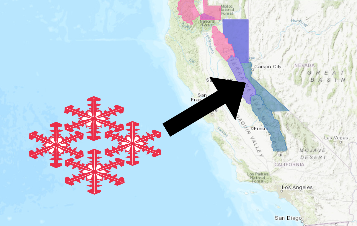
The National Weather Service has issued a Winter Storm Watch for California.
It’s in effect from 11:00pm Tuesday night – 11:00pm Wednesday night.
Heavy snow and high winds are expected to impact the area throughout that time.
Storm Summary:
- Whiteout Conditions Likely Above 7,000ft
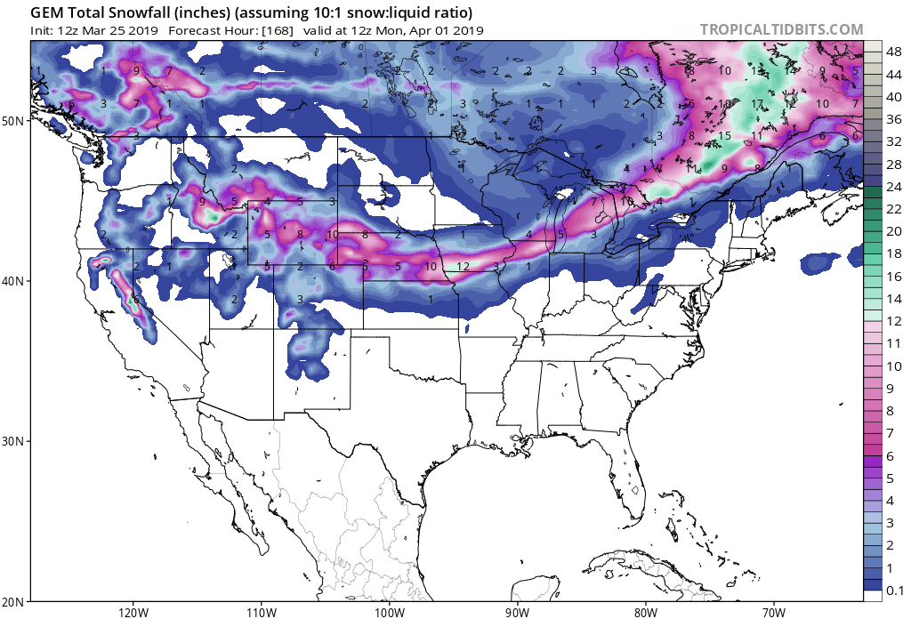
- 12-36″ of Snow Above 7,000ft Tuesday – Wednesday
- 90mph Wind Gusts Across Sierra Ridges
- Travel Could Be Very Difficult To Impossible
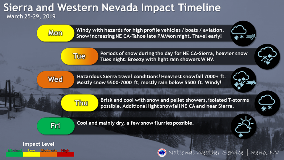
“This March came in like a lion and is expected to go out like a lion as well! A series of storm systems will bring periods of snow to the Sierra and higher elevations of northeast CA for much of the upcoming week, and gusty winds at times across the region. The heaviest snow and greatest impacts for Sierra travel are expected late Tuesday night through Wednesday evening, with whiteout conditions likely above 7000 feet. Snow is likely to accumulate down to near 5500 feet, with mainly rain below 5500 feet.”
– NOAA Reno, NV
Make sure to get your hands on an Ikon Pass, so you don’t miss out on any powder days like this next season.
Accumulating snowfall is likely at elevations greater than 5,500ft.
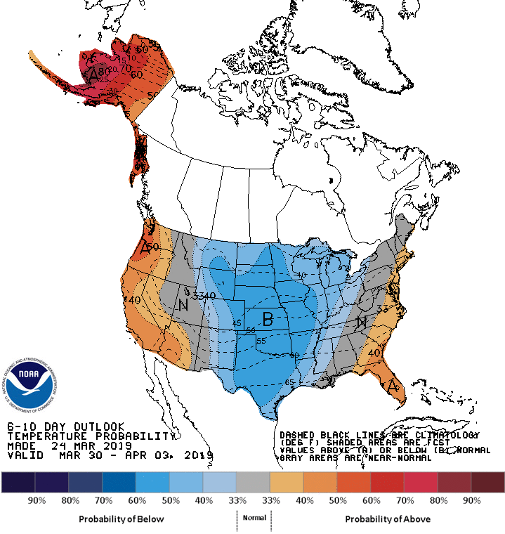
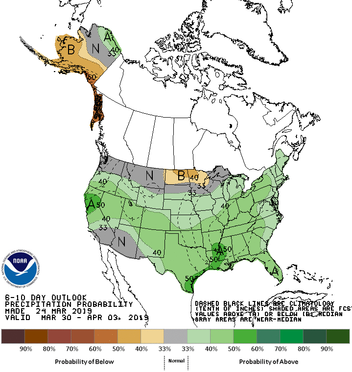
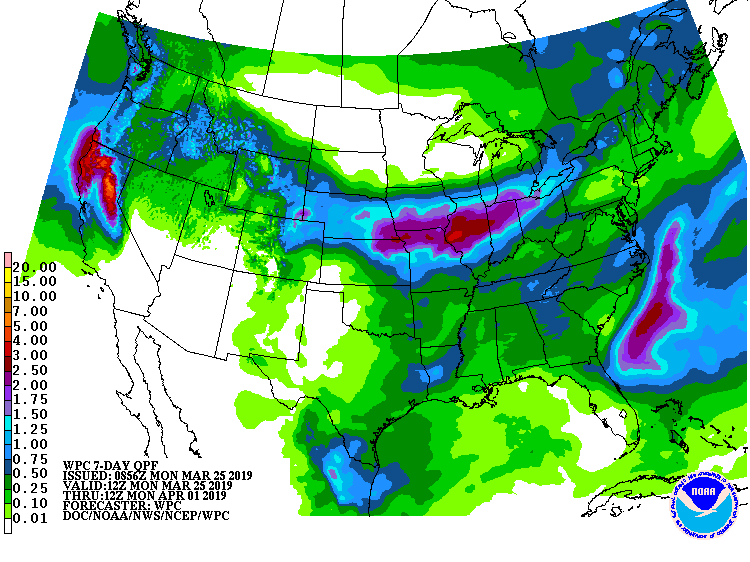
The 6-10 day outlook calls for above average precipitation and above average temperatures in California.
Additional Storm Info:
California: 12-36″ of Snow Above 7,000ft Tuesday – Wednesday
* Heavy snow possible. Total snow accumulations of
  5 to 10 inches below 7000 feet except up to 3 inches
  below 6000 feet. 1 to 2 feet above 7000 feet with
  localized amounts up to 3 feet along the crest possible.
- NOAA Reno, NV
Winter Storm Watch:
URGENT - WINTER WEATHER MESSAGE
National Weather Service Reno NV
429 AM PDT Mon Mar 25 2019

Greater Lake Tahoe Area-
Including the cities of South Lake Tahoe, Truckee, Stateline,
and Incline Village

...WINTER STORM WATCH NOW IN EFFECT FROM TUESDAY EVENING THROUGH
WEDNESDAY EVENING...

* CHANGES...None.

* WHAT...Heavy snow possible. Total snow accumulations of 5 to 10
  inches below 7000 feet except up to 3 inches below 6000 feet. 1
  to 2 feet above 7000 feet with localized amounts up to 3 feet
  along the crest possible. Winds could gust as high as 90 mph
  across Sierra ridges and up to 45 mph in valley locations.

* WHERE...Greater Lake Tahoe Area.

* WHEN...From Tuesday evening through Wednesday evening.

* ADDITIONAL DETAILS...Travel could be very difficult to
  impossible. The hazardous conditions could impact the morning
  or evening commute. Very strong winds could cause extensive
  tree damage.