NOAA is calling for a bit of snow in Lake Tahoe, CA/NV this week.
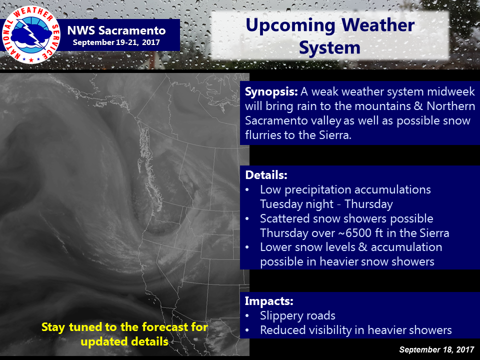
“The upcoming weather system will bring low precipitation amounts to the mountains & Northern Sacramento Valley and light snow showers to the Sierra crest.” – NOAA Sacramento, CA today
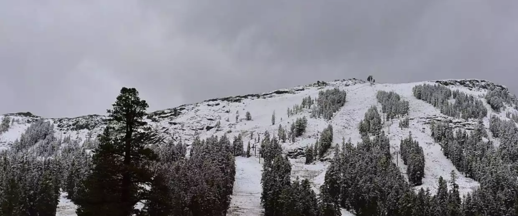
This will be Tahoe’s first snowfall of the season.
Light showers, with a dusting of snow in higher elevations, are possible at
times from Wednesday through Friday. - NOAA Reno, NV today
Snow levels are forecast to drop as low as 7,000′ on Wednesday.

The winds will be ripping with gusts of 75mph on the ridges forecast.
...gusts of 35-45 mph with Sierra ridge gusts up to 75 mph are expected for
this afternoon and evening." - NOAA Reno, NV today

NOAA Forecast Discussion Excerpts:
.SYNOPSIS...

A series of cold fronts will produce gusty winds today and again
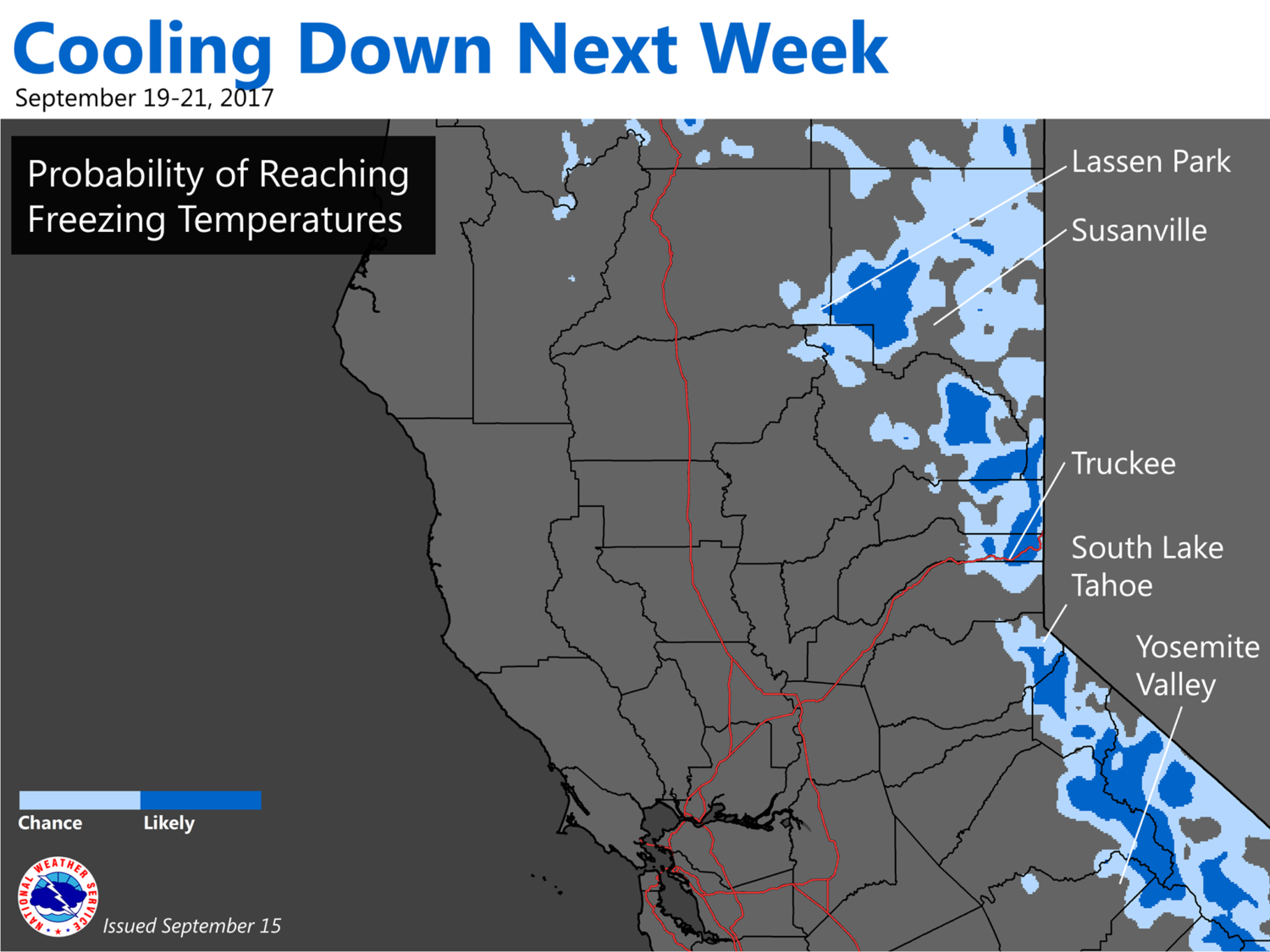
Wednesday. Below average temperatures are expected for much of the
upcoming week, with the coolest days most likely Thursday and
Friday. Light showers, with a dusting of snow in higher
elevations, are possible at times from Wednesday through Friday.

SHORT TERM...

The transition to a more active weather pattern with much cooler
temperatures and chances for showers (including a bit of snow
possible for the mountains) is still on track for this week, as
long wave trough digs into the western US.
* Winds:
In general, gusts of 35-45 mph with Sierra ridge gusts up to 75 mph
are expected for this afternoon and evening.
 * Precipitation:
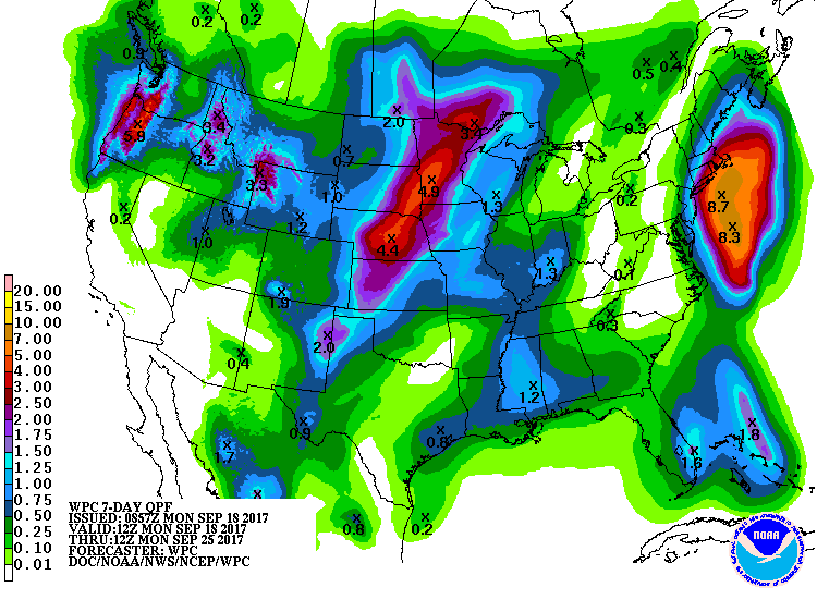
Precip amounts are not expected to be very significant, but some
locations in the Sierra, far northwest NV/Surprise Valley, and
the Basin and Range east of US-95 could receive around 0.10 inch.
Snow levels may drop to near 7000 feet by late Wed night, although
if any light snow accumulations occur, they are more likely to be
confined to higher peaks.
