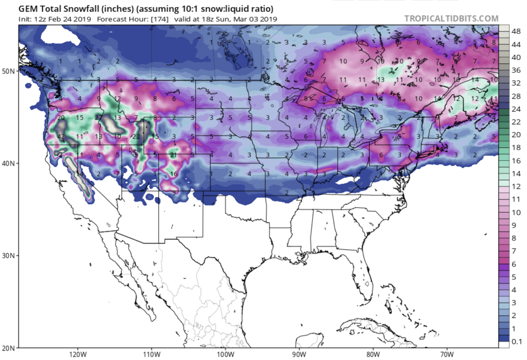
NOAA just upgraded the incoming storm headed to California.
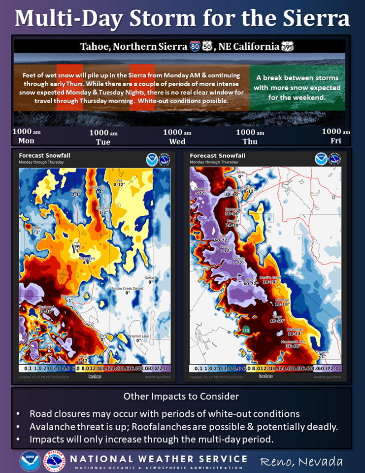
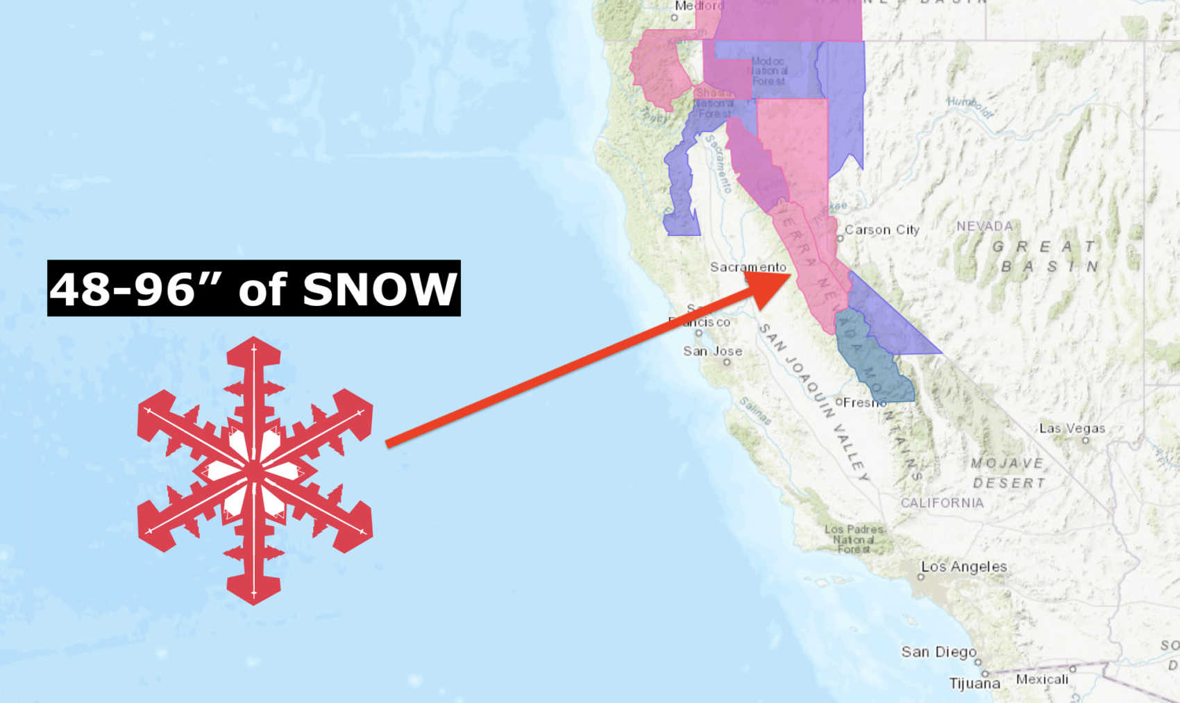
NOAA is now calling for 4-8 FEET (48-96″) of snow above 7,000′ and they’ve issued a Winter Storm Warning.
We don’t even really know what to say about this insane forecast so we’ll let NOAA do the talking.
* WHAT...Heavy snow expected. 3-Day storm total snow accumulation of 2 to 4 feet,
except 4 to 8 feet above 7000 feet expected. Winds gusting as high as 60 mph
with gusts over 140 mph for the Sierra ridges. Periods of white-out conditions
are likely.
- NOAA Reno, NV today
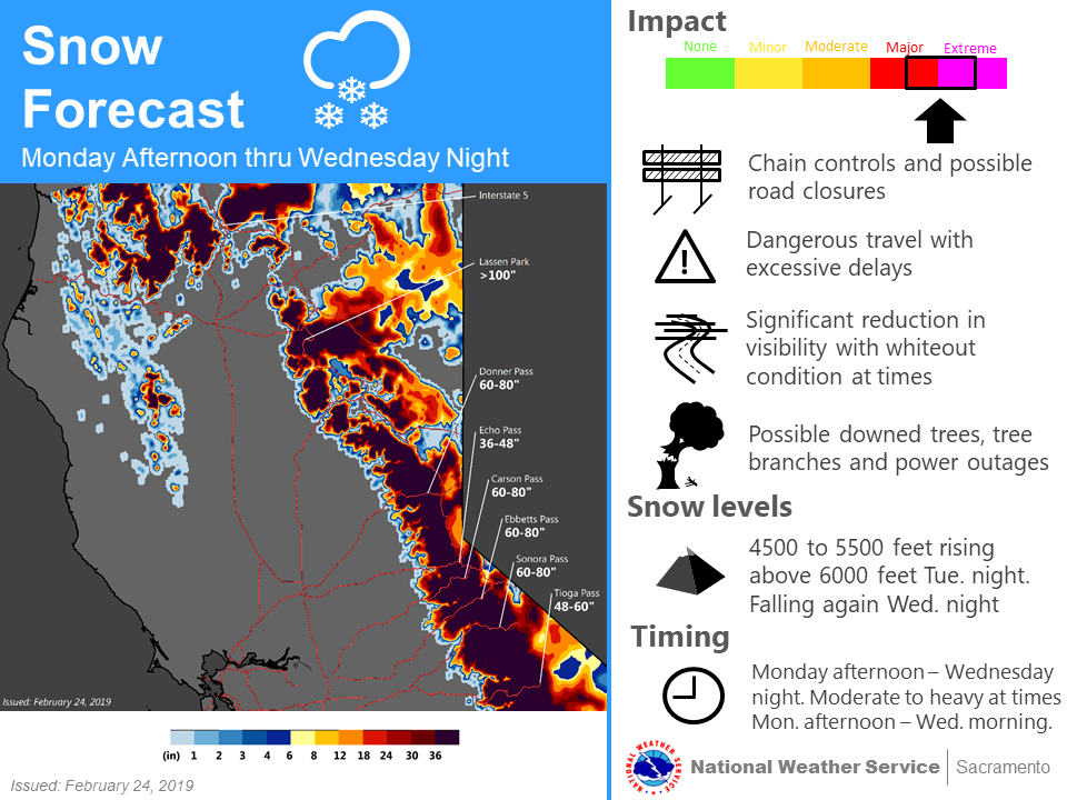
“Well, here we go again. Another storm is expected to move into the Sierra Monday bringing steady, and eventually heavy snow. This will be a marathon rather than a sprint in terms of snow accumulation with several wet feet of new snow expected over top of a drier layer of powdery snow through early Thursday.
Travel will be tough, and possibly impossible at times, through the Sierra with no clear break in snowfall once this begins. Expect to add potentially several hours to your travel time over Sierra passes; periods of white-out conditions are anticipated and road closures will be possible.
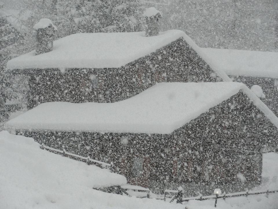
This new snow load coupled with expected wind may result in unstable slope conditions with the potential for avalanches and roofalanches – do NOT linger under eaves of buildings that have a large quantity of snow on its roof.
Impacts from this storm will likely be cumulative, meaning that they will increase through the duration of the event.
Elsewhere, not much precipitation is expected, but it will be windy.” – NOAA Reno, NV today
NOAA has also issued an Avalanche Warning with this forecast storm.
* AVALANCHE DANGER...Periods of HIGH avalanche danger may occur from Monday
evening through Thursday morning.
- NOAA Reno, NV today
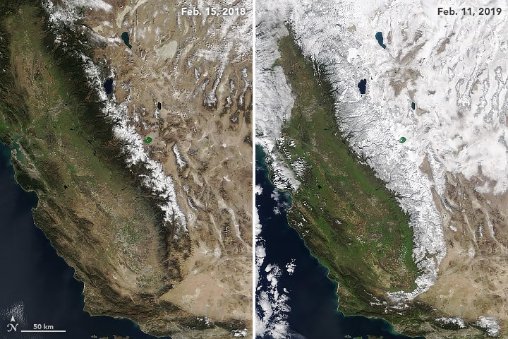
Tahoe is on track for a top 3 best snowfall season in recorded history with 515″ having already fallen on Squaw Valley.
Squaw Valley averages 450″ of snowfall per year meaning that they are already 65″ past our annual snowfall and it’s not even March yet…
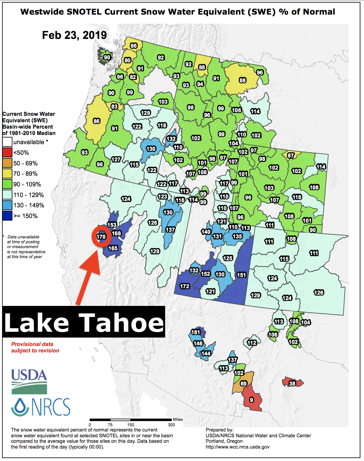
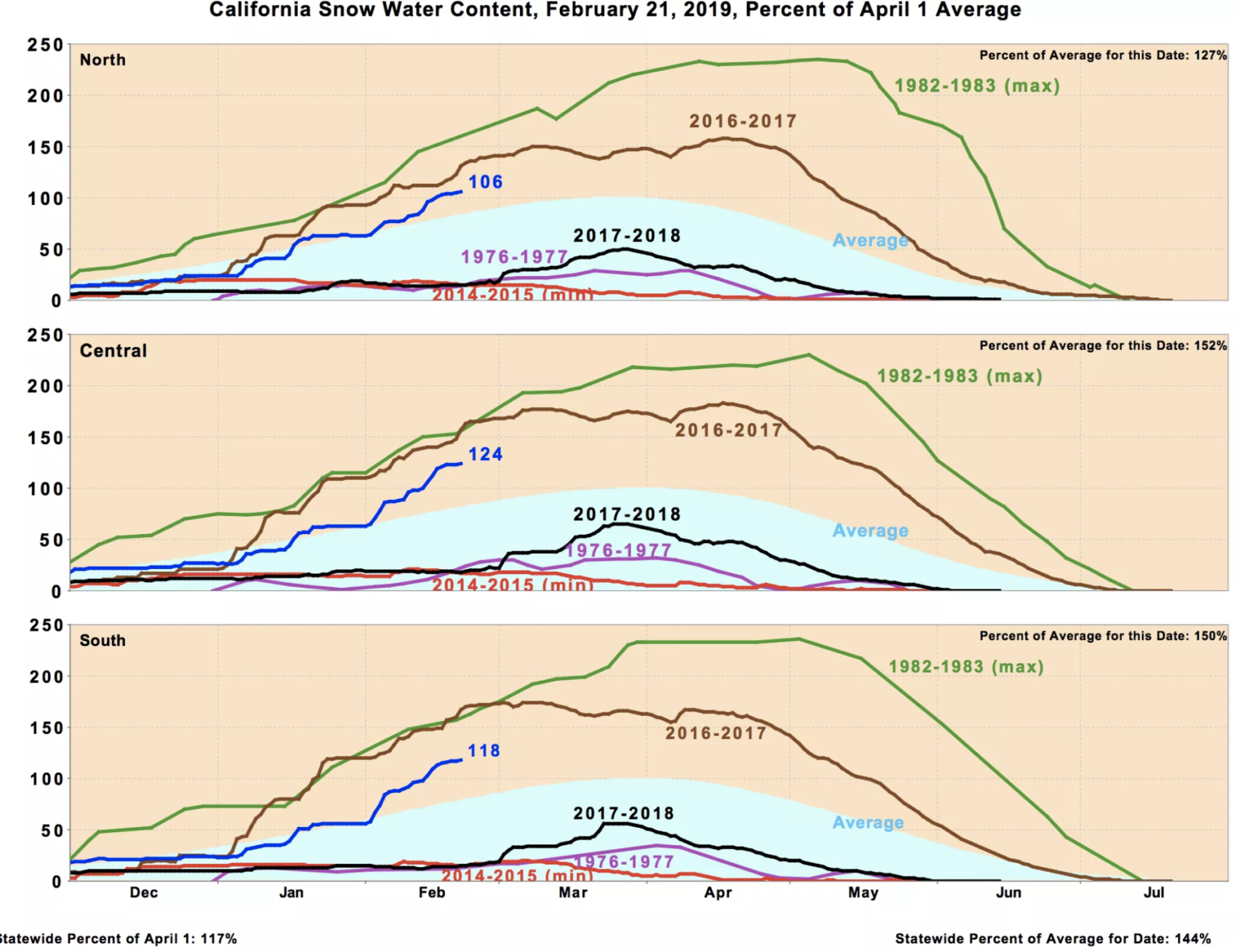
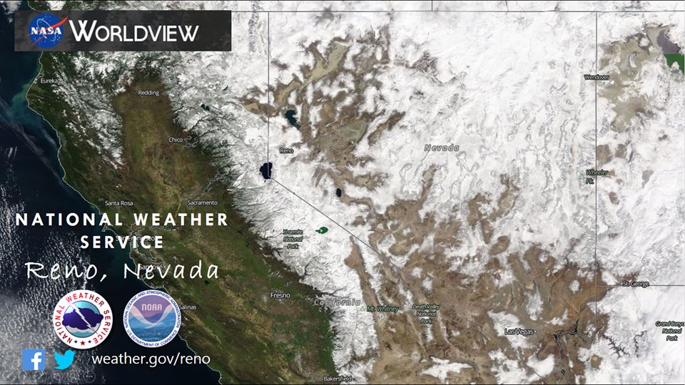
The Lake Tahoe snowpack is currently sitting at 170% of average to date and is the 2nd deepest in the nation (only Mammoth is deeper).
Squaw Valley has already seen its largest February snowfall total in history with 254″ having already fallen in February and much more on the way before the month is over.
Lake Tahoe even rose 12″ since February which is about 40 billion gallons of water.
This is the year to be in Tahoe…
Winter Storm Warning for Lake Tahoe
URGENT - WINTER WEATHER MESSAGE
National Weather Service Reno NV
1227 PM PST Sun Feb 24 2019
Greater Lake Tahoe Area-
Including the cities of South Lake Tahoe, Truckee, Stateline,
and Incline Village

...WINTER STORM WARNING IN EFFECT FROM 10 AM MONDAY TO 4 AM PST
THURSDAY...

* CHANGES...Upgraded to a Winter Storm Warning. Increased expected
  snow amounts.

* WHAT...Heavy snow expected. 3-Day storm total snow accumulation
  of 2 to 4 feet, except 4 to 8 feet above 7000 feet expected.
  Winds gusting as high as 60 mph with gusts over 140 mph for the
  Sierra ridges. Periods of white-out conditions are likely.

* WHERE...Greater Lake Tahoe Area.

* WHEN...From 10 AM Monday to 4 AM PST Thursday.

* ADDITIONAL DETAILS...Travel could be very difficult to
  impossible. The hazardous conditions could impact the morning
  or evening commute. Very strong winds could cause extensive
  tree damage and periods of white-out conditions.
Avalanche Watch for Lake Tahoe
URGENT - IMMEDIATE BROADCAST REQUESTED
Avalanche Watch
U.S. Forest Service Sierra Avalanche Center
Relayed by National Weather Service Reno NV
232 PM PST Sun Feb 24 2019

The following message is transmitted at the request of the U.S.
Forest Service Sierra Avalanche Center.

The Sierra Avalanche Center in Truckee has issued a BACKCOUNTRY
AVALANCHE WATCH for the following areas:

Greater Lake Tahoe

* TIMING...In effect from 5 PM Monday to 7 AM Thursday.

* AFFECTED AREA...Central Sierra Nevada mountains between Yuba
  Pass (Hwy 49) on the north and Ebbetts Pass (Hwy 4) on the
  south, including the greater Lake Tahoe area.

* AVALANCHE DANGER...Periods of HIGH avalanche danger may occur
  from Monday evening through Thursday morning.

* REASON/IMPACTS...Forecast heavy snow and high wind may result in
  widespread avalanche activity in the mountains.

* PRECAUTIONARY / PREPAREDNESS ACTIONS...Very dangerous avalanche
  conditions may occur. Travel in avalanche terrain is not
  recommended during HIGH avalanche danger. Large destructive
  avalanches could occur.
